
Office center fishing
| coat of arms | Germany map | |
|---|---|---|

|
Coordinates: 54 ° 42 ' N , 9 ° 35' E |
|
| Basic data | ||
| State : | Schleswig-Holstein | |
| Circle : | Schleswig-Flensburg | |
| Area : | 100 km 2 | |
| Residents: | 10.091 (Dec. 31, 2019) | |
| Population density : | 101 inhabitants per km 2 | |
| License plate : | SL | |
| Office key : | 01 0 59 5949 | |
| Office structure: | 3 municipalities | |
| Office administration address : |
Bahnhofstrasse 1 OT Satrup 24986 Mittelangeln |
|
| Website : | ||
| Head of Office : | Britta Lang ( independent ) | |
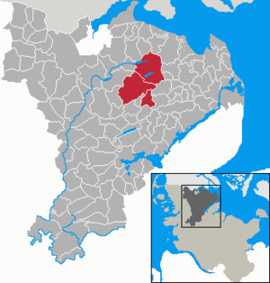
| Location of the Mittelangeln office in the Schleswig-Flensburg district | ||
  |
||

The office Mittelangeln is an office in the center of the fishing landscape in the Schleswig-Flensburg district in Schleswig-Holstein with the administrative seat in Satrup , municipality of Mittelangeln . The office maintains a citizens' office in the community of Sörup . The office borders on the Langballig office in the north, the Geltinger Bucht office in the west, the Süderbrarup office in the southeast, the Südangeln office in the southwest and the Hürup office in the northwest.
Official municipalities with their districts (OT)

- Medium fishing with the OT Esmark , Bondebrück , Dammholm , Groß Rüde , Havetoftloit , Klein Rüde , Mooswatt , Nackholz , Obdrup , Hatteshuus , Rabenkiel , Rehberg , Rehbergholz , Rüdestraße , Rüdesüderholz , Satrup , Satrupholm , Satrupkirchenholz , and Torsballig
- Schnarup-Thumby with the OT Eslingholz, Klaholz, Köhnholz, Lüttholm, Schnarup, Thumby, Thumby-West, Thumbyfeld and Thumbyhassel
- Sörup with the OT Barg, Flatzby, Gammelby, Hardesby, Hollehitt, Mooswatt, Mühlenholz, Schwensby, Sörupholz, Sörupmühle, Südensee and Winderatt
history

In 1947 the office was formed as the Satrup Office with its seat in Satrup. At that time the parishes Satrup, Esmark, Rehberg, Rüde and Obdrup belonged to him.
In the course of the territorial reform of 1970, the municipalities of Satrup, Esmark, Rehberg and Obdrup merged to form the municipality of Satrup and the municipalities of Havetoftloit, Torsballig and Schnarup-Thumby were incorporated into the administration.
On January 1, 2008, the previously free municipality Sörup joined the office and the office was renamed to Amt Mittelangeln . On March 1, 2013, Havetoftloit, male and satrup joined forces to form the Mittelangeln community.
coat of arms
Blazon : “Over a silver shield base, inside two blue wavy threads, divided diagonally left by gold and blue. Above, placed upright on the left and with the blue leaf to the right, a scythe with a red shaft, below a golden wheel with eleven spokes. "
The scythe already depicted in the coat of arms of the former Satrup office is the old symbol of the Satrupharde ( see also: Angler coat of arms ).
Web links
Individual evidence
- ↑ North Statistics Office - Population of the municipalities in Schleswig-Holstein 4th quarter 2019 (XLSX file) (update based on the 2011 census) ( help on this ).
- ↑ Schleswig-Holstein's municipal coat of arms
Arensharde | Eggebek | Geltinger Bay | Haddeby | Hürup | Kappeln-Land | Kropp stacking bar | Long-crowned | Middle fishing | Oeversee | Schafflund | South fishing | Süderbrarup