
Soerup
| coat of arms | Germany map | |
|---|---|---|

|
Coordinates: 54 ° 43 ' N , 9 ° 40' E |
|
| Basic data | ||
| State : | Schleswig-Holstein | |
| Circle : | Schleswig-Flensburg | |
| Office : | Medium fishing | |
| Height : | 46 m above sea level NHN | |
| Area : | 44.32 km 2 | |
| Residents: | 4303 (Dec. 31, 2019) | |
| Population density : | 97 inhabitants per km 2 | |
| Postal code : | 24966 | |
| Area code : | 04635 | |
| License plate : | SL | |
| Community key : | 01 0 59 161 | |
| LOCODE : | DE SOR | |
| Office administration address: | Bahnhofstrasse 1 OT Satrup 24986 Mittelangeln, Citizens' Office in Sörup, Schleswiger Str. 3, 24966 Sörup |
|
| Website : | ||
| Mayor : | Dieter Stoltmann ( CDU ) | |
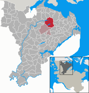
| Location of the municipality of Sörup in the Schleswig-Flensburg district | ||
  |
||

Sörup ( Danish : Sørup ) is a municipality in the Schleswig-Flensburg district in Schleswig-Holstein .
geography
The southern Schleswig community of Sörup is a rural central town in fishing . It is located in a moraine area on the Winderatter See and on the Südensee .
In the municipality are the districts of Barg (Bjerre, also Bjerg) , Bargfeld (Bjerremark) , Dingholz (Tingskov) , Flatzby (Fladsby) , Gammelby, Hardesby (Harresby) , Hollehitt (Holdhid) , Löstrup (Løstrup) , Mooswatt (Mosevad) , Möllmark (Mølmark also Møglmark) , Mühleholz (Mølskov or Mølleskov) , Schwensby (Svendsby) , Silkmoos (Silkemose) , Sörupholz (Sørupskov) , Sörupmühle (Sørup mill) , Südensee (Søndersø) and Winderatt ( Venerød , but also Vinderad and Vinderød , Anglo-Danish Vinn'raj or Vinjerat ).
history
Sörup was first mentioned in 1338 as Sodorp , i.e. village by the lake . However, it is much older, as evidenced by the imposing church from the 12th century. The other villages of today's municipality, the size of which corresponds exactly to the medieval (today Evangelical-Lutheran) parish of Sörup, are partly very old.
Sörup belonged to the area of the Nieharde and was their westernmost church village. In the Middle Ages, numerous properties in the municipality belonged to the Schleswig Cathedral Chapter , others to the Mohrkirch Monastery in the southeast . Südensee formed an independent aristocratic estate, and some neighboring estates also had individual properties in the community.
Sörup is traditionally one of the central fishing villages of the countryside . The village experienced a significant boom when the Kiel-Flensburg Railway was built in 1881. With the construction of the Flensburg circular railway line from Satrup to Rundhof , Sörup became a central railway node in fishing and received the Sörup station . Winderatt also had its own train station on the Flensburg-Kieler Bahn, as did Möllmark, Südensee and Mühlenholz (Südensee municipality) on the circular route.
During the imperial era, the large parish of Sörup, which from 1889 also formed its own administrative district, was divided into eleven rural communities and the Südensee manor district. The individual communities were Barg, Flatzby, Gammelby, Hardesby, Löstrup, Möllmark, Schwensby, Sörup, Sörupholz, Südensee and Winderatt. In 1928, the Südensee estate fell to the rural community of the same name. In 1966 Möllmark joined the community of Löstrup, four years later all the communities in the parish and district of Sörup merged to form the non-official community of Sörup. At the beginning of 2008, the community joined the Satrup office, which was then renamed the Mittelangeln office .
politics
Community representation
Local election 2013: of the 19 seats in the local council, the CDU has nine seats since the 2013 local election, the SPD five, the Voting Community FWS three and the FDP two seats.
Local election 2018: In the local election on May 6, 2018, the new local council was elected with 17 seats. Of this, nine seats are for the CDU, four for the SPD, two for the FDP and two for the FWS constituency. Due to the majority of the CDU votes, no overhang mandates (like the 2013 local elections) were necessary.
coat of arms
Blazon : "Over a silver shield base, in it two blue wavy threads, in blue a gold wheel with eleven spokes."
The eleven spokes in the wheel represent the eleven municipalities of the former Sörup office. The wavy threads symbolize the place name, the Danish form of which Sørup means "village by the lake" or "Seedorf".
Community partnerships
Sörup maintains a partnership with the municipality of Plate in Mecklenburg-Western Pomerania and with the municipality of Ruciane-Nida in Masuria (formerly East Prussia, now Poland).
_12_Jh_mit_sp%C3%A4tgotischem_Turm_-_Foto_2018_Wolfgang_Pehlemann_P1280569.jpg)
Culture and sights
The list of cultural monuments in Sörup includes the cultural monuments entered in the list of monuments of Schleswig-Holstein.
Sörup was awarded several times in the competition Our village has a future .
St. Mary's Church
The St. Mary's Church in the Sörup district, built towards the end of the 12th century , is a granite ashlar church and is one of the oldest Romanesque churches in fishing. The tower (60 m), which was built later, is late Gothic. The Danish king and thus also Duke of Schleswig was the patron saint of the church. It is believed that he commissioned the Schleswig cathedral master builder to build it.
Fruit museum "Pomarium Anglicum"
In the district of Winderatt there is the Pomarium Anglicum fruit museum , in which mainly 600 different historical apple varieties and other types of fruit were collected. In addition, equipment is exhibited that was used for growing, harvesting and processing fruit. In addition to the museum building, the museum has a 4.1 hectare orchard.
Sports
The local sports club is STV Sörup, which offers various sports such as team games, track and field, floor and apparatus gymnastics, gymnastics, etc.
Football in particular is very popular in Sörup. The soccer club FC Sörup-Sterup was created in 1999 from the soccer departments of STV Sörup and TSV Sterup and with over 300 active members is one of the largest soccer clubs in Schleswig-Holstein. One of the greatest successes is the championship title of the regional league in 2004 and 2006. The FC rose for the second time since 2004 in the highest Schleswig-Holstein division, the association league.
Handball players are organized in the SG Mittelangeln, which includes several neighboring villages. Handball is also played in the small Danish club Sørup UF, and the club holds a major international tournament in Sörup every year.
The local tennis club is the TC Sörup.
tourism
The tourist information is located in the Sörup train station. Numerous events take place in the municipality, which are gladly accepted by both citizens and tourists. The Johannifeuer am Südensee is just as much a permanent fixture as the visit of the Königsberg theater group in Südensee, which has been taking place for years. The crumbled Grauburg is located in a wooded area on the south bank of Lake Winderatter .
Economy and Infrastructure
In the originally agricultural community, businesses and a wide range of services are now also concentrated. The proximity to the Flensburg shipyard in Sörup in the last century brought about one of the world's largest manufacturers of cylinder liners for ship engines - M. Jürgensen GmbH & Co KG.
Other industrial companies are Paustian Airtex (manufacture of textile aircraft equipment), ATEC-Pharmatechnik, Arctos-Industriekälte AG and AMB Anlagen- und Metallbau.
The Soerup station is on the Kiel-Flensburg railway and has hourly in both directions connections. The once important freight yard was completely dismantled in the 1990s. The train station in Winderatt has been idle since 1985, the circular path since 1938.
The most important roads in the municipality are the state road from Sterup to Tarp , which crosses the old road to Flensburg at Sörupmühle and leads to the Tarp junction of the federal motorway 7 , and the connections to the Satrup traffic junction and to the north to federal road 199 . The old Flensburg-Kappelner Landstrasse (L 21) runs in the north of the municipality through Hardesby, Schwensby and Barg, but is of secondary importance today. The state road 22 runs from Sörup to Nübel -Triangel to the federal road 201 .
Renewable energy
The need to use alternative energy sources has resulted in several wind turbines in Sörup. A biogas plant was built in the Sörup district. The local council has approved the project to expand the wind farm between the districts of Barg and Schwensby. The systems are planned and developed as a community wind farm by local investors. The wind farm was completed in 2015.
Sons and daughters of the church
- Heinrich Kroll (1894–1930), fighter pilot in the First World War
Web links
Individual evidence
- ↑ North Statistics Office - Population of the municipalities in Schleswig-Holstein 4th quarter 2019 (XLSX file) (update based on the 2011 census) ( help on this ).
- ↑ Quoted from M. Mørk Hansen: Kirkelig Statistics over Slesvig Stift: Med historiske og topografiske bemærkninger , Kjøbenhavn 1864, page 494
- ↑ General Staff Kort over Slesvigs Fastland og Als, Kjøbenhavn 1858
- ^ Hector Boeck: Kort over Sydslesvig , 1953
- ^ Videnskabernes Selskab: Kaart over den sydlige del af Slesvig, 1864
- ^ Jens Peter Trap: Statistisk-topographisk deskrivelse af hertugdømmet Slesvig. Kjøbenhavn 1864, p. 493
- ↑ Johannes Kok: Det danske folkesprog i Sønderjylland , Volume 2, København 1867, p. 442
- ↑ Kristian Hald: Sydslesvigs stednavne , Vol. 7, København 1948, p. 266
- ^ Mørk Hansen: Kirkelig Statistics over Slesvig Stift , 2nd bind, 1864, p. 277
- ↑ Schleswig-Holstein's municipal coat of arms
- ↑ Pomarium Anglicum Fruit Museum. Retrieved July 16, 2017 .
Ahneby | Alt Bennebek | Arnis | Ausacker | Bergenhusen | Böel | Böklund | Bollingstedt | Bores | Borgwedel | Börm | Böxlund | Brodersby-Goltoft | Busdorf | Dannewerk | Dollerup | Dbodstedt | Eggebek | Ellingstedt | Invent | Esgrus | Fahrdorf | Free will | Gelting | Geltorf | Glücksburg (Baltic Sea) | Grödersby | Great Rheide | Großewiehe | Large voltage | Grundhof | Handewitt | Harrislee | Hasselberg | Havetoft | Hollingstedt | Holt | Hörup | Hürup | Husby | Hüsby | Idstedt | Jagel | Janneby | Jardelund | Jerrishoe | Jörl | Jübek | Kappeln | Folded wood | Klein Bennebek | Klein Rheide | Kronsgaard | Kropp | Long-crowned | Langstedt | Lindewitt | Loit | Lottorf | Lürschau | Maasbüll | Maasholm | Medelby | Meggerdorf | Meyn | Middle fishing | Mohrkirch | Munkbrarup | Neuberend | Nieby | Sneeze gray | Norderbrarup | Nordhackstedt | Nottfeld | Nübel | Oersberg | Oeversee | Osterby | Pommerby | Rabel | Raven wood | Rabenkirchen-Faulück | Ringsberg | Rügge | Saustrup | Schaalby | Schafflund | Scheggerott | Schleswig | Schnarup-Thumby | Schuby | Selk | Sieverstedt | Silberstedt | Sollerup | Soerup | Hatchback | Stack | Steinberg | Steinberg Church | Steinfeld | Sterup | Proud | Stoltebüll | Struxdorf | Süderbrarup | Süderfahrenstedt | Süderhackstedt | Taarstedt | Tarp | Tastrup | Tetenhusen | Tielen | Tolk | Treia | Twedt | Uelsby | Ulsnis | Wagersrott | Wallsbull | Wanderup | Wees | Weesby | Westerholz | Wohlde