
Wanderup
| coat of arms | Germany map | |
|---|---|---|

|
Coordinates: 54 ° 41 ′ N , 9 ° 20 ′ E |
|
| Basic data | ||
| State : | Schleswig-Holstein | |
| Circle : | Schleswig-Flensburg | |
| Office : | Eggebek | |
| Height : | 27 m above sea level NHN | |
| Area : | 28.64 km 2 | |
| Residents: | 2480 (Dec. 31, 2019) | |
| Population density : | 87 inhabitants per km 2 | |
| Postal code : | 24997 | |
| Area code : | 04606 | |
| License plate : | SL | |
| Community key : | 01 0 59 174 | |
| LOCODE : | DE 72O | |
| Office administration address: | Hauptstrasse 2 24852 Eggebek |
|
| Website : | ||
| Mayoress : | Ulrike Carstens ( CDU ) | |
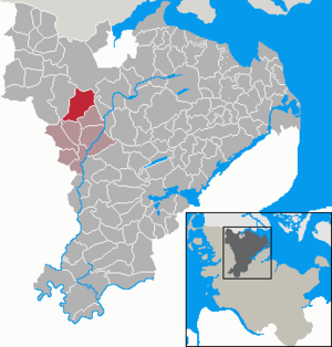
| Location of the municipality of Wanderup in the Schleswig-Flensburg district | ||
  |
||

Wanderup ( Danish : Vanderup ) is a municipality in the Schleswig-Flensburg district in Schleswig-Holstein . Birkwang ( Birkvang ), Friesik ( Frøsig ), Grünberg ( Grønbjerg ), Kellerholm, Kieracker ( Kærager ), Kragstedt ( Kragsted ), Osterkjer ( Østerkær ) and Westerkjer ( Vesterkær ) are in the municipality.
geography
The community is located as a street village on the federal highway 200 in the Schleswig Geest . Not far from the community is the dune on Rimmelsberg , a nature reserve that is part of Natura 2000 . Via the state road 12 there is a connection to the federal road 5 in Bredstedt . In the district of Kragstedt, the state road 14 leaves the B 200 and continues from there to the federal road 199 in Wallsbüll . The state road 15 connects the B 200 in Wanderup with the federal highway 7 .
history
Wanderup was first mentioned in 1377–1484 (Dipl. Flensb.). The prefix Wander- is derived from the personal name * Wambi , which is derived from the Old Norse vǫmb (correspondingly in German colloquial Wampe , see older Danish vom ), the meaning of the name is similar to the place name Vamdrup near Kolding . According to another interpretation, the name can indicate water (Danish: vand ). Friesik, documented in writing in 1801, consists of Danish. frøkorn for seeds or frø for frog and sig or siek for a swampy valley together.
Wanderup was first mentioned as Wompsdorf in the 14th century . The Romanesque stone church in Wanderup was built around 1180.
Attractions
The list of cultural monuments in Wanderup includes the cultural monuments entered in the monuments list of Schleswig-Holstein.
politics
Community representation
Of the 13 seats in the municipal council, the CDU has six seats since the local elections in 2018, the SSW has three, the voter community DGW two and the SPD two seats.
coat of arms
The coat of arms was approved on October 22, 1964.
Blazon : “Divided by gold and green. Above a standing black and white cow, below a golden chain of eight links. "
Wanderup developed in the 20th century into one of the centers of "black and colored breeding" in Schleswig-Holstein. The cow in the coat of arms, vividly drawn in black and silver tincture, gives a picture of this popular breed of cattle, which is known for its high milk yield and which visibly enlivens the agricultural landscape in summer. The particularly cultivated agricultural cooperative system in the village is symbolized by the other heraldic figure, the golden chain. The eight chain links stand for the eight districts of Birkwang, Friesik, Grünberg, Kellerholm, Kieracker, Kragstedt, Osterkjer and Westerkjer. At the same time, this symbol speaks for the cooperation of the cooperatives with the municipality, the office and the associations. The exclusively agricultural character of the place is emphasized again by the shield colors gold and green. An image seal with a black and white cow was approved by the British military government as early as 1946.
The coat of arms was designed by the Brunsbüttel heraldist Willy "Horsa" Lippert .
flag
The flag was approved on October 19, 2004.
On the horizontally divided, green-yellow flag cloth, the municipal coat of arms in tincture appropriate for the flag.
economy
The community is predominantly agricultural, although the active farms are not in the village, but in the peripheral areas.
Village museum
A village museum has been set up in the old school building, showing how people have lived in the Geest over the past two centuries and how the community has developed.
Picture gallery
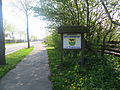
Entrance
( coming from Flensburg )
church
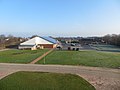
Country house on the Linnau
Only supermarket
(since 2014)
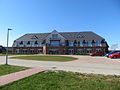
Town center

Westerkrug

Exit to Husum


Web links
Individual evidence
- ↑ North Statistics Office - Population of the municipalities in Schleswig-Holstein 4th quarter 2019 (XLSX file) (update based on the 2011 census) ( help on this ).
- ↑ Anders Bjerrum: Sydslesvigs Stednavne , Vol. 4, 1979–1986, p. 279
- ↑ Schleswig-Holstein topography. Vol. 10: Timmaspe - Ziethen . 1st edition Flying-Kiwi-Verl. Junge, Flensburg 2008, ISBN 978-3-926055-92-7 , p. 143 ( dnb.de [accessed on August 9, 2020]).
- ↑ Anders Bjerrum: Sydslesvigs stednavne , Vol. 4, Copenhagen 1979–1984. P. 279
- ↑ Wolfgang Laur: Historisches Ortsnamelexikon von Schleswig-Holstein , 2nd edition, Neumünster 1992, p. 676
- ↑ Johannes Kok: Det danske folkesprog i Sønderjylland , Vol. 2, Copenhagen 1867, p. 430
- ↑ Anders Bjerrum: Sydslesvigs stednavne , Vol. 4, Copenhagen 1979–1984. Pp. 279 and 283
- ↑ Wolfgang Laur: Historisches Ortsnamelexikon von Schleswig-Holstein , 2nd edition, Neumünster 1992, p. 260
- ↑ a b Schleswig-Holstein's municipal coat of arms
Ahneby | Alt Bennebek | Arnis | Ausacker | Bergenhusen | Böel | Böklund | Bollingstedt | Bores | Borgwedel | Börm | Böxlund | Brodersby-Goltoft | Busdorf | Dannewerk | Dollerup | Dbodstedt | Eggebek | Ellingstedt | Invent | Esgrus | Fahrdorf | Free will | Gelting | Geltorf | Glücksburg (Baltic Sea) | Grödersby | Great Rheide | Großewiehe | Large voltage | Grundhof | Handewitt | Harrislee | Hasselberg | Havetoft | Hollingstedt | Holt | Hörup | Hürup | Husby | Hüsby | Idstedt | Jagel | Janneby | Jardelund | Jerrishoe | Jörl | Jübek | Kappeln | Folded wood | Klein Bennebek | Klein Rheide | Kronsgaard | Kropp | Long-crowned | Langstedt | Lindewitt | Loit | Lottorf | Lürschau | Maasbüll | Maasholm | Medelby | Meggerdorf | Meyn | Middle fishing | Mohrkirch | Munkbrarup | Neuberend | Nieby | Sneeze gray | Norderbrarup | Nordhackstedt | Nottfeld | Nübel | Oersberg | Oeversee | Osterby | Pommerby | Rabel | Raven wood | Rabenkirchen-Faulück | Ringsberg | Rügge | Saustrup | Schaalby | Schafflund | Scheggerott | Schleswig | Schnarup-Thumby | Schuby | Selk | Sieverstedt | Silberstedt | Sollerup | Soerup | Hatchback | Stack | Steinberg | Steinberg Church | Steinfeld | Sterup | Proud | Stoltebüll | Struxdorf | Süderbrarup | Süderfahrenstedt | Süderhackstedt | Taarstedt | Tarp | Tastrup | Tetenhusen | Tielen | Tolk | Treia | Twedt | Uelsby | Ulsnis | Wagersrott | Wallsbull | Wanderup | Wees | Weesby | Westerholz | Wohlde