
Silberstedt
| coat of arms | Germany map | |
|---|---|---|

|
Coordinates: 54 ° 31 ' N , 9 ° 22' E |
|
| Basic data | ||
| State : | Schleswig-Holstein | |
| Circle : | Schleswig-Flensburg | |
| Office : | Arensharde | |
| Height : | 13 m above sea level NHN | |
| Area : | 37.91 km 2 | |
| Residents: | 2306 (Dec. 31, 2019) | |
| Population density : | 61 inhabitants per km 2 | |
| Postal code : | 24887 | |
| Primaries : | 04625, 04626 | |
| License plate : | SL | |
| Community key : | 01 0 59 079 | |
| LOCODE : | DE 72L | |
| Office administration address: | Hauptstrasse 41 24887 Silberstedt |
|
| Website : | ||
| Mayor : | Peter Johannsen ( CDU ) | |
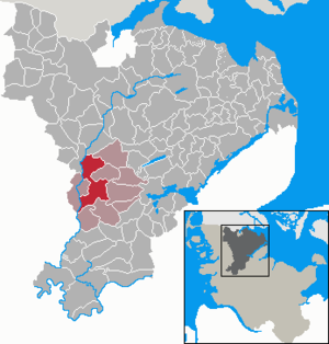
| Location of the community Silberstedt in the Schleswig-Flensburg district | ||
  |
||

Silberstedt ( Danish Sølvested or outdated Sylvested ) is a municipality near Schleswig an der Treene in the Schleswig-Flensburg district in Schleswig-Holstein . Büsche, Esperstoft, Holm, Hünning ( Hønning ), Krauheide, Maaskier ( Moskær ), Rosacker ( Rosager ) and Schwittschau ( Svidskov ) are in the municipality. In the north of the community on the border with Langstedt is the Büschauer Holz ( Byskov ).
history
Silberstedt was first mentioned in 1416 as Sulverstede . The current district of Rosacker was mentioned as early as 1196.
Silberstedt was expanded to include part of the Friedrichsfeld community, which was dissolved on January 20, 1873, and which was distributed to Silberstedt, Hollingstedt and Schuby.
Since 1970 it has been the rural central location and thus the seat of the administrative office for the Silberstedt office and since January 1, 2008 the Arensharde office .
A weather station has been in operation in Esperstoft since 2004.
Incorporations
Today's municipality has existed since November 1, 1976, when Silberstedt merged with Esperstoft, which is located to the north.
politics
Community representation
Of the 13 seats in the municipal council has CDU since the local elections in 2013 five seats, the SPD and the voter community WGS each have four.
coat of arms
Blazon : "A silver wave bar in green, accompanied by five golden ears of corn next to each other at the top, and by two slanted silver oak leaves at the bottom."
partnership
There is a partnership with the community of Groß Plasten in Mecklenburg-Western Pomerania .
economy
As a rural central location, the agriculturally oriented municipality has many commercial operations and a wide range of services.
Especially in the northern parts of the village, due to their direct location on the Treene, tourist facilities have developed since the turn of the millennium, for example in Hünning a holiday home area, a campsite on the farm and a canoe rental.
traffic
Silberstedt is crossed by the B 201 and is about halfway between Schleswig and Husum ; easternmost of the seven kilometers of highway driveway Schleswig / Schuby is the community by the Federal Highway 7 also well connected to the national road network.
The nearest railway stop is in the neighboring municipality of Jübek , which belongs to the office and where the railway line to Husum branches off from the Neumünster – Flensburg line.
Sons and daughters of the church
- Peter Johann Willatzen (1824–1898), teacher, translator and poet
Web links
Individual evidence
- ↑ North Statistics Office - Population of the municipalities in Schleswig-Holstein 4th quarter 2019 (XLSX file) (update based on the 2011 census) ( help on this ).
- ^ Videnskabernes Selskab: Kaart over den sydlige del af Slesvig , Copenhagen 1864
- ↑ a b c d Schleswig-Holstein topography. Vol. 9: Schönberg - Tielenhemme . 1st edition Flying-Kiwi-Verl. Junge, Flensburg 2007, ISBN 978-3-926055-91-0 , p. 124 ( dnb.de [accessed on August 5, 2020]).
- ↑ cf. Historical register of municipalities, State Statistical Office Schleswig-Holstein (ed.): The population of the municipalities in Schleswig-Holstein 1867–1970 . State Statistical Office Schleswig-Holstein, Kiel 1972, p. 176 and 237 .
- ^ Federal Statistical Office (ed.): Historical municipality directory for the Federal Republic of Germany. Name, border and key number changes for municipalities, counties and administrative districts from May 27, 1970 to December 31, 1982 . W. Kohlhammer, Stuttgart / Mainz 1983, ISBN 3-17-003263-1 , p. 185 .
- ↑ Schleswig-Holstein's municipal coat of arms
Ahneby | Alt Bennebek | Arnis | Ausacker | Bergenhusen | Böel | Böklund | Bollingstedt | Bores | Borgwedel | Börm | Böxlund | Brodersby-Goltoft | Busdorf | Dannewerk | Dollerup | Dbodstedt | Eggebek | Ellingstedt | Invent | Esgrus | Fahrdorf | Free will | Gelting | Geltorf | Glücksburg (Baltic Sea) | Grödersby | Great Rheide | Großewiehe | Large voltage | Grundhof | Handewitt | Harrislee | Hasselberg | Havetoft | Hollingstedt | Holt | Hörup | Hürup | Husby | Hüsby | Idstedt | Jagel | Janneby | Jardelund | Jerrishoe | Jörl | Jübek | Kappeln | Folded wood | Klein Bennebek | Klein Rheide | Kronsgaard | Kropp | Long-crowned | Langstedt | Lindewitt | Loit | Lottorf | Lürschau | Maasbüll | Maasholm | Medelby | Meggerdorf | Meyn | Middle fishing | Mohrkirch | Munkbrarup | Neuberend | Nieby | Sneeze gray | Norderbrarup | Nordhackstedt | Nottfeld | Nübel | Oersberg | Oeversee | Osterby | Pommerby | Rabel | Raven wood | Rabenkirchen-Faulück | Ringsberg | Rügge | Saustrup | Schaalby | Schafflund | Scheggerott | Schleswig | Schnarup-Thumby | Schuby | Selk | Sieverstedt | Silberstedt | Sollerup | Soerup | Hatchback | Stack | Steinberg | Steinberg Church | Steinfeld | Sterup | Proud | Stoltebüll | Struxdorf | Süderbrarup | Süderfahrenstedt | Süderhackstedt | Taarstedt | Tarp | Tastrup | Tetenhusen | Tielen | Tolk | Treia | Twedt | Uelsby | Ulsnis | Wagersrott | Wallsbull | Wanderup | Wees | Weesby | Westerholz | Wohlde