
Langstedt
| coat of arms | Germany map | |
|---|---|---|

|
Coordinates: 54 ° 37 ' N , 9 ° 23' E |
|
| Basic data | ||
| State : | Schleswig-Holstein | |
| Circle : | Schleswig-Flensburg | |
| Office : | Eggebek | |
| Height : | 16 m above sea level NHN | |
| Area : | 13.17 km 2 | |
| Residents: | 1052 (Dec. 31, 2019) | |
| Population density : | 80 inhabitants per km 2 | |
| Postal code : | 24852 | |
| Area code : | 04609 | |
| License plate : | SL | |
| Community key : | 01 0 59 138 | |
| Office administration address: | Hauptstrasse 2 24852 Eggebek |
|
| Website : | ||
| Mayor : | Ralf Ketelsen (KWL) | |
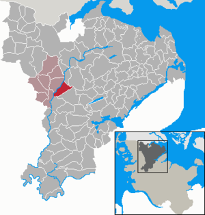
| Location of the municipality of Langstedt in the Schleswig-Flensburg district | ||
  |
||

Langstedt ( Danish : Langsted , South Jutland : Långste ) is a municipality in the Schleswig-Flensburg district in Schleswig-Holstein . Langstedt was awarded several times in the competition Our village should be more beautiful . Christinental, Marienhof, Osterlangstedt and Westerlangstedt are in the municipality.
Geography and traffic
Langstedt is located about 20 km south of Flensburg and 20 km northwest of Schleswig in a rural area on the Schleswig Geest on the Treene . The northern part of the more than 300 hectare Büschauer Holz ( Byskov ) belongs to the municipality .
To the east of the municipality, the federal highway 7 runs between the two cities, about 15 km northwest of the federal highway 200 from Flensburg to Husum .
history
The place was first mentioned in 1543, the place name describes an elongated site or settlement, going back to the old Danish stath . In the local area there is said to have been a cattle trough for the cattle on the drive to northern Denmark.
Langstedt is part of the parish Eggebek. In the Danish period the place was part of the Uggelharde (Flensburg Office) of the Duchy of Schleswig ( Sønderjylland ). After the German-Danish War in 1864, the place came to Prussia / Germany .
politics
Community representation
Of the eleven seats in the municipal council, the KWL electoral community won eight seats and the SPD three in the local elections on May 6, 2018 .
coat of arms
Blazon : “In gold between two green elm leaves, a black wall anchor, consisting of a rod that ends above and below in a heraldic lily, the lower one overturned, and to which an iron band is forged on both sides, which ends in an outward and inward spiral below. The upper spirals are rotating several times. "
The leaves first point to the rich elm population in the townscape and are intended to indicate the integration of people into nature and therefore the need to treat nature carefully. The wall anchor shows a link and is intended to indicate solidarity in the village living community as a connection, so the wall anchor ultimately links the past, present and future of the place.
economy
The community is predominantly agricultural. In addition to numerous farms, the community is home to an inn with a hotel and a large number of small craft businesses.
Attractions
The list of cultural monuments in Langstedt includes the cultural monuments entered in the list of monuments of Schleswig-Holstein.
Personalities
The Schleswig-Holstein Minister for Food, Agriculture and Forests in 1946/47 Hans Bundtzen (1883–1948) was born in Langstedt in 1883.
literature
- Eggebeker Heimatbuch - also called Chronicle I - published in 1939. Created by Wilhelm Clausen. Includes the parish villages of Eggebek, Jerrishoe, Keelbek-Tornschau, Langstedt, Bollingstedt and Esperstoft-Hunding.
- Chronicle II, Edition A - Published in 1997 as an update only for the municipalities of Eggebek, Jerrishoe and Langstedt, because only these three municipalities were able to maintain their borders with those of 1839. The chronicle deals with: communal history - social areas - nature and environment - national socialism - war and post-war period - agriculture - life in the country - handicrafts, trade and service companies - clubs and communities - cooperatives - Eggebeker church - schools in the Villages. Individual contributions. - Edited by Christian Sönnichsen, Langstedt.
- Chronicle II, Edition B - Published in 2003 as a property and family chronicle in continuation of Chronicle II, Edition A. - Edited by Christian Sönnichsen, Langstedt.
Individual evidence
- ↑ North Statistics Office - Population of the municipalities in Schleswig-Holstein 4th quarter 2019 (XLSX file) (update based on the 2011 census) ( help on this ).
- ↑ Schleswig-Holstein topography. Vol. 6: Kronprinzenkoog - Mühlenrade . 1st edition Flying-Kiwi-Verl. Junge, Flensburg 2006, ISBN 978-3-926055-85-9 , pp. 103 ( dnb.de [accessed June 26, 2020]).
- ↑ Anders Bjerrum: Sydslesvigs stednavne , Vol. 4, Copenhagen 1979–1984. P. 387
- ↑ Wolfgang Laur: Historisches Ortsnamelexikon von Schleswig-Holstein , 2nd edition, Neumünster 1992, p. 422
- ↑ Municipal Council , accessed on May 6, 2019.
- ↑ Schleswig-Holstein's municipal coat of arms
Web links
Ahneby | Alt Bennebek | Arnis | Ausacker | Bergenhusen | Böel | Böklund | Bollingstedt | Bores | Borgwedel | Börm | Böxlund | Brodersby-Goltoft | Busdorf | Dannewerk | Dollerup | Dbodstedt | Eggebek | Ellingstedt | Invent | Esgrus | Fahrdorf | Free will | Gelting | Geltorf | Glücksburg (Baltic Sea) | Grödersby | Great Rheide | Großewiehe | Large voltage | Grundhof | Handewitt | Harrislee | Hasselberg | Havetoft | Hollingstedt | Holt | Hörup | Hürup | Husby | Hüsby | Idstedt | Jagel | Janneby | Jardelund | Jerrishoe | Jörl | Jübek | Kappeln | Folded wood | Klein Bennebek | Klein Rheide | Kronsgaard | Kropp | Long-crowned | Langstedt | Lindewitt | Loit | Lottorf | Lürschau | Maasbüll | Maasholm | Medelby | Meggerdorf | Meyn | Middle fishing | Mohrkirch | Munkbrarup | Neuberend | Nieby | Sneeze gray | Norderbrarup | Nordhackstedt | Nottfeld | Nübel | Oersberg | Oeversee | Osterby | Pommerby | Rabel | Raven wood | Rabenkirchen-Faulück | Ringsberg | Rügge | Saustrup | Schaalby | Schafflund | Scheggerott | Schleswig | Schnarup-Thumby | Schuby | Selk | Sieverstedt | Silberstedt | Sollerup | Soerup | Hatchback | Stack | Steinberg | Steinberg Church | Steinfeld | Sterup | Proud | Stoltebüll | Struxdorf | Süderbrarup | Süderfahrenstedt | Süderhackstedt | Taarstedt | Tarp | Tastrup | Tetenhusen | Tielen | Tolk | Treia | Twedt | Uelsby | Ulsnis | Wagersrott | Wallsbull | Wanderup | Wees | Weesby | Westerholz | Wohlde