
Pommerby
| coat of arms | Germany map | |
|---|---|---|

|
Coordinates: 54 ° 46 ' N , 9 ° 56' E |
|
| Basic data | ||
| State : | Schleswig-Holstein | |
| Circle : | Schleswig-Flensburg | |
| Office : | Geltinger Bay | |
| Height : | 19 m above sea level NHN | |
| Area : | 5.55 km 2 | |
| Residents: | 153 (Dec. 31, 2019) | |
| Population density : | 28 inhabitants per km 2 | |
| Postal code : | 24395 | |
| Area code : | 04643 | |
| License plate : | SL | |
| Community key : | 01 0 59 152 | |
| Office administration address: | Holmlück 2 24972 Steinbergkirche |
|
| Website : | ||
| Mayor : | Malte Jacobsen ( CDU ) | |
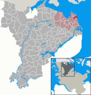
| Location of the municipality of Pommerby in the Schleswig-Flensburg district | ||
  |
||

Pommerby is a municipality on the Baltic Sea in the Schleswig-Flensburg district in Schleswig-Holstein . Börsby ( Danish : Børsby ), Falshöft, Gammeldamm ( Gammeldam ), Golsmaas, Langfeld, Mühlenbrück, Niedamm ( Nydam ), Sibbeskjär ( Sibbeskjær ) and Wattsfeld ( Vadsmark ) are in the municipality. To the north of the community lies the Geltinger Birk bird sanctuary . Pommerby is a recognized resort.
history
Pommerby was first mentioned in 1409 and as a Meierhof belonged to Gut Rundhof ( Grumtoft ). Ecclesiastically it belonged to the parish of Gelting . The districts Gammeldamm and Niedamm belonged to Gut Düttebüll ( Dyttebøl ), Börsby to Gut Buckhagen ( Bukhavn ). The estates formed their own lower court districts until 1853, then the Kappelerharde took over this function, and in 1867 finally the new district court in Kappeln . Since the introduction of the Prussian rural community order in 1867, Pommerby formed an independent rural community . While most of the neighboring parishes have since merged into larger units, the boundaries of the small parish of Pommerby have remained unchanged to this day.
politics
Community representation
Of the seven seats in the municipal council has CDU since the local elections in 2013 four and the voter community WGP three seats.
coat of arms
Blazon : "Above a blue corrugated shield foot, inside a corner placed silver harrow, in gold a growing lighthouse, divided three times by red and silver with two circumferential galleries below the pointed helmet."
economy
The community is characterized by agriculture and tourism.
Attractions
The list of cultural monuments in Pommerby includes the cultural monuments entered in the list of monuments of Schleswig-Holstein.
The Falshöft lighthouse, built in 1910, is 28 m high. Among other things, it is used by the community as a wedding room. Since 2019 it also contains a maritime museum.
Son of the community
The local writer Georg Asmussen (1856–1933), to whom the village museum commemorates, was born in 1856 in Pommerby.
Web links
Individual evidence
- ↑ North Statistics Office - Population of the municipalities in Schleswig-Holstein 4th quarter 2019 (XLSX file) (update based on the 2011 census) ( help on this ).
- ^ M. Mørk Hansen: Kirkelig Statistics over Slesvig Stift: Med historiske og topografiske bemærkninger , Volume 2, Kjøbenhavn 1864, p. 297
- ↑ Schleswig-Holstein topography. Vol. 8: Pölitz - Schönbek . 1st edition Flying-Kiwi-Verl. Junge, Flensburg 2007, ISBN 978-3-926055-89-7 , pp. 4 ( dnb.de [accessed on July 22, 2020]).
- ↑ Schleswig-Holstein's municipal coat of arms
Ahneby | Alt Bennebek | Arnis | Ausacker | Bergenhusen | Böel | Böklund | Bollingstedt | Bores | Borgwedel | Börm | Böxlund | Brodersby-Goltoft | Busdorf | Dannewerk | Dollerup | Dbodstedt | Eggebek | Ellingstedt | Invent | Esgrus | Fahrdorf | Free will | Gelting | Geltorf | Glücksburg (Baltic Sea) | Grödersby | Great Rheide | Großewiehe | Large voltage | Grundhof | Handewitt | Harrislee | Hasselberg | Havetoft | Hollingstedt | Holt | Hörup | Hürup | Husby | Hüsby | Idstedt | Jagel | Janneby | Jardelund | Jerrishoe | Jörl | Jübek | Kappeln | Folded wood | Klein Bennebek | Klein Rheide | Kronsgaard | Kropp | Long-crowned | Langstedt | Lindewitt | Loit | Lottorf | Lürschau | Maasbüll | Maasholm | Medelby | Meggerdorf | Meyn | Middle fishing | Mohrkirch | Munkbrarup | Neuberend | Nieby | Sneeze gray | Norderbrarup | Nordhackstedt | Nottfeld | Nübel | Oersberg | Oeversee | Osterby | Pommerby | Rabel | Raven wood | Rabenkirchen-Faulück | Ringsberg | Rügge | Saustrup | Schaalby | Schafflund | Scheggerott | Schleswig | Schnarup-Thumby | Schuby | Selk | Sieverstedt | Silberstedt | Sollerup | Soerup | Hatchback | Stack | Steinberg | Steinberg Church | Steinfeld | Sterup | Proud | Stoltebüll | Struxdorf | Süderbrarup | Süderfahrenstedt | Süderhackstedt | Taarstedt | Tarp | Tastrup | Tetenhusen | Tielen | Tolk | Treia | Twedt | Uelsby | Ulsnis | Wagersrott | Wallsbull | Wanderup | Wees | Weesby | Westerholz | Wohlde