
Kronsgaard
| coat of arms | Germany map | |
|---|---|---|

|
Coordinates: 54 ° 44 ' N , 9 ° 58' E |
|
| Basic data | ||
| State : | Schleswig-Holstein | |
| Circle : | Schleswig-Flensburg | |
| Office : | Geltinger Bay | |
| Height : | 0 m above sea level NHN | |
| Area : | 5.92 km 2 | |
| Residents: | 244 (Dec. 31, 2019) | |
| Population density : | 41 inhabitants per km 2 | |
| Postal code : | 24395 | |
| Area code : | 04643 | |
| License plate : | SL | |
| Community key : | 01 0 59 136 | |
| Office administration address: | Holmlück 2 24972 Steinbergkirche |
|
| Website : | ||
| Mayor : | Hans-Walter Jens ( CDU ) | |
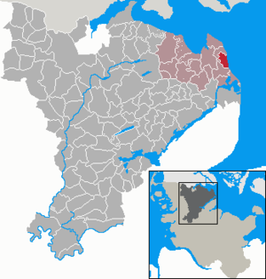
| Location of the municipality of Kronsgaard in the Schleswig-Flensburg district | ||
  |
||

Kronsgaard is a municipality in the Schleswig-Flensburg district in Schleswig-Holstein . It is located in the fishing landscape on the Baltic Sea . Breede ( Danish : Brede ), Boysenfeld, Domstag, Düttebüll ( Dyttebøl ), Golsmaas, Klorr, Langfeld and Pottloch ( Puthul ) are in the municipality.
geography
location
The municipality of Kronsgaard is located near the Geltinger Bay , a bulge in the Baltic Sea in the fishing region . Because of this location, the community was assigned to the office of Geltinger Bucht. The access to the Schlei is not far south of Kronsgaard . Incidentally, Kronsgaard is roughly at sea level and thus at 0 m above sea level. NN .
Neighboring communities
Kronsgaard is part of the Schleswig-Flensburg district . To the north and northwest is the municipality of Pommerby , to the south and southwest of the municipality of Hasselberg . In the east, Kronsgaard borders the Baltic Sea.
history
Kronsgaard was first mentioned as a farm complex in 1535, the name being composed of the Danish Gaard or Gård for farm and the crown as a reference to royal property. So it was a royal estate. The farm was demolished and the stones were used as building material for the near Gelting location Good ear field used. Initially the place belonged to Gut Buckhagen , later to Gut Düttebüll.
The village of Düttebüll, which today belongs to the municipality, was first mentioned in 1409. The Neolithic large stone grave Kronsgaard was in the municipality. Ecclesiastically Kronsgaard belonged to the parish of Gelting.
In 1922 a steamer from the Mürwiker torpedo station called Antrax sank near Kronsgaard. Twelve marines died.
politics
Community representation
Of the nine seats in the municipal council has Wählergemeinschaft CHP (Municipal Wählergemeinschaft Kronsgaard) since the local elections in 2013 five seats, the CDU has four seats.
coat of arms
Blazon : "In blue, a golden crown over a silver cross, the transverse wood of which ends in nail tips and the long wood ends in a ring with an eyelet and in a ball at the bottom."
The coat of arms represents the Kronsgaard death key. This is carried from house to house in the event of a death in order to inform the neighbors.
Culture and sights

The list of cultural monuments in Kronsgaard includes the cultural monuments entered in the list of monuments of Schleswig-Holstein.
Good Düttebüll
Gut Düttebüll was created in 1554 as a noble residence. The mansion was significantly rebuilt in 1785. In addition to the manor house, farm buildings, a bridge and an avenue of lime trees have been preserved. It is completely surrounded by a moat. The estate is privately owned and cannot be visited.
Economy and Transport
Agriculture and tourism characterize the municipality, with tourism particularly concentrated in the district of Golsmaas, which is located on the Baltic Sea. The main area of Golsmaas consists of the DEW holiday village, which was built in 1965 and consists of more than 60 holiday homes. Here Kronsgaard has an almost three kilometer long natural beach.
Web links
Individual evidence
- ↑ North Statistics Office - Population of the municipalities in Schleswig-Holstein 4th quarter 2019 (XLSX file) (update based on the 2011 census) ( help on this ).
- ↑ Anders Bjerrum, Kristian Hald, Peter Jørgensen: Sydslesvigs stednavne , Volume 7, Akademisk forlag, 1979, p. 423.
- ↑ Schleswig-Holstein topography. Vol. 6: Kronprinzenkoog - Mühlenrade . 1st edition Flying-Kiwi-Verl. Junge, Flensburg 2006, ISBN 978-3-926055-85-9 , pp. 4 ( dnb.de [accessed June 25, 2020]).
- ↑ History ( Memento of August 18, 2009 in the Internet Archive ) Presentation on the Kronsgaard community website .
- ↑ Schleswig-Holstein's municipal coat of arms
Ahneby | Alt Bennebek | Arnis | Ausacker | Bergenhusen | Böel | Böklund | Bollingstedt | Bores | Borgwedel | Börm | Böxlund | Brodersby-Goltoft | Busdorf | Dannewerk | Dollerup | Dbodstedt | Eggebek | Ellingstedt | Invent | Esgrus | Fahrdorf | Free will | Gelting | Geltorf | Glücksburg (Baltic Sea) | Grödersby | Great Rheide | Großewiehe | Large voltage | Grundhof | Handewitt | Harrislee | Hasselberg | Havetoft | Hollingstedt | Holt | Hörup | Hürup | Husby | Hüsby | Idstedt | Jagel | Janneby | Jardelund | Jerrishoe | Jörl | Jübek | Kappeln | Folded wood | Klein Bennebek | Klein Rheide | Kronsgaard | Kropp | Long-crowned | Langstedt | Lindewitt | Loit | Lottorf | Lürschau | Maasbüll | Maasholm | Medelby | Meggerdorf | Meyn | Middle fishing | Mohrkirch | Munkbrarup | Neuberend | Nieby | Sneeze gray | Norderbrarup | Nordhackstedt | Nottfeld | Nübel | Oersberg | Oeversee | Osterby | Pommerby | Rabel | Raven wood | Rabenkirchen-Faulück | Ringsberg | Rügge | Saustrup | Schaalby | Schafflund | Scheggerott | Schleswig | Schnarup-Thumby | Schuby | Selk | Sieverstedt | Silberstedt | Sollerup | Soerup | Hatchback | Stack | Steinberg | Steinberg Church | Steinfeld | Sterup | Proud | Stoltebüll | Struxdorf | Süderbrarup | Süderfahrenstedt | Süderhackstedt | Taarstedt | Tarp | Tastrup | Tetenhusen | Tielen | Tolk | Treia | Twedt | Uelsby | Ulsnis | Wagersrott | Wallsbull | Wanderup | Wees | Weesby | Westerholz | Wohlde