
Uelsby
| coat of arms | Germany map | |
|---|---|---|

|
Coordinates: 54 ° 38 ' N , 9 ° 36' E |
|
| Basic data | ||
| State : | Schleswig-Holstein | |
| Circle : | Schleswig-Flensburg | |
| Office : | South fishing | |
| Height : | 34 m above sea level NHN | |
| Area : | 10.59 km 2 | |
| Residents: | 437 (Dec 31, 2019) | |
| Population density : | 41 inhabitants per km 2 | |
| Postcodes : | 24860, 24891 | |
| Area code : | 04623 | |
| License plate : | SL | |
| Community key : | 01 0 59 093 | |
| Office administration address: | Toft 7 24860 Böklund |
|
| Website : | ||
| Mayor : | Hartmut Lund (AAU) | |
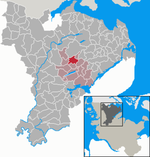
| Location of the municipality of Uelsby in the Schleswig-Flensburg district | ||
  |
||

Uelsby (formerly also: Ülsby; Danish : Ølsby ) is a municipality in the Schleswig-Flensburg district in Schleswig-Holstein . In the municipality are Quastrup ( Kvastrup ), Stade, Uelsbyfeld and Uelsbyholz ( Ølsbyskov ).
Geography and traffic
Uelsby is located about 16 kilometers north of Schleswig and 20 kilometers south of Flensburg in a rural area. To the west, the federal highway 7 runs from Schleswig to Flensburg and to the south, the federal highway 201 runs from Schleswig to Kappeln . Country road 22 runs through Uelsby and connects Sörup with Triangel on the B 201.
history
The Jakobuskirche was built in the 13th century.
After the spelling Ülsby kept appearing in addition to the traditional spelling Uelsby , the municipal council decided in the mid-1990s to use the spelling Uelsby for the municipality name.
politics
Community representation
Since the 2013 local elections , the AAU electoral community has all nine seats in the municipal council .
coat of arms
Blazon : “Divided by green, gold and silver by two gold-blue goblets pushed together. A black church below. "
Attractions
The list of cultural monuments in Uelsby includes the cultural monuments entered in the list of monuments of Schleswig-Holstein.
Uelsby Church was built in the 13th century. According to legend, it was donated by a noble lady from Uelsby. Before the church existed, the lady went to the church in Struxdorf , but there her "lap dog" was bitten by another dog, hence the building of her own church.
Web links
Individual evidence
- ↑ North Statistics Office - Population of the municipalities in Schleswig-Holstein 4th quarter 2019 (XLSX file) (update based on the 2011 census) ( help on this ).
- ↑ Schleswig-Holstein topography. Vol. 10: Timmaspe - Ziethen . 1st edition Flying-Kiwi-Verl. Junge, Flensburg 2008, ISBN 978-3-926055-92-7 , p. 72 ( dnb.de [accessed on August 6, 2020]).
- ↑ Schleswig-Holstein's municipal coat of arms
- ↑ Gundula Hubrich-Messow (ed.): Legends and fairy tales from fishing . Husum 1987, ISBN 3-88042-390-3 , p. 75: The Church of Ülsby.
Ahneby | Alt Bennebek | Arnis | Ausacker | Bergenhusen | Böel | Böklund | Bollingstedt | Bores | Borgwedel | Börm | Böxlund | Brodersby-Goltoft | Busdorf | Dannewerk | Dollerup | Dbodstedt | Eggebek | Ellingstedt | Invent | Esgrus | Fahrdorf | Free will | Gelting | Geltorf | Glücksburg (Baltic Sea) | Grödersby | Great Rheide | Großewiehe | Large voltage | Grundhof | Handewitt | Harrislee | Hasselberg | Havetoft | Hollingstedt | Holt | Hörup | Hürup | Husby | Hüsby | Idstedt | Jagel | Janneby | Jardelund | Jerrishoe | Jörl | Jübek | Kappeln | Folded wood | Klein Bennebek | Klein Rheide | Kronsgaard | Kropp | Long-crowned | Langstedt | Lindewitt | Loit | Lottorf | Lürschau | Maasbüll | Maasholm | Medelby | Meggerdorf | Meyn | Middle fishing | Mohrkirch | Munkbrarup | Neuberend | Nieby | Sneeze gray | Norderbrarup | Nordhackstedt | Nottfeld | Nübel | Oersberg | Oeversee | Osterby | Pommerby | Rabel | Raven wood | Rabenkirchen-Faulück | Ringsberg | Rügge | Saustrup | Schaalby | Schafflund | Scheggerott | Schleswig | Schnarup-Thumby | Schuby | Selk | Sieverstedt | Silberstedt | Sollerup | Soerup | Hatchback | Stack | Steinberg | Steinberg Church | Steinfeld | Sterup | Proud | Stoltebüll | Struxdorf | Süderbrarup | Süderfahrenstedt | Süderhackstedt | Taarstedt | Tarp | Tastrup | Tetenhusen | Tielen | Tolk | Treia | Twedt | Uelsby | Ulsnis | Wagersrott | Wallsbull | Wanderup | Wees | Weesby | Westerholz | Wohlde