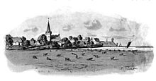
South stack
|
South stack
Parish stacks
|
||
|---|---|---|
| Coordinates: 54 ° 21 ′ 1 ″ N , 9 ° 13 ′ 6 ″ E | ||
| Height : | 6 m | |
| Area : | 16.75 km² | |
| Residents : | 1001 (December 31, 2016) | |
| Population density : | 60 inhabitants / km² | |
| Incorporation : | 1st March 2018 | |
| Postal code : | 25879, 25868, 25878 | |
| Area code : | 04883 | |
|
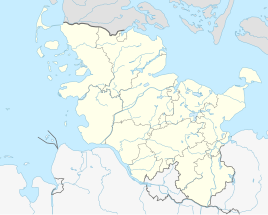
Location of Süderstapel in Schleswig-Holstein |
||
Süderstapel ( Danish : Sønder Stabel) is a district of the municipality of Stapel in the Schleswig-Flensburg district in Schleswig-Holstein . It borders on the two districts of Dithmarschen and North Friesland .
Geography and traffic
Süderstapel is located on the southernmost edge of the Stapelholmer Geestrück, which has its highest point with the Twieberg in Norderstapel . Süderstapel lies on the Eider , so that here the Geestrücken extends up to 15 meters over the adjacent bank of the Eider. In the municipality, the Alte Sorge is drained into the Eider via the Großer Schlote and Neuer Schlote, the direct connection is separated by the stone sluice. Large parts of the catchment area of the Alte Sorge, as well as the former Norderstapeler See, are below sea level, so that their water here has to be scooped into the Eider while the river Eider is dammed. On the Eiderdeich itself there is a Wehle from 1794.
Süderstapel is located about 18 km southeast of Husum on the federal highway 202 from Rendsburg towards the North Sea coast. The railways Schleswig - Friedrichstadt (1905) and Rendsburg-Husum ran through the place but were discontinued in 1934 and 1974 respectively.
history
In Süderstapel there are several prehistoric tombs, including a burial mound on the Wollenberg, so that the region must have been inhabited at this time. Süderstapel was probably founded around 1200, as the Katharinenkirche dates from this time. The first written mention, however, comes from the middle of the 15th century. Süderstapel was at that time of trial, and after the Dithmarscher the Tielenburg had destroyed, since 1500 the seat of the Stapelholmer bailiff. After the Dithmarschers from the southern bank of the Eider had represented the greatest danger for the place up to the 16th century, a major fire destroyed parts of the town center in 1885.
politics
On March 1, 2018, the municipalities of Süderstapel and Norderstapel merged to form the new municipality of Stapel . The citizens decided on the merger in a referendum on September 24, 2017.
Former community council
Of the eleven seats in the municipal council had CDU 2003 six seats after the local elections, the SPD had four and the Wählergemeinschaft a WGS.
After the 2008 local elections, the SPD and the WGS electoral community each had four seats and the CDU three seats. Since the local elections in 2013, the AfS constituency had four seats, the WGS constituency and the CDU each had three seats and the SPD had one seat.
Former mayor
Alexander Schmitz-Neuber from the AfS constituency has been mayor of the community since 2013. He replaced Ingo Endler from the SPD, who took over the office of Hans-Joachim Bellendorf from the CDU in 2008.
coat of arms
Blazon : "In blue an upright, short, golden rod that ends with a knob at the top and bottom, thickening in the middle, and with its lower half covers three silver wavy threads."
economy
The local area is predominantly agricultural, but there are also some commercial and industrial establishments. Tourism is an important source of income for the community. There are two yacht harbors with 120 berths and a beach on the Eider.
Culture and tourism
The list of cultural monuments in Süderstapel includes the cultural monuments entered in the monuments list of Schleswig-Holstein.
The St. Catherine's Church is one of the oldest surviving churches in today Stapelholm. The choir with the semicircular apse was probably built in two construction phases. The start of construction is dated around 1300. Later the nave and the tower were added to the chapel. It was destroyed several times by attacks by the Dithmarschers in the 15th century. The last major change took place after a lightning strike in 1876.
The most famous sight in Süderstapel is the Ohlsenhaus, a half-timbered house with half-timbering facing the street, which is rare for the area. The farmer's bell in front of the same property is relatively young with a creation date of 1874, as the bell of the Katharinenkirche previously performed related tasks. Since 2006, the Deele of the listed building has been the meeting point and venue for an ambitious literature series in the Ohlsenhaus, especially between May and September, under the motto author-book encounters .
Other sights include the Wegmann Fjord Stud and the former Eiderschleife restaurant in Vogteistraße. In 1821, the administrative office of the governor was added to the pharmacist and district doctor's office from 1810. The privilege of 1844 for the pharmacy business goes back to the Danish king. In summer, many guests come to the beach on the Eider .
Sons and daughters of the place
- Johann Adrian Bolten (1742–1807), Lutheran theologian, historian, writer and Bible translator
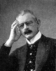
- Adolf von Tiedemann (1865–1915), officer, publicist and colonialist
- Hinrich Medau (1890–1974), gymnastics teacher , founder of the Medau School at Hohenfels Castle in Coburg
literature
- Martin Becker and Gert Kaster: Eider-Treene-Sorge cultural landscape . Wachholtz Verlag, Neumünster 2005, pp. 81–83.
- Jörg Ewersen: Stapelholmer BaukulTour - A circular route to important architectural monuments in the Stapelholm landscape . Amt Kropp, Stapelholm 2006.
Web links
Individual evidence
- ↑ Gero Trittmaack: Fusion with a sure instinct . In: Schleswiger Nachrichten. February 27, 2016. Retrieved September 28, 2017 .
- ↑ How two villages become one. ndr.de, September 25, 2017, accessed on September 28, 2017 .
- ↑ Schleswig-Holstein's municipal coat of arms


