Goltoft
|
Goltoft
Brodersby-Goltoft parish
|
||
|---|---|---|
| Coordinates: 54 ° 32 ′ 50 ″ N , 9 ° 43 ′ 22 ″ E | ||
| Height : | 17 m | |
| Area : | 3.09 km² | |
| Residents : | 214 (December 31, 2016) | |
| Population density : | 69 inhabitants / km² | |
| Incorporation : | 1st March 2018 | |
| Postal code : | 24864 | |
| Area code : | 04622 | |
|
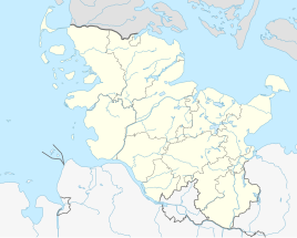
Location of Goltoft in Schleswig-Holstein |
||
Goltoft is a district of the municipality Brodersby-Goltoft in the Schleswig-Flensburg district in Schleswig-Holstein . Hellör, Norderfeld and Nordschau belong to the place.
geography
Goltoft is located on the Schlei and is a recognized resort .
history
The name of the place, first mentioned in 1386, comes from the Danish and means settlement place (toft) in barren terrain (gold) .
In earlier times there was a chapel in Goltoft, which was located on the so-called Karkbarg , which is east of the village. Since it was mentioned as early as 1463 that there were no more services in the chapel, it can be assumed that the chapel closed in the period after that. The pastorate remained in Goltoft until 1765 when it was moved to Brodersby , which had none before. Today the only legacy left is the field name Kirchenberg and the street name Zum Kirchberg. In the map “Duchy of Schleswig” (published 1756–1777) Goltoft is also referred to as “Capelberg”, located between “Hessttofft” and “Brodersbuy”.
On March 1, 2018, the municipality of Goltoft was incorporated into the neighboring municipality of Brodersby, which was then given its current name.
politics
All nine seats in the last local council had since the local elections in 2013 the voter community GWG.
Former mayor
Carmen Marxsen (GWG) was the last mayor of the dissolved municipality of Goltoft.
coat of arms
Blazon : “Divided lowered by gold and blue in a wave cut. At the top two fan-shaped green oak leaves , the stems of which are held together by a knotted green ribbon, at the bottom a silver fish . "
The two figures of the Goltofter coat of arms relate to historical circumstances. The held together by a knotted belt oak leaves are the stylized form of a double oak , the memento of the Schleswig-Holstein uprising of 1848. As in many communities was also Goltoft, probably the fiftieth anniversary in 1898, planted such oak. The old oak, which was removed by road construction in 1978, was replaced by a new one the following year. The knot of the coat of arms is a sign of the unbreakable bond between Schleswig and Holstein , the oak a guarantee for the independence and stability of the citizens of the community. Goltoft was part of the Schliesharde or Schleiharde. As an administrative and judicial district, the Schliesharde had a seal . The seal picture was a fish, which symbolized the location on the fish-rich Schlei. Goltoft took over the fish from this Hardes seal.
economy
The place is characterized by agriculture. Tourism is an important source of income.
tourism
Goltoft has a campsite. The since 1964 existing campsite Hellör is next to the loop in a protected landscape area. There is also a canoe rental , a hand weaving mill, a bike rental and rental apartments.
Personalities
Wilfried Erdmann lives in Goltoft , the only single-handed sailor who has sailed around the world non-stop in both directions and with the same sailing yacht Kathena Nui (1984–1985 in west-east direction, 2000–2001 in east-west direction).
Web links
Individual evidence
- ↑ Wolfgang Laur : Historisches Ortnamelexikon von Schleswig-Holstein , Neumünster 1992.
- ↑ Jensen, HN: fishing. Described historically and topographically . Schramm, B, 1922, ISBN 3-921361-00-1 , pp. 743 .
- ↑ https://archive.thulb.uni-jena.de/collections/receive/HisBest_imgitem_00000025
- ↑ Schleswig-Holstein's municipal coat of arms


