
Oldenburg in Holstein
| coat of arms | Germany map | |
|---|---|---|

|
Coordinates: 54 ° 18 ' N , 10 ° 53' E |
|
| Basic data | ||
| State : | Schleswig-Holstein | |
| Circle : | Ostholstein | |
| Height : | 12 m above sea level NHN | |
| Area : | 39.68 km 2 | |
| Residents: | 9794 (Dec. 31, 2019) | |
| Population density : | 247 inhabitants per km 2 | |
| Postal code : | 23758 | |
| Area code : | 04361 | |
| License plate : | OH | |
| Community key : | 01 0 55 033 | |
| LOCODE : | DE OLH | |
City administration address : |
Markt 1 23758 Oldenburg in Holstein |
|
| Website : | ||
| Mayor : | Jörg Saba ( independent ) | |
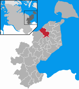
| Location of the city of Oldenburg in Holstein in the Ostholstein district | ||
  |
||

Oldenburg in Holstein ( Low German : Olenborg and Oudeborg , Danish : Oldenborg ) is a town in Schleswig-Holstein north of Lübeck in the Ostholstein district .
geography
Oldenburg is located between the Hohwachter Bay in the west and the Lübeck Bay in the east on the Wagrien peninsula , just under 50 km (as the crow flies ) north of Lübeck, immediately north of the Oldenburg Graben . Not far from Oldenburg are the seaside resorts of Weißenhäuser Strand , Heiligenhafen , Grömitz and Neustadt in Holstein .
The districts of Bruch, Dannau, Johannisdorf, Kleinwessek, Kröß and Lübbersdorf belong to Oldenburg. The military training area Putlos of the Bundeswehr with the Wagrien barracks is located north of the Dannau district and the core town of Oldenburg .
history


Oldenburg used to be on a bay in the Baltic Sea and was the port and main town of the Slavic Wagrians . Between 780 and 840 what is known today as the Oldenburger Wall was built , a Slavic castle complex of which only one wall remains today. The westernmost Slavic prince seat Starigard ("Old Castle") became the place name Aldinborg , later Oldenburg . The place was fought over in the early Middle Ages. In 972 at the latest (others call it 968 or even 948), the later so-called Diocese of Oldenburg was established in Starigard , which belonged to the Archdiocese of Hamburg .
Adam von Bremen mentions the German version of the name Oldenburg for the first time in 1076: “ Aldinborg civitas magna Sclavorum, qui Waigri dicuntur, sita est iuxta mare, quod Balticum sive Barbarum dicitur, itinere die. .. from Hammaburg “( Aldinburg is a large city of the Slavs, called Wagrians, located near the sea, which is called the Baltic or the barbaric, ... a day's journey from Hamburg ). Together with Haithabu , Aldinburg was a port in the Baltic Sea trade . The ships went as far as Samland or Kiev .
The St. John's Church was built from around 1150 . Around this time the Slavic tribes were disempowered, in 1160 (or 1163) the bishopric was moved to Lübeck. 1233 Oldenburg were by Count Adolf IV. The city rights awarded. Since 1325 "before the Dolgentor" a medieval leper detectable, which was called "St.-Jürgen-Hospital".
There are only a few historical records about the navigability of the Oldenburg Graben and direct access to the settlement's Baltic Sea, which also leave a lot of room for interpretation:
Helmold von Bosau wrote in his Slavonic Chronicle (Chapter 109) on 1168–1171: “Filius quoque regis ex concubina natus Christoforus nomine cum mille, ut aiunt, loricis venit ad Aldenburg, quae Danice dicitur Brandenhuse, et percusserunt maritima illius.” (“Also the son of the [Danish] king, born of a lover [and] Christopher by name, came with a thousand, it is said, armored fighters to Oldenburg, which is called Brandenhuse in Danish, and they destroyed its coastline. ")
Sebastian Münster says in his Cosmographia Universalis from 1552: “Olim ad mare posita civitas portum habebat tutissimum, nunc mediterranea videtur abiisse, quod mariaestus exaggerans arenas exclusit urbem a portu, ut importuosa esset, indeque & per Sclavorum bella defluxit splendor eius, ut iamamendor eius diu rusticum nec clausum habeatur oppidulum. ” (“ The city once located on the sea had a very safe harbor, but now seems to be shifted in the middle of the country because the waves of the sea, bringing sand up, cut off the city from the harbor, so that it was no longer usable; therefore, and due to the Slavic Wars, its prosperity dwindled, so that it is only a rural town and has no fortifications. ")
The view from 1572 from Georg Braun's and Frans Hogenberg's Civitates Orbis Terrarum , incorrectly referred to as “Aldenburgum Holsatiae”, is not a view of Oldenburg, but a view of the Hanseatic city of Stade .
A map of Wagrien by Johannes Mejer from 1652 shows the Oldenburger Graben only more than two inland lakes, which are connected by watercourses both with each other and with the Baltic Sea on both sides. A sea trip to Oldenburg would therefore no longer have been possible. The map also contains two city maps of Oldenburg: The map from 1652 corresponds to the main features of the map; it contains the designation "Alte Schiffhafen" west of the Oldenburg bridge over the moat and "Stegen" east of it; the ditch is only shown as a narrow watercourse; the city is unpaved. However, the plan, dated 1520, shows the city fortified and over a larger area. West of the bridge is the “Haskenfleet” as a broad body of water and on its banks the “Schiffbrucke” as in the Braun-Hogenberg view. To the east, an “Oster Schiffbrugke” and “Stegen” are marked on the banks of the Oldenburg Trench, which is much wider here. Accordingly, shipping from Oldenburg would have been possible in both directions of the trench at the time. Later maps of Wagrien from the 18th century largely correspond to the Mejers map.
It is highly likely that Oldenburg was a port city up to the beginning of the 17th century, although it cannot be ruled out that the connections between the Oldenburg Trench and the sea were interrupted again and again (even for longer periods) by silting and had to be laboriously reopened by the Oldenburgers. It is possible that the devastation of the Thirty Years' War weakened Oldenburg's economic strength to such an extent that the city could no longer provide these services.
On August 15, 1773, almost the entire city was destroyed by a great fire.
The Second World War ended in May 1945 . On May 4th, German representatives, who were authorized by Reich President Karl Dönitz in Flensburg - Mürwik , signed the partial surrender for the associations in the northwest , which was supposed to come into force on May 5th at 8:00 a.m. But on May 4th, British soldiers with tanks occupied the city of Oldenburg without a fight. The British set up restricted area F in the greater Oldenburg area . The restricted area could not be entered or left without a pass. Over 500,000 members of the Wehrmacht were brought together and housed in the restricted area. In March 1946 the restricted area was dissolved.
From 1867 to 1970, Oldenburg was the district town of the district of the same name ( Oldenburg in Holstein ). In the course of administrative reform in 1970, he was then with the county Eutin to Ostholstein merged.
politics

City council
| Electoral term | CDU | SPD | FDP | Green | FBO * | Mayor | First councilor |
|---|---|---|---|---|---|---|---|
| 1962-1966 | Wilhelm Petersen | Arthur Frieben | |||||
| 1966-1970 | |||||||
| 1970-1974 | |||||||
| 1974-1988 | Wilhelm Petersen | ||||||
| 1978-1982 | |||||||
| 1982-1986 | Joachim Barth, CDU | ||||||
| 1986-1990 | |||||||
| 1990-1994 | Jürgen Schröder, SPD | ||||||
| 1994-1998 | Beate Krebs, CDU | Hans-Jürgen Löschky, FDP | |||||
| 1998-2003 | Jürgen Schröder, SPD | Günter Reinhold, SPD | |||||
| 2003-2008 | 12 | 10 | 1 | Helmut Schwarze, CDU | Karsten Marzian, CDU | ||
| 2008-2013 | 6th | 6th | 3 | 4th | Helmut Schwarze, CDU | Volker Lohr, SPD | |
| 2013-2018 | 7th | 7th | 2 | 3 | Susanne Knees, CDU | Annette Schlichter-Schenk, SPD | |
| 2018-2023 | 6th | 5 | 2 | 4th | 2 | Susanne Knees, CDU | Jens Junkersdorf, CDU |
* Free citizen list Oldenburg
mayor
Mayor of Oldenburg in Holstein has been Martin Voigt (independent) since 2007. In November 2018, Voigt publicly announced that he would not run for mayor's office again at the end of his term of office on December 31, 2019. In the mayoral election on May 26, 2019, Jörg Saba (non-party) was elected as the new mayor; his term of office began on January 1, 2020.
coat of arms
Blazon : “In blue, a broad, two-storey golden pinnacle tower with an open gate and a quadruple-shaped window between two windows with an arched top; a red shield with a silver nettle leaf floating above. "
Town twinning
Since 1990 there has been a town partnership with Bergen on Rügen . A partnership with the French city of Blain has existed since August 26, 2017 . Since 2016 there have also been friendly relations with the city of Palanga in Lithuania .
Culture and sights

The St. Johannis Toten- und Schützengilde from 1192 is the oldest rifle guild in Germany.
Museums
- Wall Museum , a large open-air complex and exhibition rooms convey the city's past
- Guild museum of the St. Johannis Toten- und Schützengilde from 1192 e. V. (located on the grounds of the Wall Museum)
Buildings
- Oldenburger Wall
- The St. Johannis Church (1156–1160) is considered to be the first large brick church building in Northern Europe.
- Auxiliary hospital under the secondary school gym, a relic of the Cold War
Recreation area
- Oldenburger Bruch nature reserve
Economy and Infrastructure
schools
- General education schools
- Kastanienhof School (mental, physical and motor development center), Kremsdorfer Weg (156 students in 16 classes / 25 supervised)
- Primary school at Wasserquell, Breslauer Straße (305 students in 15 classes)
- Wagrienschule (community school with support center share), Mühlenkamp (463 students in 21 classes / 64 supervised)
- Freiherr-vom-Stein-Gymnasium, Adolf-Friedrich-Straße (521 students in 24 classes)
Student numbers from the school year 2018/2019.
- Former schools
- Heinrich Zigelski School
- Erich Kästner School
- Johann Liss School
The Wagrien School was created in 2009 through the merger of these schools.
- Vocational schools
- Vocational schools in the Ostholstein district, Kremsdorfer Weg (2812 students in 206 classes)
Student numbers from the school year 2018/2019.
- Other educational institutions
- City library, Schauenburger Platz
- Volkshochschule Ostholstein-Nord, Göhler Straße
Churches and ecclesiastical institutions
- St. Johannis (Evangelical-Lutheran), Wallstrasse
- St. Vicelin (Roman Catholic), Neustädter Straße
- Evangelical Free Church Congregation, Carl-Maria-von-Weber-Straße
- St. Johannis Kindergarten, Kremsdorfer Weg
- Cemetery, Hoheluftstrasse
Spatial planning
Oldenburg is a sub-center with the function of a middle center. Oldenburg plays a special role on the Wagrien peninsula . Oldenburg is a central place for the surrounding places, especially the health resorts and baths along the Baltic Sea coast. Oldenburg has all types of schools. In addition to a primary and community school, there is the Freiherr-vom-Stein Gymnasium and the Oldenburg in Holstein vocational schools. Numerous kindergartens and day-care centers as well as an open all-day school ensure a holistic approach to caring for children.
traffic

Rail transport
The Oldenburg (Holst) train station is on the “ Vogelfluglinie ”, which is the main rail route connecting the cities of Hamburg and Copenhagen. It is a stop for several Intercity and EuroCity from Hamburg to Fehmarn-Burg or Copenhagen , see also the list of InterCity train stations . There has been no Intercity Express in Oldenburg since 2017 .
There is also a regional train that runs every two hours between Puttgarden and Lübeck ( Lübeck – Puttgarden line ).
The Oldenburg (Holst) train station is also regularly used for loading and unloading military vehicles for exercise projects at the nearby Putlos military training area. There is a track connection to a head and side ramp for this purpose. With the construction of the fixed link across the Fehmarnbelt and the upgrading of the rail connection, the Oldenburg train station will be given up. The military traffic is then to be set up at a future depot in Sipsdorf / Lensahn. For local and long-distance traffic, a new train stop is to be built between Oldenburg and Göhl at Landesstraße 59, according to a resolution by the city council.
Rail hinterland connection
In the course of the construction of the fixed link across the Fehmarnbelt, the rail connection in the hinterland is also to be electrified with two tracks. Along with this, the railway line is to be laid out of the city in the Oldenburger Bruch . A new train stop will then be built around 1.5 kilometers outside of the city center. The DB AG intends to expand the railway stop as a long-distance stop , but no specific stop numbers are known so far. The train stop in the Oldenburger Bruch is controversial. Deutsche Bahn plans to use its long-distance trains to connect the two metropolitan regions of Hamburg and Copenhagen in 2.5 hours. It is therefore questionable how many of these trains can stop in Oldenburg. For the proponents of the project, a secure connection between fast local traffic and long-distance traffic by rail is important. Thus, after the construction of the Fehmarnbelt Fixed Link, the city could play an important role as a center for local rail passenger transport for North-East Holstein. The region is of particular importance for tourism.
Road traffic
Oldenburg is connected to federal motorway 1 via three junctions . The A 1 and B 207 are around 21 km from the Fehmarnsund Bridge . These two roads are also called Europastraße 47 or “ Vogelfluglinie ”, and after about 33 km the Puttgarden ferry port on the island of Fehmarn with its ferry connection to Denmark is reached.
The B 202 connects Oldenburg with the state capital Kiel .
Public facilities
Oldenburg is the seat of a local court . Its ensemble includes a listed brick building where the district council used to hold its meetings. The northern part of the Ostholstein district, including the island of Fehmarn, belongs to the judicial district of the district court .
Personalities
sons and daughters of the town
- Johann Liss (1597–1631), painter
- Carl von Holstein (1700–1763), Danish special envoy to St. Petersburg
- Friedrich Franz Hasselmann (1713–1784), German Evangelical Lutheran clergyman, general superintendent of the ducal portion of Holstein
- Carl Ehrenberg (1840–1914), born in Dannau near Oldenburg, history painter and illustrator
- Herrmann Petersen (1844–1917), Minister of State in the Principality of Schwarzburg-Sondershausen
- Wilhelm Pfitzner (1853–1903), physician
- Theodor Rehtwisch (1864–1912), writer
- Otto Lüth (1899–1965), politician (SPD)
- Hans-Joachim Jarchow (* 1935), economist
- Wolfgang Köpke (* 1953), retired major general D.
- Thies Kaspareit (* 1964), eventing rider
- Metin Tolan (* 1965), physicist, university professor and science cabaret artist
- Axel Linke (* 1966), politician (CDU), mayor of Warendorf
- Torben Köhlbrandt (* 1979), show jumping and Nations Cup rider
- Ronny Marcos (* 1993), soccer player
- Rune Hanisch (* 1996), German handball player
People connected to the city
- Johann Petersen (around 1500–1552), first Lutheran chief pastor and chronicler
- Peter Lackmann (1659–1713), German Protestant theologian, sacred song writer and pastor at St. Johannis Church
- David Reinhold von Sievers (1732–1814), Grand Duke District Administrator of Cismar and Oldenburg
- Franz Michael d'Aubert (1795–1868), mayor and state politician
- Fedor von Bock (1880–1945), German army officer, field marshal general, the only field marshal of the Third Reich who died as a result of direct enemy action
- Wilhelm Föllmer (1908–2007), gynecologist, chief physician at the district hospital
- Rolf Olderog (* 1937), lawyer and politician
Honorary citizen of the city
- Heinrich Zigelski, 1975, City Councilor and First City Councilor
- Wilhelm Petersen, 1975, city councilor and mayor
- Karl Wilhelm Struve (1917–1988), 1988 (posthumously), German prehistoric and early historian
- Manfred Hoffmann, 2001, Mayor of Oldenburg (1972–2002)
- Günter Reinhold, 2003, local politician
Honorary Mayor of the City:
- Werner Schröpfer, died 2000
Mayor of the city
- from January 1, 2020 Jörg Saba , independent
- since 2007 Martin Voigt , independent
- 2002–2007 Andreas Bigott , CDU
- 1972–2002 Manfred Hoffmann, CDU
- 1950–1972 Friedrich Seltmann
- 1948–1950 August Hansen
- 1946 Otto Lüth (November 11 and 12, 1946), SPD
- 1946 Karl Panitzki (February 16 to November 10), SPD
- 1946 August Hansen (January 24th to February 15th)
- 1945–1946 Colonel Quail, British Military Government
- 1934–1945 Martin Friedrichsen
- 1933–1934 deaths, provisional
- 1933 Middelmann, acting (April to July)
- 1923–1933 Karl Wein
- 1910–1922 Kurt Meyerhoff
- 1907–1910 Karl Eißfeld
- 1904–1907 Markus Voss
- 1902–1904 at this time Oldenburg had no mayor
- 1898–1902 Emil Kieback
- 1882–1898 Hingst
- 1867–1882 Arnold Brenken
- 1853-1867 W. Hensen
- 1823–1853 Franz Michael d'Aubert , chamberlain
- 1799–1823 Johann Friedrich Möller , councilor of war
- 1772–1799 Caspar Arnold Engel
- 1767–1772 Lindeloff, interim mayor
- 1762–1767 Henning Friedrich Matthias Böhndel, war assessor
Period of dual mayors
- 1744–1759 Joachim Engel, he was appointed mayor by the state government in 1744 alongside Tönnies Baumann.
- 1736–1747 Tönnies Baumann
- 1732–1736 Konrad Weihe
- 1722–1731 Israel glasses
- 1705–1724 Caspar Wiedener, he succeeded Christoffer Wentzel, who died in 1705. After the death of Mayor Lorenz Wulf in 1712, he was mayor alone until 1722.
- 1697–1712 Lorenz Wulf, son of Lorenz Wulf, who died in 1664. He succeeded Christoffer Wentzel (II).
- 1696–1697 Christoffer Wentzel (II), he succeeded Cay Göders.
- 1688–1696 Cay Göders, he succeeded Carsten Wegener.
- 1679–1705 Christoffer Wentzel, he succeeded Hans Prien.
- 1665–1687 Carsten Wegener, he succeeded Lorenz Wulf.
- 1658–1679 Hans Prien, he succeeded Henning Johannsen.
- 1642–1664 Lorenz Wulf, he succeeded Hans Bumann.
- 1639–1658 Henning Johannsen, he succeeded Berendt Niehus.
- 1636–1642 Hans Bumann, son of Thomas Bumann. He followed Claus Stampe.
- 1627–1639 Berendt Niehus, he succeeded Johann Ewens.
- 1624–1635 Claus Stampe, he succeeded Sievert Breyer.
- 1619–1627 Johann Ewens, he succeeded Hans Flügge.
- 1605–1624 Sievert Breyer (Broyer), he succeeded Thomas Bumann.
- 1598–1605 Thomas Bumann, succeeding Jacob Hadeler.
- 1591–1598 Jacob Hadeler, he succeeded Hans Unrow.
- 1585–1618 Hans Flügge, he succeeded Nicolaus Hartmann.
- 1581–1591 Hans Unrow, he succeeded Jochim Westfal.
- 1572–1581 Jochim Westfal, he succeeded Lorenz Wulf.
- 1568–1584 Nicolaus Hartmann, he succeeded Jochim Klinckhammer.
- 1569–1571 Lorenz Wulf, he succeeded Arendt Ewesen.
- 1564–1568 Jochim Klinckhammer, he succeeded Johann Maeß.
- 1558–1568 Arendt Ewesen, he succeeded Heinrich Emke.
- 1557–1563 Johann Maeß
- 1554–1557 Heinrich Emke
- 1530–1536 Georg Westfal
- 1521–1554 Thomas Unrow
- 1488 Hans Höper and Timmo Timme
- 1486 Timme Wyse and Hans Höper
- 1482 Claus Schone
- 1480 Hans Steffen
- until 1480 Georg Berteldes
- 1479 Gerhard Schar
- 1423–1458 Volrat Spikermann
- 1408 Claus Wollin and Bertold Jürgern
- 1370 Otte van der Okker and Hinrich Honreyegher
Web links
Individual evidence
- ↑ North Statistics Office - Population of the municipalities in Schleswig-Holstein 4th quarter 2019 (XLSX file) (update based on the 2011 census) ( help on this ).
- ↑ Schleswig-Holstein topography. Vol. 7: Munkbrarup - Pohnsdorf . 1st edition Flying-Kiwi-Verl. Junge, Flensburg 2006, ISBN 978-3-926055-88-0 , p. 243 ( dnb.de [accessed on July 22, 2020]).
- ↑ see data from the Society for Leprosy under Archived Copy ( Memento from December 10, 2014 in the Internet Archive )
- ↑ Wirtgen, Bernhard: View of Stade. Views and plans from seven centuries, Stade 1974 (Fig. 10)
- ↑ Der Spiegel : End of the war in Holstein girls with flak and plow , from: January 5, 2010; Retrieved on: May 17, 2017
- ↑ Schleswig-Holstein's municipal coat of arms
- ↑ Will Oldenburg have an international town twinning soon? In: Foerdeaktuell.de. April 3, 2015, accessed July 24, 2019 .
- ↑ Oldenburg and Blain now officially partners. In: LN-Online.de (Lübecker Nachrichten). August 29, 2017. Retrieved September 1, 2017 .
- ↑ Statistical Office for Hamburg and Schleswig-Holstein: Directory of general education schools in Schleswig-Holstein 2018/2019
- ↑ Statistical Office for Hamburg and Schleswig-Holstein: Directory of vocational schools in Schleswig-Holstein 2018/2019
- ^ Hans Peter Jungclaussen: Franz Michael d'Aubert, Mayor of Oldenburg / Holstein 1823-1853 . In: Jahrbuch für Heimatkunde, Oldenburg / Ostholstein . tape 6/1962 , p. 224 .
- ↑ Erich Koglin: Oldenburg in the Napoleonic era under its mayor, the war councilor Johann Friedrich Möller . In: Jahrbuch für Heimatkunde, Oldenburg / Ostholstein . tape 33/1989 , pp. 42 .
Ahrensbök | Old brim | Bad Schwartau | Beschendorf | Bosau | Dahme | Damlos | Eutin | Fehmarn | Göhl | Gremersdorf | Grömitz | Großenbrode | Pit | Harmsdorf | Heiligenhafen | Heringsdorf | Kabelhorst | Kasseedorf | Kellenhusen (Baltic Sea) | Lensahn | Malente | Manhagen | Neukirchen | Neustadt in Holstein | Oldenburg in Holstein | Ratekau | Riepsdorf | Scharbeutz | Schashagen | Schönwalde am Bungsberg | Sierksdorf | Stockelsdorf | Süsel | Timmendorfer Strand | Wangels