
Ratekau
| coat of arms | Germany map | |
|---|---|---|

|
Coordinates: 53 ° 57 ' N , 10 ° 44' E |
|
| Basic data | ||
| State : | Schleswig-Holstein | |
| Circle : | Ostholstein | |
| Height : | 20 m above sea level NHN | |
| Area : | 59.61 km 2 | |
| Residents: | 15,148 (Dec. 31, 2019) | |
| Population density : | 254 inhabitants per km 2 | |
| Postcodes : | 23626, 23611, 23669, 23689 | |
| Primaries : | 04504, 04502, 04503, 0451 | |
| License plate : | OH | |
| Community key : | 01 0 55 035 | |
| LOCODE : | DE RAK | |
| Address of the municipal administration: |
Bäderstrasse 19 23626 Ratekau |
|
| Website : | ||
| Mayor : | Thomas Keller (independent) | |
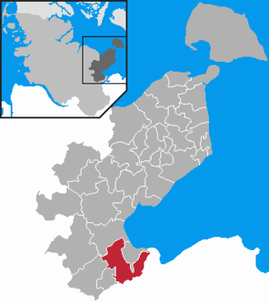
| Location of the community of Ratekau in the Ostholstein district | ||
  |
||

Ratekau is a municipality and a village (see Villages) in the Ostholstein district in Schleswig-Holstein , ten kilometers north of Lübeck . Neighboring places are Bad Schwartau and Lübeck in the south , Timmendorfer Strand and Scharbeutz in the north and Ahrensbök in the west . The larger community has good transport connections with the A1 , A 226 and A 20 .
geography
The community consists of villages with a rural character, some of which are located around the Hemmelsdorfer See , a short distance from the Bay of Lübeck . Business parks and new housing estates also benefit from the proximity to Lübeck. The largest villages in the municipality are Sereetz , Ratekau, Pansdorf and Techau . The nature reserve Sielbektal, Kreuzkamper Seelandschaft and surrounding forests have existed in the municipality since August 2015 .
Villages
Population figures 2019:
- Grammersdorf / Wilmsdorf , 58/36 inhabitants
- Häven , 97 residents
- Hobbersdorf , 74 inhabitants
- Luschendorf , 430 inhabitants
- Offendorf / Kreuzkamp , 217/258 inhabitants
- Ovendorf , 252 inhabitants
- Pansdorf , 3533 inhabitants
- Ratekau, 3919 inhabitants
- Rohlsdorf , 91 inhabitants
- Ruppersdorf / Neuhof , 65/36 inhabitants
- Sereetz , 4274 inhabitants
- Techau , 1698 inhabitants
- Warnsdorf , 365 inhabitants
history

_2012d_04.jpg)
_2012d_01.jpg)
- In the area of the community of Ratekau there are traces of Neolithic settlement in the form of burial mounds, e.g. B. the Grellberg , an (unnamed) burial mound near Pansdorf , the long bed Langenrehm near Kreuzkamp.
- Ratekau used to be in the settlement area of the Wends , the villages were laid out as rounds like in the Hanoverian Wendland . In the village of Pansdorf there are remains of a Slavic castle wall , the Blocksberg .
- After the missionary work, further fortifications were built, of which the remains of the fortifications in Hobbersdorf , the castle in Ruppersdorfer See , the castle hill in Offendorf and the castle Gosefeld near Niendorf have been preserved.
- The Ratekau field stone church was built in the course of the missionary work . It is a round tower church that belongs to the so-called Vizelin churches (others can be found in Bornhöved , Bosau and Süsel ).
- On November 7, 1806, after the battle of Lübeck the day before, a Prussian army under Lieutenant General Fürst Blücher surrendered in Ratekau with a good 9,000 men to the superior strength of Napoleon's troops (see also Blüchiche in Ratekau ). Blücher himself wrote the place name in the minutes of the surrender "Radkau". As a result, the village of Ratekau was better known as "Radkau" in contemporary reports, but also in historical literature than under its current name.
- In 1934 the community of Ratekau was created by merging the communities of East Ratekau and West Ratekau due to the Oldenburg Simplification Act.
- During the Second World War there were two forced labor commandos in the Pansdorf part of the community .
- In 1945, Groß Timmendorf , Klein Timmendorf , Hemmelsdorf and Niendorf were spun off from the Ratekau community by the British military government and the new Timmendorfer Strand community was formed.
- After the war, a youth development plant was housed in the barracks of the brick factory.
- Relics of the Cold War are blasting shafts on both sides of the A1 federal motorway on the hard shoulder around the Sereetz exit. The associated five pioneer barrier houses (explosives bunkers) are located near the Blocksberg and are now housing for bats.
Outsourcing
On January 1, 1971, an area with then about 30 inhabitants was assigned to the neighboring municipality of Haffkrug-Scharbeutz.
Community representation
The 2018 election resulted in the following:
coat of arms
Blazon : “Above a blue shield base, in it a golden sheaf, in gold on the right a green oak, on which a silver stone leans below, on the left a single-towered silver church with red roofs; above two black ears leaning outwards. "
The main statute of the municipality describes an occasionally used version of the coat of arms with a slightly modified shield base.
The heraldic figures represent the Vizelin Church , the Blüchiche and the associated memorial stone, which was erected in 1856 and is intended to commemorate the surrender of Gebhard Leberecht von Blücher in 1806 to the Napoleonic troops.
The coat of arms was chosen by the community after the Second World War in the absence of official seals that are free of Nazi and Imperial symbols and approved by the British Military Government.
Schools and education
The Ratekau community is responsible for the following schools:
- Elementary school Otto-Preußler-Schule, Pansdorf, Schulkoppel (merging of the elementary schools Techau and Pansdorf 2012, closure of the Techau location in 2018) 161 pupils in 9 classes
- Ratekau elementary school, Bäderstraße, 197 students in 9 classes
- Primary school Achim-Bröger-Schule, Sereetz, Schulstraße, 146 students in 7 classes
- Community school with upper level César-Klein-Schule , Ratekau, Preesterkoppel, 801 students in 35 classes
Student numbers from the school year 2019/2020
Other educational institutions:
- Adult Education Center Ratekau, Im Grund
traffic
Road traffic

The localities of the community of Ratekau are connected to one another via a well-developed network of country roads and cycle paths. The connection to long-distance traffic is mainly via the federal motorway 1 .
By the end of the 1960s, the A1 ended on the southern edge of the municipality just before the Blüchichee in Ratekau . Long-distance traffic was then directed further north via federal highway 207 . Since the beginning of the 1970s, the A1 has been continued northwards and has received the three junctions Pansdorf (No. 17), Ratekau (No. 18) and Sereetz (No. 19) in the area of the municipality. In the summer months, the Ratekau departure in particular serves numerous day tourists from Hamburg to reach the Baltic Sea . The federal road 207 was downgraded to the state road at the end of the 1990s.
Rail transport
The area of the community is crossed by the Lübeck – Puttgarden (Vogelfluglinie) and Lübeck – Kiel railway lines . The only train stop in the community is the Pansdorf station, which was reactivated in 2000. A second train station on the northern outskirts of Ratekau has been closed since 1968. At the turn of the millennium there were considerations to reactivate this station as well. Because of its unfavorable location to the place, a new building closer to the residential areas of the village was considered more sensible. The commissioning of the new Ratekau stop was planned for 2012, but was no longer implemented due to the new hinterland expansion to the fixed Fehmarnbelt crossing . Instead, Ratekau will receive a joint regional and IC train station together with Timmendorfer Strand from 2028 , which is to be built immediately south of today's Ratekau motorway exit. The previous railway line that runs through the village is due to be closed at the end of 2021.
Sports
With the SV Sereetz and the TSV Pansdorf , the community provided two clubs that took part in the Northern Football League in the 1990s . In addition to Kiel, Lübeck and Flensburg, Ratekau is one of only four municipalities in the Schleswig-Holstein Football Association that was represented by several clubs in supraregional leagues. In women's football, TSV Ratekau - partly in a syndicate with NTSV Strand 08 - was Schleswig-Holstein football champion four times, but always refrained from being promoted to the regional league.
In addition, the young female handball players of TSV Ratekau 2013/14 belonged to the first season of the newly founded A-Junior Handball Bundesliga .
Attractions

- Ratekau field stone church
- The Village Museum Ratekau was 2000 in a in Luschendorf dismantled and rebuilt in Ratekau thatched Tudor - Räucherkate opened and supplemented by additional buildings and a cottage garden later. Among other things, a collection of agricultural, handicraft and household appliances is on display.
- A Karl Adventure Village was opened in Warnsdorf in 2014 .
Personalities
- Joachim Hossenfelder (1899–1976), NSDAP member since 1929, co-founder of the “German Christians” in 1932 , “Bishop of Brandenburg” from September 6, 1933 until his dismissal in December 1933, clergyman vice-president of the Prussian Evangelical Church Council and member of the Reich Church Government , from 1954 to 1969 pastor of the Ev.-Luth. Parish in Ratekau.
- César Klein (1876–1954), painter , graphic artist and set designer .
- Bastian Sick (* 1965), journalist and non-fiction author.
- Max Steen (1898–1997), teacher and local history researcher .
- Bodo Wartke (* 1977), music cabaret artist , songwriter and actor .
- Amandus Weinreich (1860–1943), born in Offendorf, pastor and university professor
literature
- Harald Gerhardt: The community Ratekau (series archive pictures ). Sutton, Erfurt 2004, ISBN 3-89702-776-3 .
- Joachim Hossenfelder: Festschrift to commemorate the eight hundredth anniversary of the Church in Ratekau on September 23, 1956 . Struve, Eutin 1956.
- Otto Rönnpag: A new community is emerging . Timmendorfer Strand 1945. In: Yearbook for local history . Eutin 1987, p. 150-154 .
swell
- ↑ North Statistics Office - Population of the municipalities in Schleswig-Holstein 4th quarter 2019 (XLSX file) (update based on the 2011 census) ( help on this ).
- ↑ Sielbektal in Ostholstein becomes a new nature reserve - Environment Minister Habeck signs state ordinance
- ^ Ratekau parish - town hall , accessed on March 12, 2019
- ↑ Friedrich Christoph Förster : The Field Marshal Prince Blücher of Wahlstatt and his surroundings. Brockhaus, Leipzig 1821, p. 67.
- ↑ warehouse list http://www.zwangsarbeiter-sh.de/ .
- ^ Federal Statistical Office (ed.): Historical municipality directory for the Federal Republic of Germany. Name, border and key number changes in municipalities, counties and administrative districts from May 27, 1970 to December 31, 1982 . W. Kohlhammer GmbH, Stuttgart / Mainz 1983, ISBN 3-17-003263-1 , p. 183 .
- ↑ Schleswig-Holstein's municipal coat of arms
- ↑ Main statutes of the community of Ratekau, last amended on July 15, 2008
- ^ Wikipedia: Coats of arms in Schleswig-Holstein approved by the British military government
- ↑ Statistical Office for Hamburg and Schleswig-Holstein: Directory of general education schools in Schleswig-Holstein 2019/2020
- ↑ http://www.lvs-sh.de/media/pdf/090320_lnvp_090306_web_FINAL.pdf
- ↑ https://www.anbombination-fbq.de/de/vor-ort/pfa-1.html
- ↑ https://www.nahverkehrhamburg.de/bahnstrecke-nach-fehmarn-ab-2022-fuenf-jahre-lang-gesperr-9792/
- ↑ http://www.ratekau.de/city_info/webaccessibility/index.cfm?waid=231&item_id=845022®ion_id=299&design_id=0&modul_id=5&record_id=31554&fsize=1&contrast=0&search=dorfmuseum
Web links
Ahrensbök | Old brim | Bad Schwartau | Beschendorf | Bosau | Dahme | Damlos | Eutin | Fehmarn | Göhl | Gremersdorf | Grömitz | Großenbrode | Pit | Harmsdorf | Heiligenhafen | Heringsdorf | Kabelhorst | Kasseedorf | Kellenhusen (Baltic Sea) | Lensahn | Malente | Manhagen | Neukirchen | Neustadt in Holstein | Oldenburg in Holstein | Ratekau | Riepsdorf | Scharbeutz | Schashagen | Schönwalde am Bungsberg | Sierksdorf | Stockelsdorf | Süsel | Timmendorfer Strand | Wangels