
Süsel
| coat of arms | Germany map | |
|---|---|---|

|
Coordinates: 54 ° 5 ' N , 10 ° 43' E |
|
| Basic data | ||
| State : | Schleswig-Holstein | |
| Circle : | Ostholstein | |
| Management Community : | Eutin | |
| Height : | 40 m above sea level NHN | |
| Area : | 75.31 km 2 | |
| Residents: | 5048 (Dec. 31, 2019) | |
| Population density : | 67 inhabitants per km 2 | |
| Postal code : | 23701 | |
| Primaries : | 04524, 04521, 04529 | |
| License plate : | OH | |
| Community key : | 01 0 55 041 | |
| Community structure: | 15 villages | |
| Address of the municipal administration: |
At Bäderstraße 64 23701 Süsel |
|
| Website : | ||
| Mayor : | Adrianus Boonekamp ( CDU ) | |
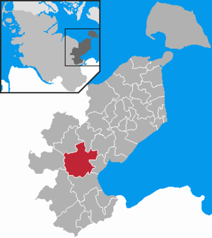
| Location of the community of Süsel in the Ostholstein district | ||
  |
||

Süsel is a municipality in the Ostholstein district in Schleswig-Holstein . The municipality borders in the north on Eutin , in the northeast on Kasseedorf , in the east on Altenkrempe and Sierksdorf , in the south on Scharbeutz , in the southwest on Ahrensbök and in the northwest on Bosau .
Geography and traffic
The municipality of Süsel consists of the main town of Süsel (in the southeast), where most of the residents live, and the other 14 villages : Barkau (in the southwest), Bockholt (in the north), Bujendorf (in the east), Ekelsdorf (in the south) , Fassensdorf (in the middle), Gömnitz (in the east), Gothendorf (in the west), Groß Meinsdorf (in the northwest), Kesdorf (in the southwest), Middelburg (in the middle), Ottendorf (in the south), Röbel (in the Middle), Woltersmühlen (in the south) and Zarnekau (in the northeast). The districts of Bujendorf and Röbel each had a stop on the Eutin – Neustadt railway line, which was opened in 1866 and closed in 1982 .
history


On Süseler See is the Süseler ski jump , the rest of a Slavic hill fort . Until the 12th century, Süsel was one of the main places of the Wends resident here . The damp lowlands were colonized by recruited Frisian farmers from 1142 onwards .
The Romanesque St. Laurentius Church was also built in the 12th century as part of the missionary work, it belongs to the so-called Vicelinkirchen , others can be found in Bornhöved , Bosau and Ratekau .
The Gömnitzer Tower shows the proximity to the Baltic Sea , a few kilometers away . Until 1815 there was a large tree called the Major on the Gömnitzer Berg . This solitaire served as an orientation mark for shipping in the Bay of Lübeck . The tree was struck by lightning and burned down. Since the seafarers lacked an important point of orientation, the new major , a brick tower , was built in 1827-28 . The top of the tower is 105.8 meters above sea level, the tower was restored in 1990 and 2010 and is open to the public.
politics
Community representation
The municipal elections on May 6, 2018 led to the following result:
administration
Since January 1, 2007, Süsel has formed an administrative partnership with the district town of Eutin and has transferred the administrative business there. Since then there has only been one honorary mayor in the community.
coat of arms
Blazon : "In blue on a golden three-mountain topped with a blue wave bar, a round, flat-roofed silver tower, which is accompanied on the right by a golden sun, on the left by a golden moon turned towards it."

Infrastructure
There is a hospital in Middelburg that was formerly operated by the DRK and taken over by the Sana Kliniken in 2017 . It has 158 inpatient beds and 18 places in the geriatric day clinic and has specialist departments for geriatrics and neurology . In the future, the departments are to be distributed to other locations in the region. The primary school in Süsel hit the headlines in 2019 because of violence among students.
Sports
A water ski lift is located in Rumpelsee, a quarry pond near Süseler tree.
There is also an all-terrain riding arena with many natural obstacles and artificially created water points, which was founded in 1987 in a former gravel pit.
Sons and daughters
- Carl Ferdinand Stelzner (1805–1894), photographer and portrait painter
- Paul Behncke (1866–1937), admiral and chief of the naval command of the Reichsmarine
Web links
Individual evidence
- ↑ North Statistics Office - Population of the municipalities in Schleswig-Holstein 4th quarter 2019 (XLSX file) (update based on the 2011 census) ( help on this ).
- ↑ Schleswig-Holstein's municipal coat of arms
- ^ DRK Hospital Middelburg , accessed on October 19, 2018
- ↑ Sana press release of September 4, 2017
- ↑ SHZ of September 19, 2018
- ↑ https://www.shz.de/lokales/ostholsteiner-anzeiger/nach-gewalt-unter-schuelern-suesels-schulleiterin-gibt-leitung-ab-id26800587.html
Ahrensbök | Old brim | Bad Schwartau | Beschendorf | Bosau | Dahme | Damlos | Eutin | Fehmarn | Göhl | Gremersdorf | Grömitz | Großenbrode | Pit | Harmsdorf | Heiligenhafen | Heringsdorf | Kabelhorst | Kasseedorf | Kellenhusen (Baltic Sea) | Lensahn | Malente | Manhagen | Neukirchen | Neustadt in Holstein | Oldenburg in Holstein | Ratekau | Riepsdorf | Scharbeutz | Schashagen | Schönwalde am Bungsberg | Sierksdorf | Stockelsdorf | Süsel | Timmendorfer Strand | Wangels