
Luetjenburg
| coat of arms | Germany map | |
|---|---|---|

|
Coordinates: 54 ° 18 ' N , 10 ° 35' E |
|
| Basic data | ||
| State : | Schleswig-Holstein | |
| Circle : | Plön | |
| Office : | Luetjenburg | |
| Height : | 33 m above sea level NHN | |
| Area : | 6.15 km 2 | |
| Residents: | 5269 (Dec. 31, 2019) | |
| Population density : | 857 inhabitants per km 2 | |
| Postal code : | 24321 | |
| Area code : | 04381 | |
| License plate : | PLÖ | |
| Community key : | 01 0 57 048 | |
| Office administration address: | Neverstorfer Strasse 7 24321 Lütjenburg |
|
| Website : | ||
| Mayor : | Dirk Sohn ( CDU ) | |
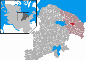
| Location of the city of Lütjenburg in the Plön district | ||
  |
||

Lütjenburg ( Low German Lüttenborg ) is a town in the Plön district in Schleswig-Holstein . It is the administrative seat of the Lütjenburg office . Nienthal and Neudorf are in the urban area.
geography
The city is located about 38 km east of Kiel on the federal highway 202 and on the small river Kossau . A neighboring town is the Ostseebad Hohwacht .
history
middle Ages


The history of Lütjenburg began with a fortified settlement of the Wagrians , which Saxo Grammaticus Liutcha and Helmold von Bosau named Lutilinburg ; it was probably located on the large inland lake ( old castle of Stöfs ramparts ) and / or on the Sehlendorfer inland lake ( Hochborre / Hochborm ramparts near Sechendorf and Futterkamp ). The inland lakes could serve as ports; the Wagrians used them for raids into Denmark . This led to an (unsuccessful) Danish naval attack on Liutcha in 1113. There were also repeated Vagrian-Slavic incursions into the Holstein-Saxon regions west of the Limes Saxoniae . The Wagrians were finally defeated around 1138/39 and brought under German rule through the campaigns of Heinrich von Bathide and Overboden Marcrad I from Holstein .
As part of the colonization and missionary efforts of Adolf II of Schauenburg , the first Lütjenburg church was built around 1156, but not near the old Wagrian settlement, but a little inland at the intersection of two traffic routes. In 1163, Bishop Gerold von Oldenburg / Lübeck found a small settlement of German settlers near the church. The settlement developed as a resting and market place and probably received city rights from Adolf IV von Schauenburg (before 1239) in accordance with Lübischen law . On this occasion, the construction of today's church began. It is the oldest brick church in the Baltic Sea region, at first it was probably called St. Blasius , since the Reformation St. Michaelis .
The city's economy was based on agriculture, handicrafts and trade, but the lack of a port and competition from neighboring cities such as Kiel (founded around 1240), Neustadt in Holstein (founded around 1244) and Heiligenhafen (founded around 1250) hampered the development of trade considerable. For this reason, there were repeated plans to move the city to the Baltic Sea, which ultimately did not materialize. The economic situation of Lütjenburg was finally so tense that Adolf VII granted the city a five-year tax exemption in 1373, which was very unusual.
Modern times
Around 1497, the Danish crown, to which the Duchy of Schleswig and the Duchy of Holstein had been under since 1460, gave Lütjenburg as an inheritance to Hans Rantzau (1477–1522), the lord of the Neuhaus (near Giekau ). The relationship between the town of Luebschen Rechts and its new noble masters was often tense; in the Count Feud , a war Lübeck against Denmark (and thus also against the Rantzaus, who acted as Danish governors and military leaders) 1534–1536, Lütjenburg sided with Lübeck. As a punishment for this, the city was sentenced to labor for Gut Neuhaus in a contract of 1545. The continued conflicts between Lütjenburg and Neuhaus were from now on mainly resolved by legal means, whereby the city failed in its attempt to defend its jurisdiction.
Furthermore, the city complained about the impairment of its agriculture through hunting activities of the nobility living on the surrounding estates ( Neuhaus , Neudorf , Helmstorf , (Water-) Neversdorf , Panker , Hohenfelde , Kletkamp , Klamp ), while the nobility in turn accused the Lütjenburgers of stealing wood . On the other hand, the Lütjenburg traders were dependent on the consent of the landowners in order to be able to operate sea trade via Hohwacht .
In the Thirty Years War in 1627 an imperial army occupied the city and sacked it; In 1643 Lütjenburg paid the Swedish General Torstensson 1000 Reichstaler (a so-called pillage ) in order to avoid a new occupation. In addition, fires ravaged the city in 1633 and 1645.
In 1639/42 Lütjenburg was ceded by the Rantzaus to the imperial count Christian von Pentz , the governor of Glückstadt , in exchange for Großenbrode and Gut Klausdorf . The new owner sold the town and the Neudorf estate to the Danish King Christian IV in 1642. As a result of the turmoil of war that continued after 1648, the town was so deeply in debt that Christian V declared bankruptcy in 1696.
During the Northern War, the Swedish General Stenbock invaded Holstein in 1713 ; Lütjenburg had to raise another pillage of 2000 Reichstalers. After that it remained largely peaceful until the Napoleonic Wars and gradually a modest upswing set in. A census in 1769 showed 1006 inhabitants. From 1813 to 1815 Holstein was occupied by a Swedish-Prussian-Russian army, which also meant extensive billeting for Lütjenburg.
In 1826 a large fire from the windmill destroyed about a third of the city, including the church tower; however, the carved high altar from 1467 was spared. The windmill was quickly rebuilt as it reduced the dependence on the water mill of the Helmstorf estate ; In 1929 it burned down again.
The Schleswig-Holstein survey (1848-1851) cost five Lütjenburgers their lives and mayor Ludwig Wyneken the office, from which the Danish authorities removed him because of doubts about his loyalty. With the end of Danish rule in 1864, however, he was reinstated. In 1867 Schleswig-Holstein became a Prussian province.
Twentieth century
Towards the end of the 19th century, the city's economy experienced a considerable boom, especially since the opening of the railway line to Malente in 1892. Another railway line, the Kleinbahn Kirchbarkau-Preetz-Lütjenburg , followed in 1910; it led to the end of sea trade via Hohwacht. By train were u. a. Exports of livestock, meat products and timber. Passenger traffic was also an important economic factor; 5–6 passenger trains ran daily on the route to Malente . The road to Kiel was not completed until 1931 (today part of the federal highway 202 ), which connected Lütjenburg to the Kiel economic area, after centuries of alignment with Lübeck.
As a result of industrialization, the first workers' associations were formed . Local politics, however, remained conservative; until 1918 there were no social democratic city councilors. The economic upturn came to a standstill during the First World War . The city provided a land storm company and a coastal protection company (stationed in Hohwacht). 168 soldiers from Lütjenburg, or the associated villages and farms, died in the war.
At the end of 1930 a local NSDAP group was founded in Lütjenburg; In the Reichstag elections of March 5, 1933 , 52.5% of the votes went to the NSDAP . Mayor Ulrich Günther was able to remain in office after the seizure of power because he had joined the party in good time.
During the Second World War , the Kiel Naval Arsenal maintained optical workshops in Lütjenburg. About 170 Lütjenburg soldiers died in the course of the war. On May 6, 1945 troops of the VIII Corps of the British 2nd Army occupied the city without a fight. The British soon withdrew, however, as the "Sperrgebiet F", known as "Kral", was set up in Ostholstein, an area still provisionally administered by the Wehrmacht, in which up to 750,000 former German soldiers were interned. The area in command was GenLt Wilhelm-Hunold von Stockhausen (1891–1964). About 450 internees were housed in Lütjenburg.
In 1950 the population was 4860 inhabitants, 2326 of whom were displaced from the eastern regions. Most of the displaced settled here permanently; In 1961 there were 77 newly founded businesses by displaced persons, compared to 157 local businesses.
The opening of the German Armed Forces' Schill barracks in 1962 resulted in a further increase in the population of around 1,000 people. The Bundeswehr's 6th Air Defense Training Regiment was based in Lütjenburg and had around 950 soldiers . The barracks were closed at the end of 2012. In 2013, the property is to be handed over by the Bundeswehr to the Federal Agency for Real Estate Tasks .
In 1970 an SOS Children's Village was opened in Lütjenburg , the twelfth in Germany.
On January 1, 2008, the previously free city joined the Amt Lütjenburg-Land, which then changed its name to Amt Lütjenburg .
In October 2017, the city became known when it demanded € 217,000 from a farmer for a resident participation in a new road construction. The Schleswig Administrative Court reduced the claim to € 189,000, but confirmed the claim in principle. The incident led to general criticism of the allocation of road construction costs to residents in Schleswig-Holstein. Lütjenburger defends itself against a 190,000 euro fee.
politics
City council
The 2018 election resulted in the following:
mayor
|
|
In September 2012, Dirk Sohn (CDU) was elected full-time mayor by the city council. Lütjenburg is one of the few Schleswig-Holstein municipalities that have made use of the regulation still valid in 2012 that municipalities without their own administration with more than 4,000 inhabitants can appoint a full-time mayor.
coat of arms
Blazon : “In blue over green-silver waves a continuous, goalless silver battlement wall, with a wide battlement tower, which has a quadruple-shaped window and is decorated with two outwardly inclined red flags on golden poles and each with three six-pointed golden stars one above the other; between the flags a red shield with a silver nettle leaf; A six-pointed golden star on both sides of the tower. "
The coat of arms of Lütjenburg is based on the city seal from 1353. Walls and towers are the usual symbols of the legal status as a city in the Middle Ages. At the same time, they represent the eponymous castle in the Lütjenburg coat of arms, the location of which is still unknown today. But there are reasonable assumptions that the "Luttelinburch", first mentioned in 1163, is identical to the older Slavic castle "Liutcha". Bishop Gerold von Lübeck had today's Michaeliskirche built in "Lutkenborch" shortly after the wars of revolution in 1156. Raised a town by Count Gerhard I von Holstein in 1275, Lütjenburg only slowly developed into a small market town for the surrounding goods due to its poor traffic location and no port. A traditional seal from 1353 and another from 1374 show the image that has been retained to this day. The flags in particular have experienced various forms of representation and interpretation over the centuries. The stars have been interpreted as nettle leaves, crosses or roses and the flags themselves as key whiskers or feathers. At the end of the 16th century the shield base was missing; the tower also had windows and the wall had loopholes and a gate. Despite these representational differences, the coat of arms has remained essentially the same to this day.
The coat of arms was designed by the Brunsbüttel heraldist Willy "Horsa" Lippert .
flag
The flag was approved on April 25, 1952.
The city flag shows the silver castle and the rest of the city's coat of arms on a blue background, which is bordered at the top and bottom by a narrow silver stripe.
Youth work
The city's (sports) clubs receive financial support for every minor member and there is the possibility of investment aid for unusual projects or purchases. The city also has a youth action center (JAZ), which was run by the workers' welfare organization and has been run by the city since January 2018. Various courses and working groups are offered here. The city also benefits from the open youth work of the SOS Children's Village , which opens its gates three times a week for young people and offers a community room and a fitness room.
The safeguarding of the interests of children and young people, which is required by the municipal code of Schleswig-Holstein , is implemented, among other things, by the “Stadtjugendring Lütjenburg eV”. Among other things, he operates (with the support of the city) the "Rolling Play Room", a cart with board games, painting utensils and much more. This is put down on the city's playgrounds, which changes every day, and is therefore available to all children.
Social city
The city of Lütjenburg takes part in the urban development project Social City . As part of this measure, the “Social City Advisory Board”, among others, decides on the distribution of a budget of 15,000 euros annually for social purposes. For example, projects in local kindergartens and schools, “parenting courses”, youth trips or other activities that benefit the citizens of the city are funded. The redevelopment of the northern Gildeplatz in Lütjenburg was initially assigned to the Social City project, but later the Ministry of the Interior of Schleswig-Holstein informed the local Greens at the request of the local Greens that it did not consider the funding criteria to be met.
Twin cities
Sister cities of Lütjenburg are:
-
 Bain-de-Bretagne ( France )
 -
 Uljanowo ( Russia )
 -
 Rakvere ( Estonia ) and
 -
 Sternberg ( Mecklenburg-Western Pomerania )
economy
Due to the proximity to the Ostseebad Hohwacht , a lot of tourists visit Lütjenburg to buy groceries or just to stroll.
With the Air Defense Training Regiment 6, the Bundeswehr was the largest employer in the region until it withdrew in 2012. Merz Dental, a provider of medical technology, employs 181 people.
traffic
Lütjenburg is the end point of the Malente-Gremsmühlen – Lütjenburg railway line , on which no rail traffic is carried out. Mittenwalder Eisenbahnimmobiliengesellschaft mbH & Co. KG has bought the railway line again and is planning to start trolley traffic. Until the Second World War , the Kirchbarkau – Preetz – Lütjenburg small railway ended in the city. The station building and most of the city's tracks have now been demolished.
The most important traffic connection is the B 202 which goes from Oldenburg / Holstein to Kiel and leads past Lütjenburg as a bypass road.
education
General education schools:
- Support center Plön, branch Lütjenburg (since 2012 / focus on learning), Friedrich-Speck-Straße, since 2018 "Otto-Mensing-Haus"
- Elementary school of the city of Lütjenburg and the communities of Giekau and Panker, Plöner Straße (306 students in 14 classes)
- Hoffmann-von-Fallersleben Community School, Kieler Straße (351 students in 16 classes)
- Gymnasium Lütjenburg, Kieler Straße (555 students in 25 classes)
- Former school: Otto-Mensing-Realschule (name since 1964, formation of the community school in 2012)
Student numbers from the school year 2019/2020.


Culture
Several choirs are located in Lütjenburg and they regularly give choir concerts. The best known among them is the male choir “Lütjenburger Liedertafel von 1841 e. V. ”, one of the oldest male choirs in Schleswig-Holstein, which has recently been joined by a shanty choir. There is the small Kulturkreis Lütjenburg eV, which organizes readings and classical concerts. There is also the “Galerie Richter”, which - frequently changing - presents artistic works from all eras and periods and introduces Klaus Heckert's studios. In addition, there is the Hohwachter Bucht artists' association, in which artists from and around Lütjenburg have easily come together.
Buildings and landmarks

Lütjenburg is known for the old city center with the town hall, the Färberhaus and the St. Michaelis Church, which has been Protestant since the Reformation . In the north side chapel of Michaeliskirche there is one of the most important works of art of the late Renaissance of this kind in Schleswig-Holstein with the tomb for Otto von Reventlow . It was made by the Flemish sculptor Robert Coppens . Another attraction is the Lütjenburg Bismarck Tower . The town's oldest surviving residential building is located on the market square, a half-timbered house built in 1576, known as the “dyer's house” (although a dyer never worked there); today it houses the registry office. There is also the Ice Age Museum on the outskirts .
Since August 2003 there has been a reconstruction of a medieval hilltop castle from around 1250 on the outskirts of the city in Nienthal. It was created in close cooperation with the Schleswig-Holstein State Archaeological Office in Schleswig and was built practically by hand according to various historical models and sources. A private support association is expanding the castle complex into a medieval homestead and a living museum. Numerous medieval buildings have been built in the outer bailey, such as a residential stable building, a forge, a knight's house, a large farm building and a granary. In 2009 the complex with a chapel and a large castle gate is to be completed.
The goods Helmstorf , Neudorf , Panker and Gut Waterneverstorf with their manor houses are in the immediate vicinity of the city .
Personalities
sons and daughters of the town
- Hans Eppendorfer (1942–1999), writer and screenwriter
- Willy Knoop (1888–1966), painter and since 1962 honorary citizen of Lütjenburg
- Otto Mensing (1868–1939), linguist
- Rocko Schamoni (* 1966), musician, actor and entertainer
Personalities who have worked in the city
- Jacob Georg Christian Adler (1756–1834), educator and theologian
- Rudolf Duhn (1888–1893), landscape painter
- Friedrich Junge (1832–1905), biologist and educator
- Karl-Otto Dummer (1932–2009), seaman and one of six survivors when the sailing ship Pamir sank in 1957, lived in Lütjenburg
- Torsten Albig (* 1963), politician ( SPD ), 2012–2017 Prime Minister Schleswig-Holstein
- Herbert Beer (1914–1971), politician (GB / BHE, GDP, CDU)
- Wolfgang Treu (1930–2018), cameraman
- Olaf Böttger (* 1956), politician (CDU)
- Daniel Richter (* 1962), internationally known painter
swell
- Johannes von Schröder, Hermann Biernatzki: Topography of the duchies Holstein and Lauenburg. Fränckel, Oldenburg / Holstein 1855.
- Henning Oldekop: Topography of the Duchy of Holstein. Volume I, Verlag Bernd Schramm, Kiel 1908.
- Helmut Willert: Outlines of the early development of Lütjenburg. In: ZSHG . 117 (1992), pp. 73-99.
- Irmtraut Engling, Herbert Engling: History of the city of Lütjenburg 1163-1918. Struve, Eutin 2002.
- Sigurd Zillmann, Volker Zillmann: History of the City of Lütjenburg 1918–1945. Struve, Eutin 2006.
- Sigurd Zillmann: History of the City of Lütjenburg 1945–1978. Struve, Eutin 2008.
Web links
Individual evidence
- ↑ North Statistics Office - Population of the municipalities in Schleswig-Holstein 4th quarter 2019 (XLSX file) (update based on the 2011 census) ( help on this ).
- ↑ Schleswig-Holstein topography. Vol. 6: Kronprinzenkoog - Mühlenrade . 1st edition Flying-Kiwi-Verl. Junge, Flensburg 2006, ISBN 978-3-926055-85-9 , pp. 231 ( dnb.de [accessed July 26, 2020]).
- ^ Federal Ministry of Defense: Report on the status of the realignment of the Bundeswehr. (PDF; 309 kB) May 8, 2013, p. 53 , accessed on May 18, 2013 .
- ↑ Lütjenburger defends himself against a fee of 190,000 euros. In: NDR . October 19, 2017. Retrieved October 21, 2017 .
- ↑ Schleswig-Holstein's municipal coat of arms
- ↑ Inge Muster, Aristide Hamann - Grüne Lütjenburg Archived copy ( Memento of the original from March 4, 2016 in the Internet Archive ) Info: The archive link was inserted automatically and has not yet been checked. Please check the original and archive link according to the instructions and then remove this notice. . On: gruene-luetjenburg.de , accessed on March 6, 2012. Press release from the Greens and letter from the Secretary of State on the eligibility for funding of the Gildenplatz conversion
- ↑ Statistical Office for Hamburg and Schleswig-Holstein: Directory of general education schools in Schleswig-Holstein 2019/2020
- ↑ Curt Stoermer : Obituary for a painter , in: Der Wagen 1967, pp. 112-114.

Cities: Lütjenburg | Plön | Preetz | Schwentinental .
Other municipalities: Ascheberg (Holstein) | Barman | Barsbek | Behrensdorf (Baltic Sea) | Belau | Bendfeld | Blekendorf | Boksee | Bönebüttel | Bösdorf | Bothkamp | Brodersdorf | Dannau | Dersau | Dobersdorf | Dörnick | Driving | Fargau-Pratjau | Fiefbergen | Giekau | Grebin | Großbarkau | Grand Harrie | Heikendorf | Helmstorf | Högsdorf | Hohenfelde | Höhndorf | Hohwacht (Baltic Sea) | Honey lake | Calves | Kirchbarkau | Kirchnüchel | Klamp | Klein Barkau | Kletkamp | Köhn | Krokau | Krummbek | Cooling | Laboe | Lammershagen | Lebrade | Lehmkuhlen | Löptin | Lutterbek | Martensrade | Mönkeberg | Mucheln | Took | Nettelsee | Panker | Passade | Pohnsdorf | Post field | Prasdorf | Probsteierhagen | Rantzau | Rastorf | Rathjensdorf | Rendswühren | Angle of rest | Schellhorn | Schillsdorf | Reading | Schönberg (Holstein) | Schönkirchen | Schwartbuck | Selent | Stakendorf | Stone | Stumble | Stoltenberg | Tasdorf | Trundle | Wahlstorf | Wankendorf | Warnau | Wendtorf | Wipe | Wittmoldt .