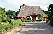
Lutterbek
| coat of arms | Germany map | |
|---|---|---|

|
Coordinates: 54 ° 23 ' N , 10 ° 17' E |
|
| Basic data | ||
| State : | Schleswig-Holstein | |
| Circle : | Plön | |
| Office : | Probstei | |
| Height : | 9 m above sea level NHN | |
| Area : | 3.23 km 2 | |
| Residents: | 354 (Dec. 31, 2019) | |
| Population density : | 110 inhabitants per km 2 | |
| Postal code : | 24235 | |
| Area code : | 04343 | |
| License plate : | PLÖ | |
| Community key : | 01 0 57 049 | |
| LOCODE : | DE 66X | |
| Office administration address: | Knüll 4 24217 Schönberg |
|
| Website : | ||
| Mayor : | Wolf Mönkemeier (FWG) | |
| Location of the municipality of Lutterbek in the Plön district | ||
Lutterbek is a parish in the provost in the Plön district in Schleswig-Holstein . Freienfelde is located in the municipality.
Geography and traffic
Lutterbek is about twelve kilometers northeast of Kiel and about two kilometers inland from Laboe on the federal highway 502 from Kiel to Lütjenburg . The place is in the valley of the Hagener Au .
history
The place was first mentioned in 1240, when the convent of Preetz was moved for a few years after Lutterbek. The place name is derived from the Old Saxon word hluttar ( pure , clear ) and the Low German word beke ( Bach ).
There has been a watermill in town since 1286. Until 1850 there was a mill obligation, due to which the farmers from all villages in the parish of Probsteierhagen had to bring their grain to Lutterbek for grinding. The mill was stopped in 1979.
From 1709 there were school lessons in Lutterbek.
politics
Community representation
The 2018 election resulted in the following:
- FWG : 9
coat of arms
Blazon : "In green a silver mill wheel, in the upper corners accompanied by a golden Latin cross on the front and a golden ear of corn behind."
economy
The community is predominantly agricultural. There is also a village mug called Lutterbeker , which is also known nationwide as a gallery and cabaret.
Web links
Individual evidence
- ↑ North Statistics Office - Population of the municipalities in Schleswig-Holstein 4th quarter 2019 (XLSX file) (update based on the 2011 census) ( help on this ).
- ↑ Schleswig-Holstein topography. Vol. 6: Kronprinzenkoog - Mühlenrade . 1st edition Flying-Kiwi-Verl. Junge, Flensburg 2006, ISBN 978-3-926055-85-9 , pp. 243 ( dnb.de [accessed July 26, 2020]).
- ↑ Schleswig-Holstein's municipal coat of arms


