
Dannau
| coat of arms | Germany map | |
|---|---|---|

|
Coordinates: 54 ° 14 ' N , 10 ° 32' E |
|
| Basic data | ||
| State : | Schleswig-Holstein | |
| Circle : | Plön | |
| Office : | Luetjenburg | |
| Height : | 38 m above sea level NHN | |
| Area : | 9.12 km 2 | |
| Residents: | 610 (December 31, 2019) | |
| Population density : | 67 inhabitants per km 2 | |
| Postal code : | 24329 | |
| Area code : | 04383 | |
| License plate : | PLÖ | |
| Community key : | 01 0 57 013 | |
| Office administration address: | Neverstorfer Strasse 7 24321 Lütjenburg |
|
| Website : | ||
| Mayor : | Roland Feichtner (KWD) | |
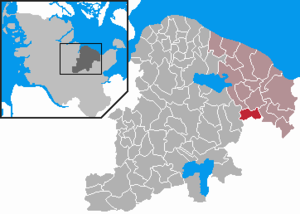
| Location of the community of Dannau in the district of Plön | ||
  |
||

Dannau is a municipality in the Plön district in Schleswig-Holstein . The municipality includes the Hahnenberg farm and the districts of Grellenkamp, Gerstenkamp, Neu-Wetterade, Gänsekrug, Timmrade, Luxrade, Gowens and Dannau.
A memorial for the fallen of the First World War , which was erected on a megalithic tomb in 1920 , is the symbol of the community.
Geography and traffic
Dannau is located on the Dannau Lake, named after him, near the federal highway 430 between Lütjenburg and Plön . The lake and its surroundings are a nature reserve and are part of Natura 2000 .
history
In 1928 the community of Dannau was created from the amalgamation of the villages of Dannau and Gowens. Dannau is first mentioned in 1286 and Gowens in 1358. The origins of the settlement are believed to be Slavic.
coat of arms
Blazon : “Divided by silver and blue in a wave cut. Above, a red ax and a red flail crossed at an angle, below in a fan-like arrangement a awned golden ear of barley between two silver oak leaves. "
Web links
Individual evidence
- ↑ North Statistics Office - Population of the municipalities in Schleswig-Holstein 4th quarter 2019 (XLSX file) (update based on the 2011 census) ( help on this ).
- ↑ Schleswig-Holstein topography. Vol. 2: Boren - Ellerau . 1st edition Flying-Kiwi-Verl. Junge, Flensburg 2002, ISBN 978-3-926055-68-2 , p. 250 ( dnb.de [accessed June 11, 2020]).
- ↑ Schleswig-Holstein's municipal coat of arms

Cities: Lütjenburg | Plön | Preetz | Schwentinental .
Other municipalities: Ascheberg (Holstein) | Barman | Barsbek | Behrensdorf (Baltic Sea) | Belau | Bendfeld | Blekendorf | Boksee | Bönebüttel | Bösdorf | Bothkamp | Brodersdorf | Dannau | Dersau | Dobersdorf | Dörnick | Driving | Fargau-Pratjau | Fiefbergen | Giekau | Grebin | Großbarkau | Grand Harrie | Heikendorf | Helmstorf | Högsdorf | Hohenfelde | Höhndorf | Hohwacht (Baltic Sea) | Honey lake | Calves | Kirchbarkau | Kirchnüchel | Klamp | Klein Barkau | Kletkamp | Köhn | Krokau | Krummbek | Cooling | Laboe | Lammershagen | Lebrade | Lehmkuhlen | Löptin | Lutterbek | Martensrade | Mönkeberg | Mucheln | Took | Nettelsee | Panker | Passade | Pohnsdorf | Post field | Prasdorf | Probsteierhagen | Rantzau | Rastorf | Rathjensdorf | Rendswühren | Angle of rest | Schellhorn | Schillsdorf | Reading | Schönberg (Holstein) | Schönkirchen | Schwartbuck | Selent | Stakendorf | Stone | Stumble | Stoltenberg | Tasdorf | Trundle | Wahlstorf | Wankendorf | Warnau | Wendtorf | Wipe | Wittmoldt .