
Pohnsdorf
| coat of arms | Germany map | |
|---|---|---|

|
Coordinates: 54 ° 14 ' N , 10 ° 14' E |
|
| Basic data | ||
| State : | Schleswig-Holstein | |
| Circle : | Plön | |
| Office : | Preetz country | |
| Height : | 24 m above sea level NHN | |
| Area : | 24.62 km 2 | |
| Residents: | 407 (Dec. 31, 2019) | |
| Population density : | 17 inhabitants per km 2 | |
| Postcodes : | 24211, 24223 | |
| Area code : | 04342 | |
| License plate : | PLÖ | |
| Community key : | 01 0 57 058 | |
| LOCODE : | DE 66M | |
| Office administration address: | Am Berg 2 24211 Schellhorn |
|
| Website : | ||
| Mayor : | Marco Lüth (KWG) | |
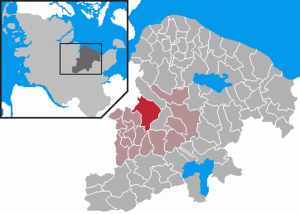
| Location of the municipality of Pohnsdorf in the district of Plön | ||
  |
||

Pohnsdorf is a municipality in the Plön district in Schleswig-Holstein . Pohnsdorf includes the towns of Hohenhorst, Hörnsee-Kronsredder, Neuwühren I, II and III, Oha, Pohnsdorferfeld, Pohnsdorfer Stauung, Rönnerholz, Sieversdorf and Tannenredder. There are several megalithic tombs and the Schwedenschanze in the municipality .
Geography and traffic
Pohnsdorf is about one kilometer west of Preetz am Postsee . The municipality includes both the Vogelsang and the Rönner Gehege and the Pohnsdorfer Stauung nature reserve on the area of farms that have since been closed. There is also an extensive forest area in the municipality, the Preetz monastery forest . From 1910 to 1930 Sieversdorf was the station of the Kleinbahn Kirchbarkau – Preetz – Lütjenburg .
history
Pohnsdorf was first mentioned in 1286 as Ponathesthorp . In 1807 the local farmers became independent after the abolition of serfdom.
politics
Community representation
Of the nine seats in the municipal council has Wählergemeinschaft KWG since the municipal election in 2018 seven seats and the CDU two.
coat of arms
Blazon : "In silver, a broad blue wave pole covered with a silver abbot's staff trimmed at the bottom, accompanied in front by a red ear, behind by three red beech leaves, the lower ones of which cover the upper ones like scales."
economy
As in many other places in the area, the number of farmers in Pohnsdorf is falling steadily. From 1956 to 1999 crude oil was produced on the area of the municipality . In 2016 the DEA company returned the permit for the oil field.
Web links
Individual evidence
- ↑ North Statistics Office - Population of the municipalities in Schleswig-Holstein 4th quarter 2019 (XLSX file) (update based on the 2011 census) ( help on this ).
- ↑ Schleswig-Holstein topography. Vol. 7: Munkbrarup - Pohnsdorf . 1st edition Flying-Kiwi-Verl. Junge, Flensburg 2006, ISBN 978-3-926055-88-0 , p. 358 ( dnb.de [accessed on July 22, 2020]).
- ^ Green stations in Kiel
- ↑ Schleswig-Holstein's municipal coat of arms
- ↑ Pohnsdorf - Oil stays in the earth. Retrieved July 4, 2020 .

Cities: Lütjenburg | Plön | Preetz | Schwentinental .
Other municipalities: Ascheberg (Holstein) | Barman | Barsbek | Behrensdorf (Baltic Sea) | Belau | Bendfeld | Blekendorf | Boksee | Bönebüttel | Bösdorf | Bothkamp | Brodersdorf | Dannau | Dersau | Dobersdorf | Dörnick | Driving | Fargau-Pratjau | Fiefbergen | Giekau | Grebin | Großbarkau | Grand Harrie | Heikendorf | Helmstorf | Högsdorf | Hohenfelde | Höhndorf | Hohwacht (Baltic Sea) | Honey lake | Calves | Kirchbarkau | Kirchnüchel | Klamp | Klein Barkau | Kletkamp | Köhn | Krokau | Krummbek | Cooling | Laboe | Lammershagen | Lebrade | Lehmkuhlen | Löptin | Lutterbek | Martensrade | Mönkeberg | Mucheln | Took | Nettelsee | Panker | Passade | Pohnsdorf | Post field | Prasdorf | Probsteierhagen | Rantzau | Rastorf | Rathjensdorf | Rendswühren | Angle of rest | Schellhorn | Schillsdorf | Reading | Schönberg (Holstein) | Schönkirchen | Schwartbuck | Selent | Stakendorf | Stone | Stumble | Stoltenberg | Tasdorf | Trundle | Wahlstorf | Wankendorf | Warnau | Wendtorf | Wipe | Wittmoldt .