
Schellhorn
| coat of arms | Germany map | |
|---|---|---|

|
Coordinates: 54 ° 14 ' N , 10 ° 18' E |
|
| Basic data | ||
| State : | Schleswig-Holstein | |
| Circle : | Plön | |
| Office : | Preetz country | |
| Height : | 33 m above sea level NHN | |
| Area : | 10.54 km 2 | |
| Residents: | 1481 (Dec. 31, 2019) | |
| Population density : | 141 inhabitants per km 2 | |
| Postal code : | 24211 | |
| Area code : | 04342 | |
| License plate : | PLÖ | |
| Community key : | 01 0 57 070 | |
| LOCODE : | DE 66P | |
| Office administration address: | Am Berg 2 24211 Schellhorn |
|
| Website : | ||
| Mayor : | Kai Johanssen (SWG) | |
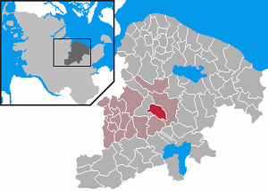
| Location of the community Schellhorn in the district of Plön | ||
  |
||

Schellhorn is a municipality in the Plön district in Schleswig-Holstein . Freudenholm, Scharstorf and Sophienhof are in the municipality.
The municipality is the seat of the administration of the Preetz-Land office .
Geography and traffic
Schellhorn is located directly southeast of Preetz am Lanker See . The place is about 16 km from Kiel and 11 km from Plön on the old federal highway 76 (now K 53).
politics
Local council, mayor
The local elections in May 2013 confirmed Kai Johanssen as mayor in office. He succeeded Gerd Baumgarten, who has been in office since 2008 and who died in June 2011.
The current 13-member council is divided into two non-partisan parliamentary groups: the Schellhorn voter community (SWG) with nine seats and the Schellhorn Citizens List (BLS) with four seats. The traditional parties did not compete at the local level.
coat of arms
Blazon : “Divided by a silver bar on the left. Above in blue a silver ring evenly divided into four parts, below in red an upright silver horn. "
The silver bar represents the salt road that used to run through the town. The ring symbolizes a Slavic castle in the district of Scharstorf, the ring wall of which is still clearly visible today. The four equal parts represent the four districts of Freudenholm, Scharstorf, Schellhorn and Sophienhof. The horn itself represents the name of the community, which in Middle Low German means a small cornucopia.
Attractions
One of the landmarks of the community is the Sophienhof chapel in the Sophienhof district. There is an old fortification at the Scharsee .
Personalities
- The journalist Sabine Christiansen (born September 20, 1957 in Preetz as Sabine Frahm ) grew up in Schellhorn.
- The Rear Admiral Hans Voss (born April 28, 1894 in Schellhorn, † May 29, 1973 in Eutin ), German naval officer, most recently Rear Admiral in World War II.
Web links
Individual evidence
- ↑ North Statistics Office - Population of the municipalities in Schleswig-Holstein 4th quarter 2019 (XLSX file) (update based on the 2011 census) ( help on this ).
- ↑ Schleswig-Holstein topography. Vol. 8: Pölitz - Schönbek . 1st edition Flying-Kiwi-Verl. Junge, Flensburg 2007, ISBN 978-3-926055-89-7 , pp. 291 ( dnb.de [accessed July 24, 2020]).
- ↑ Schleswig-Holstein's municipal coat of arms

Cities: Lütjenburg | Plön | Preetz | Schwentinental .
Other municipalities: Ascheberg (Holstein) | Barman | Barsbek | Behrensdorf (Baltic Sea) | Belau | Bendfeld | Blekendorf | Boksee | Bönebüttel | Bösdorf | Bothkamp | Brodersdorf | Dannau | Dersau | Dobersdorf | Dörnick | Driving | Fargau-Pratjau | Fiefbergen | Giekau | Grebin | Großbarkau | Grand Harrie | Heikendorf | Helmstorf | Högsdorf | Hohenfelde | Höhndorf | Hohwacht (Baltic Sea) | Honey lake | Calves | Kirchbarkau | Kirchnüchel | Klamp | Klein Barkau | Kletkamp | Köhn | Krokau | Krummbek | Cooling | Laboe | Lammershagen | Lebrade | Lehmkuhlen | Löptin | Lutterbek | Martensrade | Mönkeberg | Mucheln | Took | Nettelsee | Panker | Passade | Pohnsdorf | Post field | Prasdorf | Probsteierhagen | Rantzau | Rastorf | Rathjensdorf | Rendswühren | Angle of rest | Schellhorn | Schillsdorf | Reading | Schönberg (Holstein) | Schönkirchen | Schwartbuck | Selent | Stakendorf | Stone | Stumble | Stoltenberg | Tasdorf | Trundle | Wahlstorf | Wankendorf | Warnau | Wendtorf | Wipe | Wittmoldt .