
Post field
| coat of arms | Germany map | |
|---|---|---|

|
Coordinates: 54 ° 13 ' N , 10 ° 13' E |
|
| Basic data | ||
| State : | Schleswig-Holstein | |
| Circle : | Plön | |
| Office : | Preetz country | |
| Height : | 25 m above sea level NHN | |
| Area : | 8.33 km 2 | |
| Residents: | 440 (December 31, 2019) | |
| Population density : | 53 inhabitants per km 2 | |
| Postal code : | 24211 | |
| Area code : | 04342 | |
| License plate : | PLÖ | |
| Community key : | 01 0 57 059 | |
| LOCODE : | DE 66N | |
| Office administration address: | Am Berg 2 24211 Schellhorn |
|
| Website : | ||
| Mayor : | Uwe Leiner | |
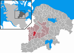
| Location of the community of Postfeld in the district of Plön | ||
  |
||

Postfeld is a municipality in the Barkauer Land region in the Plön district in Schleswig-Holstein . Bormsdorf is in the municipality.
Geography and traffic
Postfeld is located about 10 km southeast of Kiel and about 5 km southwest of Preetz near the federal highway 404 from Kiel to Bad Segeberg . Postfeld is located on the Postsee .
history
The place emerged from the forest villages of the Preetz Monastery , which they owned from 1224 to 1325. The place was originally called Porsvelde . The forest villages were created by clearing the Isarnhoe, the impenetrable forest .
In 1652 two residents of Postfeld were accused of being witches and were presumably executed.
The school was first mentioned in 1748.
politics
Community representation
Of the nine seats in the municipal council, PW has had six seats and the UWP three since the 2013 local elections.
coat of arms
Blazon : "Under a blue shield head, in it three golden sheaves, in silver a red mill wheel."
economy
The municipality is predominantly agricultural.
literature
- J. Kortum: Chronicle of Postfeld , Edition Barkau, Großbarkau 2000, ISBN 3-928326-23-6
Web links
Individual evidence
- ↑ North Statistics Office - Population of the municipalities in Schleswig-Holstein 4th quarter 2019 (XLSX file) (update based on the 2011 census) ( help on this ).
- ↑ Schleswig-Holstein topography. Vol. 8: Pölitz - Schönbek . 1st edition Flying-Kiwi-Verl. Junge, Flensburg 2007, ISBN 978-3-926055-89-7 , pp. 13 ( dnb.de [accessed on July 22, 2020]).
- ↑ Schleswig-Holstein's municipal coat of arms

Cities: Lütjenburg | Plön | Preetz | Schwentinental .
Other municipalities: Ascheberg (Holstein) | Barman | Barsbek | Behrensdorf (Baltic Sea) | Belau | Bendfeld | Blekendorf | Boksee | Bönebüttel | Bösdorf | Bothkamp | Brodersdorf | Dannau | Dersau | Dobersdorf | Dörnick | Driving | Fargau-Pratjau | Fiefbergen | Giekau | Grebin | Großbarkau | Grand Harrie | Heikendorf | Helmstorf | Högsdorf | Hohenfelde | Höhndorf | Hohwacht (Baltic Sea) | Honey lake | Calves | Kirchbarkau | Kirchnüchel | Klamp | Klein Barkau | Kletkamp | Köhn | Krokau | Krummbek | Cooling | Laboe | Lammershagen | Lebrade | Lehmkuhlen | Löptin | Lutterbek | Martensrade | Mönkeberg | Mucheln | Took | Nettelsee | Panker | Passade | Pohnsdorf | Post field | Prasdorf | Probsteierhagen | Rantzau | Rastorf | Rathjensdorf | Rendswühren | Angle of rest | Schellhorn | Schillsdorf | Reading | Schönberg (Holstein) | Schönkirchen | Schwartbuck | Selent | Stakendorf | Stone | Stumble | Stoltenberg | Tasdorf | Trundle | Wahlstorf | Wankendorf | Warnau | Wendtorf | Wipe | Wittmoldt .