
Löptin
| coat of arms | Germany map | |
|---|---|---|

|
Coordinates: 54 ° 11 ' N , 10 ° 13' E |
|
| Basic data | ||
| State : | Schleswig-Holstein | |
| Circle : | Plön | |
| Office : | Preetz country | |
| Height : | 36 m above sea level NHN | |
| Area : | 9.08 km 2 | |
| Residents: | 295 (Dec. 31, 2019) | |
| Population density : | 32 inhabitants per km 2 | |
| Postal code : | 24250 | |
| Primaries : | 04302, 04342 | |
| License plate : | PLÖ | |
| Community key : | 01 0 57 047 | |
| LOCODE : | DE 66K | |
| Office administration address: | Am Berg 2 24211 Schellhorn |
|
| Website : | ||
| Mayor : | Uwe Mewes (FWL) | |
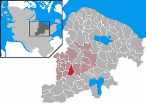
| Location of the municipality of Löptin in the district of Plön | ||
  |
||

Löptin is a municipality in the Barkauer Land region in the Plön district in Schleswig-Holstein . The localities Behnkenmühlen, Fischkroog and Hohenwühren as well as Preetzer Straße and Kührener Brücke are located in the municipality.
Geography and traffic
Löptin is located about 16 km northeast of Neumünster and about 8 km southwest of Preetz on the federal highway 404 from Kiel to Bad Segeberg and at the Löptiner See .
history
The place was first mentioned in 1224 as the estate of the knight Johann von Lübbe-tyn .
As the form of the place name (on -in ) and the still-preserved village complex of a Wendish Rundling show, Löptin was originally a Slavic settlement.
politics
Community representation
Since the local elections in 2013, the FWL voter community has all nine seats in the local council.
coat of arms
Blazon : “Split. In front of silver and red diced vertically in two rows; divided twice at the back by silver and blue. "
economy
The community is predominantly agricultural. However, there are also craft and retail businesses in town.
Web links
Individual evidence
- ↑ North Statistics Office - Population of the municipalities in Schleswig-Holstein 4th quarter 2019 (XLSX file) (update based on the 2011 census) ( help on this ).
- ↑ Schleswig-Holstein topography. Vol. 6: Kronprinzenkoog - Mühlenrade . 1st edition Flying-Kiwi-Verl. Junge, Flensburg 2006, ISBN 978-3-926055-85-9 , pp. 196 ( dnb.de [accessed July 26, 2020]).
- ↑ Schleswig-Holstein's municipal coat of arms

Cities: Lütjenburg | Plön | Preetz | Schwentinental .
Other municipalities: Ascheberg (Holstein) | Barman | Barsbek | Behrensdorf (Baltic Sea) | Belau | Bendfeld | Blekendorf | Boksee | Bönebüttel | Bösdorf | Bothkamp | Brodersdorf | Dannau | Dersau | Dobersdorf | Dörnick | Driving | Fargau-Pratjau | Fiefbergen | Giekau | Grebin | Großbarkau | Grand Harrie | Heikendorf | Helmstorf | Högsdorf | Hohenfelde | Höhndorf | Hohwacht (Baltic Sea) | Honey lake | Calves | Kirchbarkau | Kirchnüchel | Klamp | Klein Barkau | Kletkamp | Köhn | Krokau | Krummbek | Cooling | Laboe | Lammershagen | Lebrade | Lehmkuhlen | Löptin | Lutterbek | Martensrade | Mönkeberg | Mucheln | Took | Nettelsee | Panker | Passade | Pohnsdorf | Post field | Prasdorf | Probsteierhagen | Rantzau | Rastorf | Rathjensdorf | Rendswühren | Angle of rest | Schellhorn | Schillsdorf | Reading | Schönberg (Holstein) | Schönkirchen | Schwartbuck | Selent | Stakendorf | Stone | Stumble | Stoltenberg | Tasdorf | Trundle | Wahlstorf | Wankendorf | Warnau | Wendtorf | Wipe | Wittmoldt .