
Panker
| coat of arms | Germany map | |
|---|---|---|

|
Coordinates: 54 ° 20 ' N , 10 ° 34' E |
|
| Basic data | ||
| State : | Schleswig-Holstein | |
| Circle : | Plön | |
| Office : | Luetjenburg | |
| Height : | 55 m above sea level NHN | |
| Area : | 22.76 km 2 | |
| Residents: | 1415 (Dec. 31, 2019) | |
| Population density : | 62 inhabitants per km 2 | |
| Postal code : | 24321 | |
| Area code : | 04381 | |
| License plate : | PLÖ | |
| Community key : | 01 0 57 055 | |
| LOCODE : | DE 65Y | |
| Office administration address: | Neverstorfer Strasse 7 24321 Lütjenburg |
|
| Website : | ||
| Mayor : | Ewald Schöning ( CDU ) | |
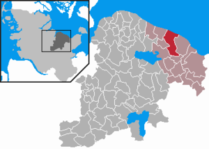
| Location of the municipality of Panker in the district of Plön | ||
  |
||

Panker is a municipality in the Plön district in Schleswig-Holstein .
geography
The municipality of Panker borders the Kiel Bay in the north and is about 30 kilometers east of Kiel .
Neighboring communities
The neighboring communities of Panker start clockwise from the east: Behrensdorf , Lütjenburg , Giekau , Tröndel and Hohenfelde .
Community structure
The municipality consists of the following districts:
- Darry
- Friedrichshof
- Gadendorf
- Good panker
- Matzwitz
- Satjendorf
- Todendorf
- as well as 11 extensions
history
Panker was first mentioned in 1433 as "Pankuren". The place name is of Slavic origin.
politics
Community representation
The 2018 election resulted in the following:
coat of arms
Blazon : “A broad silver pole in blue, covered with a neo-Gothic red brick tower over a polygonal ground plan with pinnacles above the crenellated crown, Gothic windows in the lower and circular windows in the upper storeys and an open, gabled gate and accompanied on both sides by three pillar-like, curved ones silver diamonds. "
Good panker

From the 15th century until it was sold to Friedrich I, Landgrave of Hesse and King of Sweden in 1739, the Panker estate belonged to the long-established Rantzau family . Friedrich I handed over the estate and some other lands to his illegitimate sons, who were made Counts of Hessenstein. The manor, located directly on the Baltic Sea, was built around this time, the current manor house was built around 1800. It belongs to the property of the Hessian House Foundation and is therefore in fact owned by the former Hessian princely house . It is not freely accessible to the public.
Gut Panker is privately owned and is still inhabited today. On the estate there is a restaurant (Ole Liese) named after the favorite horse of the first Hessian landowner, a gallery in the gatehouse and a stud farm.
Not far from the manor on the Pilsberg is the Hessenstein, a lookout tower built in 1841 from brick.
At Gut Panker there is a Trakehner stud established in 1947 by the Kurhessische Hausstiftung . Breeding began with twenty mares that could be rescued from East Prussia.
Todendorf military training area


The Todendorf military training area is located in Todendorf, which is now a branch of the Putlos military training area .
Originally, the British occupation forces planned to set up an anti-aircraft firing range in Hohwacht. The former positions of the Wehrmacht should be used for this purpose. However, this project was not implemented due to citizen protests that saw tourism as endangered. The British military leadership then decided to build a new firing range a few kilometers west on the grounds of the Todendorf estate.
With the confiscation notice of March 20, 1952, the construction of two camps and two shooting ranges began despite various complaints and protests from citizens, the community, the Bundestag and the government. On January 29, 1953, the mayor of the community of Panker received a second confiscation notice, this time from the American occupation forces. Another camp and a shooting range were built directly to the west of the English camp.
With the establishment of the American command, the "shooting range Todendorf" was renamed "Nato-FlaSchießplatz Todendorf". In 1956, under the direction of the British command, the expansion of another camp and another shooting range began. In 1956 the shooting range in Todendorf was shot on 260 days.
On March 31, 1958, the three British camps and shooting ranges were handed over to the German commanders. The transfer of the American camp and the shooting range took place in 1962. The NATO status was revoked on July 1, 1962. The new name was: "Military training area and anti-aircraft firing range Todendorf".
Shipping will be informed of the respective shooting times.
At peak times, all camps had permanent accommodation for 2,000 soldiers. Due to the constant presence of British and American soldiers, several restaurants were quickly opened in front of the barracks gates. At the "heyday" of that time there were seven restaurants, of which only one is still in operation today. Of the rest of the restaurants, only one building remains today.
The Dolmen Panker 1 and 2 lie on a 87 m high hill at the border to Giekau .
Web links
Individual evidence
- ↑ North Statistics Office - Population of the municipalities in Schleswig-Holstein 4th quarter 2019 (XLSX file) (update based on the 2011 census) ( help on this ).
- ↑ Panker's community structure on the website of the Lütjenburg Office , accessed on March 8, 2019
- ↑ Schleswig-Holstein's municipal coat of arms , accessed on March 8, 2019
- ↑ [1] Shooting times in Todendorf and Putlos
Darry | Friedrichshof | Gadendorf | Good Panker | Matzwitz | Satjendorf | Todendorf

Cities: Lütjenburg | Plön | Preetz | Schwentinental .
Other municipalities: Ascheberg (Holstein) | Barman | Barsbek | Behrensdorf (Baltic Sea) | Belau | Bendfeld | Blekendorf | Boksee | Bönebüttel | Bösdorf | Bothkamp | Brodersdorf | Dannau | Dersau | Dobersdorf | Dörnick | Driving | Fargau-Pratjau | Fiefbergen | Giekau | Grebin | Großbarkau | Grand Harrie | Heikendorf | Helmstorf | Högsdorf | Hohenfelde | Höhndorf | Hohwacht (Baltic Sea) | Honey lake | Calves | Kirchbarkau | Kirchnüchel | Klamp | Klein Barkau | Kletkamp | Köhn | Krokau | Krummbek | Cooling | Laboe | Lammershagen | Lebrade | Lehmkuhlen | Löptin | Lutterbek | Martensrade | Mönkeberg | Mucheln | Took | Nettelsee | Panker | Passade | Pohnsdorf | Post field | Prasdorf | Probsteierhagen | Rantzau | Rastorf | Rathjensdorf | Rendswühren | Angle of rest | Schellhorn | Schillsdorf | Reading | Schönberg (Holstein) | Schönkirchen | Schwartbuck | Selent | Stakendorf | Stone | Stumble | Stoltenberg | Tasdorf | Trundle | Wahlstorf | Wankendorf | Warnau | Wendtorf | Wipe | Wittmoldt .