
Rathjensdorf
| coat of arms | Germany map | |
|---|---|---|

|
Coordinates: 54 ° 11 ' N , 10 ° 26' E |
|
| Basic data | ||
| State : | Schleswig-Holstein | |
| Circle : | Plön | |
| Office : | Great Lake Plön | |
| Height : | 32 m above sea level NHN | |
| Area : | 11.79 km 2 | |
| Residents: | 490 (Dec. 31, 2019) | |
| Population density : | 42 inhabitants per km 2 | |
| Postal code : | 24306 | |
| Area code : | 04522 | |
| License plate : | PLÖ | |
| Community key : | 01 0 57 067 | |
| LOCODE : | DE 66A | |
| Office administration address: | Heinrich-Rieper-Strasse 8 24306 Plön |
|
| Website : | ||
| Mayoress : | Gertrud Henningsen (KWG) | |
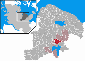
| Location of the community Rathjensdorf in the district of Plön | ||
  |
||

Rathjensdorf is a municipality in the Plön district in Schleswig-Holstein . It is made up of the districts Rathjensdorf, Theresienhof, Tramm and Neutramm. Rathjensdorf is located in the heart of the Holstein Switzerland region and was named the Most Beautiful Village in 1963 .
Geography and traffic
Rathjensdorf is located near the federal highway 430 about 2 km north of Plön . It is a street village through which the approx. 1 km long Alte Dorfstraße leads. The Kossau rises in the Trentmoor .
history
The municipality of Tramm was formed in 1928 after the Rixdorf estate was dissolved. On October 1, 1949, the municipality of Tramm was renamed Rathjensdorf .
politics
Community representation
Since the local elections in 2018 which has Wählergemeinschaft KWG five (+1 compared to 2013), the CDU two (-1) and the SPD two seats (± 0) in the local council.
coat of arms
Blazon : “Divided by red and gold obliquely on the left. In front a silver pot helmet from the 13th century, flattened at the top, set with two silver wheels (helmet ornament) with thorns on the outside, behind a four-leaf green clover. "
Economy and Infrastructure
The municipality is predominantly agricultural. In the Rathjensdorf district is the Dörpskrog country inn , which had developed into supra-local importance and was taken over in 1991 by Karsten Lindemann in the third generation.
In 1963 a 5000 m² school forest was set up in a former gravel pit at the eastern entrance to the village , which is still in a well-tended condition today. On the edge of the school forest there is a memorial for those who fell in the war. Both facilities can be traced back to the diverse activities of the former village school teacher Heinz Petersen . To the south of the school forest there is an observation station of the "Project Group Sea Eagle Protection"
education
The school operation of the last single-class elementary school was stopped in the 1975/76 school year, and the children have been going to school in Plön since then. In 1996 a kindergarten was set up in the former school building in Rathjensdorf, which is run jointly with the neighboring community of Lebrade .
church
Rathjensdorf belongs to the ev.-luth. Parish Lebrade .

Former school building, now kindergarten

Award

Entrance to the Rathjensdorf school forest
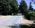
View of the old village street from the west


See also
In the municipality of Kronprinzenkoog there is a district of the same name and street name Rathjensdorf ( map )
Web links
Individual evidence
- ↑ North Statistics Office - Population of the municipalities in Schleswig-Holstein 4th quarter 2019 (XLSX file) (update based on the 2011 census) ( help on this ).
- ↑ Schleswig-Holstein topography. Vol. 8: Pölitz - Schönbek . 1st edition Flying-Kiwi-Verl. Junge, Flensburg 2007, ISBN 978-3-926055-89-7 , pp. 106 ( dnb.de [accessed on July 23, 2020]).
- ↑ State Statistical Office Schleswig-Holstein (Ed.): The population of the communities in Schleswig-Holstein . Historical municipality directory: Notes on the municipality of Rathjensdorf (footnote). Kiel 1972 ( digitized from genealogy.net [accessed on April 21, 2015]).
- ^ Election results for the community of Rathjensdorf , accessed on June 17, 2018.
- ↑ Schleswig-Holstein's municipal coat of arms
- ^ Project group Sea eagle protection , last accessed on January 10, 2013

Cities: Lütjenburg | Plön | Preetz | Schwentinental .
Other municipalities: Ascheberg (Holstein) | Barman | Barsbek | Behrensdorf (Baltic Sea) | Belau | Bendfeld | Blekendorf | Boksee | Bönebüttel | Bösdorf | Bothkamp | Brodersdorf | Dannau | Dersau | Dobersdorf | Dörnick | Driving | Fargau-Pratjau | Fiefbergen | Giekau | Grebin | Großbarkau | Grand Harrie | Heikendorf | Helmstorf | Högsdorf | Hohenfelde | Höhndorf | Hohwacht (Baltic Sea) | Honey lake | Calves | Kirchbarkau | Kirchnüchel | Klamp | Klein Barkau | Kletkamp | Köhn | Krokau | Krummbek | Cooling | Laboe | Lammershagen | Lebrade | Lehmkuhlen | Löptin | Lutterbek | Martensrade | Mönkeberg | Mucheln | Took | Nettelsee | Panker | Passade | Pohnsdorf | Post field | Prasdorf | Probsteierhagen | Rantzau | Rastorf | Rathjensdorf | Rendswühren | Angle of rest | Schellhorn | Schillsdorf | Reading | Schönberg (Holstein) | Schönkirchen | Schwartbuck | Selent | Stakendorf | Stone | Stumble | Stoltenberg | Tasdorf | Trundle | Wahlstorf | Wankendorf | Warnau | Wendtorf | Wipe | Wittmoldt .