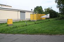
Schillsdorf
| coat of arms | Germany map | |
|---|---|---|

|
Coordinates: 54 ° 7 ' N , 10 ° 7' E |
|
| Basic data | ||
| State : | Schleswig-Holstein | |
| Circle : | Plön | |
| Office : | Bokhorst-Wankendorf | |
| Height : | 42 m above sea level NHN | |
| Area : | 26.5 km 2 | |
| Residents: | 883 (Dec. 31, 2019) | |
| Population density : | 33 inhabitants per km 2 | |
| Postal code : | 24637 | |
| Area code : | 04394 | |
| License plate : | PLÖ | |
| Community key : | 01 0 57 071 | |
| LOCODE : | DE 65P | |
| Office administration address: | Kampstrasse 1 24601 Wankendorf |
|
| Website : | ||
| Mayor : | Heinrich Danker ( CDU ) | |
| Location of the community of Schillsdorf in the district of Plön | ||
Schillsdorf is a municipality in the Plön district in Schleswig-Holstein . Altbokhorst, Bokhorst, Busdorf, Hüttenwohld, Kuhteich, Lange Reihe, Mannhagen, Ovendorfer Redder, Schlagbaum, Schönhagen, Wildhagen and Ziegelhof are located in the municipality.
Geography and traffic
Schillsdorf is located about 10 km east of Neumünster and about 5 km west of the federal highway 21 (extension of the federal highway 404 ) from Kiel to Bad Segeberg on the former railway line from Neumünster to Plön . The Schillsdorfer Heickenteich is the source pond of the Eider .
history
The district of Busdorf was first mentioned in a document in 1284. This had to pay taxes to the Bordesholm monastery until 1538 .
The districts of Schillsdorf arose around branch offices of the Bothkamp estate . After the dissolution of the Bothkamp manor district, Schillsdorf became an independent rural community in 1928, which belonged to the Bothkamp district and thus to the Bordesholm district . After the Bordesholm district was dissolved in 1932, Bothkamp and the entire district became part of the Plön district .
After the dissolution of the administrative districts in 1948 and the formation of the offices, Schillsdorf belonged to the Bokhorst office and was its administrative seat. Since the merger of the offices of Bokhorst and Wankendorf on January 1, 2008, Schillsdorf has belonged to the office of Bokhorst-Wankendorf .
Local council, mayor
Of the eleven seats in the municipal council, the CDU has had seven seats since the 2008 local elections and the WuSB electoral community four. Mayor Karl Fock was replaced by Heinrich Danker.
education
In Schillsdorf there is a kindergarten run by the Bokhorst parish and a primary school. Secondary schools are in Neumünster, Bornhöved and Wankendorf .
leisure
Draisine rides are offered between the Brammerhof near Bokhorst and the Lange Reihe Süd near Wankendorf . The starting point is the former train station in Bokhorst.
church
In the district of Bokhorst there is the Evangelical Lutheran Holy Spirit Church, which was inaugurated in 1950 and changed in 1960 and 2009. In 1971 the kindergarten "K.in.der Kastanie Bokhorst" and in 1996 the "Boy Scouts Bokhorst" was founded.
economy
In the community there is a farm trade, a pig insemination station with around 200 boars, an electrician and a carpentry shop.
Web links
Individual evidence
- ↑ North Statistics Office - Population of the municipalities in Schleswig-Holstein 4th quarter 2019 (XLSX file) (update based on the 2011 census) ( help on this ).
- ↑ Schleswig-Holstein topography. Vol. 8: Pölitz - Schönbek . 1st edition Flying-Kiwi-Verl. Junge, Flensburg 2007, ISBN 978-3-926055-89-7 , pp. 308 ( dnb.de [accessed July 24, 2020]).
- ↑ Archived copy ( Memento of the original from May 21, 2016 in the Internet Archive ) Info: The archive link was inserted automatically and has not yet been checked. Please check the original and archive link according to the instructions and then remove this notice.
- ↑ Draisinenfreunde Mittelholstein. Retrieved August 29, 2016 .
- ^ Bokhorst parish. (No longer available online.) Archived from the original on March 5, 2016 ; Retrieved July 29, 2011 . Info: The archive link was inserted automatically and has not yet been checked. Please check the original and archive link according to the instructions and then remove this notice.
- ↑ Schillsdorf. Retrieved June 18, 2020 .


