
Office Lütjenburg
| coat of arms | Germany map | |
|---|---|---|

|
Coordinates: 54 ° 18 ' N , 10 ° 35' E |
|
| Basic data | ||
| State : | Schleswig-Holstein | |
| Circle : | Plön | |
| Area : | 225.04 km 2 | |
| Residents: | 15,251 (Dec. 31, 2019) | |
| Population density : | 68 inhabitants per km 2 | |
| License plate : | PLÖ | |
| Office key : | 01 0 57 5727 | |
| Office structure: | 15 municipalities | |
| Office administration address : |
Neverstorfer Strasse 7 24321 Lütjenburg |
|
| Website : | ||
| Head of Office : | Volker Schütte-Felsche ( CDU ) | |
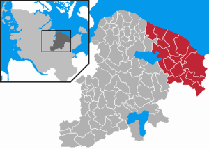
| Location of the Lütjenburg office in the Plön district | ||
  |
||

The Lütjenburg office is an office in the Plön district in Schleswig-Holstein with its administrative headquarters in the city of Lütjenburg .
The office is located in the east of the Plön district and borders the Baltic Sea in the north, the Ostholstein district in the east and south and the offices of Großer Plöner See , Selent / Schlesen and Probstei in the west .
Official communities with their districts
- Behrensdorf (Baltic Sea) with the OT Lippe, Seekamp, Neuland, Kembs, Waterneverstorf and Stöfs
- Blekendorf with the OT Belvedere, Tivoli, Friederikental, Ellert, Friedrichsleben, Futterkamp, Günnenfelde, Hasenberg, Kaköhl, Nessendorf, Nessendorfer Mühle, Windmühlenkamp, Packhaus, Rathlau, Diekkate, Rathlau Colony, Lehmberg, Sechendorf and Sehlendorf
- Dannau with the OT Gowens, Luxrade, Neuwetterade and Söhren
- Giekau with the OT Gottesgabe, Engelau, Dransau, Fresendorf, Neuhaus, Warderhof and Ölböhm
- Helmstorf with the OT Kühren and Wetterade
- Högsdorf with the OT Achtersöhren, Steinbusch, Flehm, Kuhlrade, Hohenstein and Schoppel
- Hohenfelde with the OT Krummsiek, Monkamp, Malmsteg, Radeland, Mühlenau, Grünberg, and Hoffeld
- Hohwacht (Baltic Sea) with the OT Haßberg and Schmiedendorf
- Kirchnüchel with the OT Altharmhorst, Neuharmhorst, and Kirchmühl
- Klamp with the OT Vogelsdorf, Rönfeldholz and Wentorf
- Kletkamp with the OT Großrolübbe, Hähnersaal, Ludwigshof and Schoolbrook
- Lütjenburg , city
- Panker with the OT Darry, Futterkamp, Gadendorf, Haferstoppel, Matzwitz, Todendorf, Friedrichshof and Satjendorf
- Schwartbuck with the OT Maaskamp, Schmoel and Schwartbuckerholz
- Frenzy
history
The office was formed in 1968 as the Office Lütjenburg-Land . At that time, it comprised all of the parishes still belonging to the office today, except for the city of Lütjenburg, which was free of office. At that time, the administrative headquarters were already in Lütjenburg.
On January 1, 2008, the city of Lütjenburg joined the office, which then changed its name to Amt Lütjenburg .
coat of arms
Blazon : "A narrow silver wave thread above a blue shield base, above it a wide green wave bar, above it a red brick tower with three battlements, silver support bars and a silver window on the right, bordered by 15 blue cornflowers."
The tower represents the red brick Bismarck tower in Lütjenburg. The blue in the base of the shield symbolizes the Baltic Sea and the silver the Kossau , a river in the official area. Green stands for agriculture, which is dominated by rapeseed (gold). The fifteen cornflowers represent the parishes belonging to the office.
Web link
Individual evidence
- ↑ North Statistics Office - Population of the municipalities in Schleswig-Holstein 4th quarter 2019 (XLSX file) (update based on the 2011 census) ( help on this ).
- ↑ Schleswig-Holstein's municipal coat of arms