Bielstein (Kaufunger Forest)
| Bielstein | ||
|---|---|---|
|
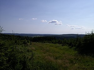
View from Bielstein towards Eschenstruth |
||
| height | 527.8 m above sea level NHN | |
| location | at Helsa ; District of Kassel , Hessen ( Germany ) | |
| Mountains | Söhre (Stiftswald Kaufungen) | |
| Coordinates | 51 ° 15 '2 " N , 9 ° 39' 34" E | |
|
|
||
| particularities | Rock formation Bielsteinkirche ( ND ) | |
The Bielstein (not to be confused with the nearby Großalmerode in the Kaufunger Wald , Bilstein ) is 527.8 m above sea level. NHN high mountain of the Söhre (subsection Stiftswald Kaufungen ) near Helsa in the north Hessian district of Kassel .
geography
location
The Bielstein rises in the geo-nature park Frau-Holle-Land (Werratal.Meißner.Kaufunger Wald) within the wooded Stiftswald Kaufungen around 2 km west-southwest of the core town of Helsa , 2.5 km north of its district Eschenstruth and around 4 km (distances each as the crow flies ) southeast of Kaufungen .
Almost 200 m (as the crow flies) east of the Bielstein summit is the massive natural monument Bielstein Church (also called Bielstein Church or Bielstein Church), a church- shaped basalt rock formation, the rocks of which rise up to about 15 m and were probably used as a sacrificial site in pre-Christian times .
The Michelskopf lakes are located almost 600 m (as the crow flies) northwest of the Bilstein summit on the Michelskopf . The source of the pork croissant lies in the direction of Eschenstruth .
Natural allocation
The Bielstein belongs in the natural spatial main unit group Osthessisches Bergland (No. 35), in the main unit Fulda-Werra-Bergland (357) and in the subunit Kaufunger Wald und Söhre (357.7) to the natural area Söhre (357.70).
Development
The Bielstein with its Bielstein Church can only be reached on hiking trails , for example on the Eder-Gelster-Weg, which connects the Eder in the west and the Gelster in the east.
Individual evidence
- ↑ a b Map services of the Federal Agency for Nature Conservation ( information )
- ^ Hans-Jürgen Klink: Geographical land survey: The natural space units on sheet 112 Kassel. Federal Institute for Regional Studies, Bad Godesberg 1969. → Online map (PDF; 6.9 MB)

