Michelskopf
| Michelskopf | ||
|---|---|---|
|
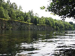
The larger of the two Michelskopf lakes on the Michelskopf |
||
| height | 485 m above sea level NHN | |
| location | near acquisitions ; District of Kassel , Hessen ( Germany ) | |
| Mountains | Kaufunger Forest | |
| Coordinates | 51 ° 15 '13 " N , 9 ° 39' 2" E | |
|
|
||
| rock | basalt | |
| particularities | Michelskopfseen | |
The Michelskopf near Oberkaufungen in the Hessian district of Kassel is about 485 m above sea level. NHN high mountain top and western foothills of the Bielstein .
geography
location
The Michelskopf rises in the Geo-Naturpark Frau-Holle-Land (Werratal.Meißner.Kaufunger Wald) in the Stiftswald Kaufungen . Its summit is around 2.7 km west-southwest of Helsa , 3 km north-north-west of its district Eschenstruth and 3.5 km (as the crow flies ) south-east of Oberkaufungen .
Natural allocation
The Michelskopf belongs to the natural spatial main unit group Osthessisches Bergland (35), in the main unit Fulda-Werra-Bergland (357) and in the subunit Kaufunger Wald und Söhre (357.7) to the natural area Söhre (357.70).
Waters
The Setzebach rises on the northwest flank of the Michelskopf . Below the summit are the Michelskopfseen , two directly neighboring lakes in former basalt quarries that are up to 100 m wide and together are around 700 m long. They are towered over by about 8 to 10 m high basalt rocks or walls of the former quarry .
hike
The Michelskopf with its remote still waters , which are a year-round excursion destination, can only be reached on hiking trails, for example on the Eder-Gelster-Weg , which connects the Eder in the west and the Gelster in the east. Hikers , joggers and cyclists get to the lakes via numerous forest paths, for example to enjoy the lake landscape during a break. In the warm season, the larger of the two lakes is often used as a bathing lake.
About 600 m (distance) east-southeast of Michelskopf Summit is located at Bielstein the natural monument Bielstein Church .
Individual evidence
- ↑ a b Map services of the Federal Agency for Nature Conservation ( information )
- ^ Hans-Jürgen Klink: Geographical land survey: The natural space units on sheet 112 Kassel. Federal Institute for Regional Studies, Bad Godesberg 1969. → Online map (PDF; 6.9 MB)

