
Great Aspen
| coat of arms | Germany map | |
|---|---|---|

|
Coordinates: 53 ° 58 ' N , 9 ° 58' E |
|
| Basic data | ||
| State : | Schleswig-Holstein | |
| Circle : | Segeberg | |
| Office : | Bad Bramstedt-Land | |
| Height : | 33 m above sea level NHN | |
| Area : | 45.62 km 2 | |
| Residents: | 2984 (Dec. 31, 2019) | |
| Population density : | 65 inhabitants per km 2 | |
| Postal code : | 24623 | |
| Primaries : | 04320, 04327 | |
| License plate : | SE | |
| Community key : | 01 0 60 027 | |
| Office administration address: | König-Christian-Strasse 6 24576 Bad Bramstedt |
|
| Website : | ||
| Mayor : | Torsten Klinger ( CDU ) | |
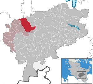
| Location of the community of Großenaspe in the Segeberg district | ||
  |
||

Großenaspe is a municipality in the west of the Segeberg district in Schleswig-Holstein . Freiweide, Brokenlande, Warmkammer, Bissenbrook, Dorotheental, Oberhof, Sellhornhof and Immehof are in the municipality.
Geography and traffic
Großenaspe is located about ten kilometers south of Neumünster in a rural area. The federal motorway 7 runs to the west from Hamburg to Flensburg. The Hamburg-Altona-Neumünster railway runs on the outskirts and the AKN Großenaspe stop is in the north.
history
Großenaspe was first mentioned in a document in 1343. The name is probably derived from the tree species aspen .
In 1860 a ring was found while plowing, which consists of a metal alloy of gold and silver and is hollow. It dates from the Bronze Age and is known as the Eidring , although contrary to earlier beliefs it was not used for this purpose. Today it is in the State Museum in Gottorf Castle and is depicted in the municipal coat of arms.
The place also became famous for the construction of the octagonal Katharinenkirche , which was commissioned by the Russian Tsarina Catherine II in 1772 and named after her.
politics
Community representation
Of the 17 seats in the municipal council, the CDU has had nine seats since the 2013 local elections, the SPD and the BfB electoral community each have three and the FDP two seats.
coat of arms
Blazon : "A golden oath ring in green, accompanied by two silver aspen leaves in the upper corners."
Attractions
The list of cultural monuments in Großenaspe includes the cultural monuments entered in the list of monuments of Schleswig-Holstein. From the 16 meter high Ketelvierth observation tower , you have a good view of the Holstein Geest.
literature
- Great Aspen. Pictures from past decades . Edited by the community of Großenaspe, Geiger-Verlag Horb am Neckar 1988.
- Großenasper village chronicle , issue 1–45. Edited by the village chronicle working group Großenaspe over Neumünster, 1961–1970.
Web links
Individual evidence
- ↑ North Statistics Office - Population of the municipalities in Schleswig-Holstein 4th quarter 2019 (XLSX file) (update based on the 2011 census) ( help on this ).
- ↑ Schleswig-Holstein topography. Vol. 4: Groß Sarau - Holstenniendorf . 1st edition Flying-Kiwi-Verl. Junge, Flensburg 2004, ISBN 978-3-926055-75-0 , p. 16 ( dnb.de [accessed on May 1, 2020]).
- ↑ Schleswig-Holstein's municipal coat of arms
Alveslohe | Armstedt | Bad Bramstedt | Bad Segeberg | Bahrenhof | Bark | Bebensee | Bimöhlen | Blunk | Boostedt | Bornhöved | Borstel | Bühnsdorf | Daldorf | Damsdorf | Dreggers | Ellerau | Fahrenkrug | Föhrden-Barl | Fredesdorf | Fuhlendorf | Geschendorf | Glasau | Gönnebek | Groß Kummerfeld | Gross Niendorf | Groß Rönnau | Great Aspen | Hagen | Hardebek | Hartenholm | Hasenkrug | Rabbit Moor | Heidmoor | Heidmühlen | Henstedt-Ulzburg | Hitzhusen | Högersdorf | Hüttblek | Itzstedt | Kaltenkirchen | Kattendorf | Kayhude | Kisdorf | Klein Gladebrugge | Klein Rönnau | Krems II | Kükels | Latendorf | Leezen | Lentföhrden | Mönkloh | Mözen | Near | Negro Bay | Take | Neuengörs | Neversdorf | Norderstedt | Use | Oering | Oersdorf | Pronstorf | Rickling | Rohlstorf | Schackendorf | Sheer | Schmalensee | Narrow field | Schwissel | Seedorf | Seth | Sievershütten | Stipsdorf | Stocksee | Strukdorf | Struvenhütten | Stuvenborn | Sülfeld | Tarbek | Tensfeld | Fields of death | Trappenkamp | Travenhorst | Traventhal | Wahlstedt | Wakendorf I | Wakendorf II | Weddelbrook | Weede | Wensin | Westerrade | Wiemersdorf | Winsen | Wittenborn
Non-parish area in the Segeberg
forest district of Buchholz