
Hasenkrug
| coat of arms | Germany map | |
|---|---|---|

|
Coordinates: 53 ° 59 ' N , 9 ° 51' E |
|
| Basic data | ||
| State : | Schleswig-Holstein | |
| Circle : | Segeberg | |
| Office : | Bad Bramstedt-Land | |
| Height : | 11 m above sea level NHN | |
| Area : | 5.2 km 2 | |
| Residents: | 340 (Dec. 31, 2019) | |
| Population density : | 65 inhabitants per km 2 | |
| Postal code : | 24616 | |
| Area code : | 04324 | |
| License plate : | SE | |
| Community key : | 01 0 60 035 | |
| LOCODE : | DE 58Y | |
| Office administration address: | König-Christian-Strasse 6 24576 Bad Bramstedt |
|
| Website : | ||
| Mayor : | Bernd Aszmoneit (KWV) | |
| Location of the community Hasenkrug in the Segeberg district | ||
  |
||

Hasenkrug is a municipality in the Segeberg district in Schleswig-Holstein . The community has no other districts.
Geography and traffic
Hasenkrug is located about 8 km north of Bad Bramstedt and 12 km southwest of Neumünster in a rural area. The federal motorway 7 runs to the east from Hamburg to Flensburg . The train station in Brokstedt and the AKN stops in Bad Bramstedt and Neumünster connect Hasenkrug to the rail network.
history
The place was first mentioned in 1523 and got its own flag in 1998 for the 475th anniversary.
politics
Community representation
Since the local elections of 2008, has Wählergemeinschaft KWV all nine seats in the municipal council.
coat of arms
Blazon : “In gold, a lowered, flat blue lintel rafter. Above a red hare in the run, below two outwardly inclined green oak leaves. "
photos
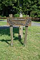
At the entrance to Hasenkrug

The "Wiemersdorfer Au" in Hasenkrug


economy
The originally purely agricultural community is currently changing into a residential community. In 2002 the new village house was inaugurated. Integrated into the village house is the market meeting place "Dbodshöker". This ensures the supply of food and fresh baked goods. An internet connection is available in the entrance area to the village house.
Web links
Individual evidence
- ↑ North Statistics Office - Population of the municipalities in Schleswig-Holstein 4th quarter 2019 (XLSX file) (update based on the 2011 census) ( help on this ).
- ↑ Schleswig-Holstein topography. Vol. 4: Groß Sarau - Holstenniendorf . 1st edition Flying-Kiwi-Verl. Junge, Flensburg 2004, ISBN 978-3-926055-75-0 , p. 147 ( dnb.de [accessed on May 2, 2020]).
- ↑ Schleswig-Holstein's municipal coat of arms
Alveslohe | Armstedt | Bad Bramstedt | Bad Segeberg | Bahrenhof | Bark | Bebensee | Bimöhlen | Blunk | Boostedt | Bornhöved | Borstel | Bühnsdorf | Daldorf | Damsdorf | Dreggers | Ellerau | Fahrenkrug | Föhrden-Barl | Fredesdorf | Fuhlendorf | Geschendorf | Glasau | Gönnebek | Groß Kummerfeld | Gross Niendorf | Groß Rönnau | Great Aspen | Hagen | Hardebek | Hartenholm | Hasenkrug | Rabbit Moor | Heidmoor | Heidmühlen | Henstedt-Ulzburg | Hitzhusen | Högersdorf | Hüttblek | Itzstedt | Kaltenkirchen | Kattendorf | Kayhude | Kisdorf | Klein Gladebrugge | Klein Rönnau | Krems II | Kükels | Latendorf | Leezen | Lentföhrden | Mönkloh | Mözen | Near | Negro Bay | Take | Neuengörs | Neversdorf | Norderstedt | Use | Oering | Oersdorf | Pronstorf | Rickling | Rohlstorf | Schackendorf | Sheer | Schmalensee | Narrow field | Schwissel | Seedorf | Seth | Sievershütten | Stipsdorf | Stocksee | Strukdorf | Struvenhütten | Stuvenborn | Sülfeld | Tarbek | Tensfeld | Fields of death | Trappenkamp | Travenhorst | Traventhal | Wahlstedt | Wakendorf I | Wakendorf II | Weddelbrook | Weede | Wensin | Westerrade | Wiemersdorf | Winsen | Wittenborn
Non-parish area in the Segeberg
forest district of Buchholz