
Sülfeld
| coat of arms | Germany map | |
|---|---|---|

|
Coordinates: 53 ° 48 ' N , 10 ° 14' E |
|
| Basic data | ||
| State : | Schleswig-Holstein | |
| Circle : | Segeberg | |
| Office : | Itzstedt | |
| Height : | 32 m above sea level NHN | |
| Area : | 26.05 km 2 | |
| Residents: | 3280 (Dec. 31, 2019) | |
| Population density : | 126 inhabitants per km 2 | |
| Postcodes : | 23867, 23845 | |
| Area code : | 04537 | |
| License plate : | SE | |
| Community key : | 01 0 60 085 | |
| LOCODE : | DE 59G | |
| Office administration address: | Segeberger Strasse 41 23845 Itzstedt |
|
| Website : | ||
| Mayor : | Karl-Heinz Wegner ( CDU ) | |
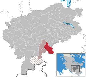
| Location of the community of Sülfeld in the Segeberg district | ||
  |
||

Sülfeld is a municipality in the Segeberg district in Schleswig-Holstein . Since 1936 it has consisted of the districts Borstel , Petersfelde, Sülfeld and Tönningstedt.
history


The church in Sülfeld was first mentioned in 1207. The remains of the Alster-Beste canal , which was created in the first half of the 16th century, are still in the center of the village today.
From 1907 to 1973 Sülfeld was the railway station of the Elmshorn-Barmstedt-Oldesloer Railway .
politics
Community representation
Of the 17 seats in the municipal council, the CDU has had nine seats since the 2013 local elections, the ABS voting community has five and the SPD has three.
coat of arms
Blazon : “Divided. Above in red a golden bell, below in silver a growing, continuous blue Antonius cross with wavy curved bars. "
The wavy blue bar symbolizes the Norderbeste , the straight blue bar perpendicular to it symbolizes the artificial canal bed of the Alster-Beste canal.
economy
The community is predominantly agricultural, but the Borstel Research Center , which deals with medicine and biosciences , has a special position .
Well and research center Borstel
The borstel estate district, to which the villages of Grabau , Kayhude , Oering , Seth and Sülfeld as well as the villages of Bargfeld , Elmenhorst , Mönkenbrook, Nienwohld, Rade , Stegen and Wulksfelde later belonged, was dissolved in 1927. It used to be called Borlstede or Borstelde and was first mentioned in the middle of the 13th century. In 1588 the property was divided and Gut Jersbek , today in the Stormarn district, was separated. In 1806 Gut Grabau also became independent.
The current Borstel manor house was built in 1751 in the Rococo style.
In 1930 the estate was converted into a children's rest home and since then has had an eventful history as a training center for female labor service under the National Socialists and as a reception camp for refugees after the Second World War. Since 1947 Gut Borstel has been the seat of the Borstel Research Center, which was established by the State of Schleswig-Holstein and converted into a foundation in 1963, and the associated research clinic.
Attractions
The list of cultural monuments in Sülfeld includes the cultural monuments entered in the list of monuments of Schleswig-Holstein.
Personalities
- Ollegard von Ahlefeldt (1547–1618), registrar
- Benedikt von Ahlefeldt (1678–1757) , buried in Sülfeld, landlord and provost of the Uetersen monastery
- Justus Corthum (1653–1724), 1682–1696 pastor in Sülfeld
- Justus Corthum (1684–1731), born in Sülfeld, Evangelical Lutheran clergyman
- Lucas Corthum (1688–1765), born in Sülfeld, 1751–1765 Mayor of Hamburg
- Margarete Weiß (1912–1990), born in Sülfeld, politician (FDP) and MdL
- Sven Stückelschweiger (* 1977), resident in Sülfeld, politician (pirate party)
literature
- Riediger, Hans: Farms and families in the Altholian settlement area of the parish Bramstedt: Armstedt, Borstel, Hardebek , Vol. II, Roland-Verlag, Bad Bramstedt, 1994
Web links
Individual evidence
- ↑ North Statistics Office - Population of the municipalities in Schleswig-Holstein 4th quarter 2019 (XLSX file) (update based on the 2011 census) ( help on this ).
- ↑ Schleswig-Holstein topography. Vol. 9: Schönberg - Tielenhemme . 1st edition Flying-Kiwi-Verl. Junge, Flensburg 2007, ISBN 978-3-926055-91-0 , p. 307 ( dnb.de [accessed on August 6, 2020]).
- ↑ Schleswig-Holstein's municipal coat of arms
Alveslohe | Armstedt | Bad Bramstedt | Bad Segeberg | Bahrenhof | Bark | Bebensee | Bimöhlen | Blunk | Boostedt | Bornhöved | Borstel | Bühnsdorf | Daldorf | Damsdorf | Dreggers | Ellerau | Fahrenkrug | Föhrden-Barl | Fredesdorf | Fuhlendorf | Geschendorf | Glasau | Gönnebek | Groß Kummerfeld | Gross Niendorf | Groß Rönnau | Great Aspen | Hagen | Hardebek | Hartenholm | Hasenkrug | Rabbit Moor | Heidmoor | Heidmühlen | Henstedt-Ulzburg | Hitzhusen | Högersdorf | Hüttblek | Itzstedt | Kaltenkirchen | Kattendorf | Kayhude | Kisdorf | Klein Gladebrugge | Klein Rönnau | Krems II | Kükels | Latendorf | Leezen | Lentföhrden | Mönkloh | Mözen | Near | Negro Bay | Take | Neuengörs | Neversdorf | Norderstedt | Use | Oering | Oersdorf | Pronstorf | Rickling | Rohlstorf | Schackendorf | Sheer | Schmalensee | Narrow field | Schwissel | Seedorf | Seth | Sievershütten | Stipsdorf | Stocksee | Strukdorf | Struvenhütten | Stuvenborn | Sülfeld | Tarbek | Tensfeld | Fields of death | Trappenkamp | Travenhorst | Traventhal | Wahlstedt | Wakendorf I | Wakendorf II | Weddelbrook | Weede | Wensin | Westerrade | Wiemersdorf | Winsen | Wittenborn
Non-parish area in the Segeberg
forest district of Buchholz