
Oersdorf
| coat of arms | Germany map | |
|---|---|---|

|
Coordinates: 53 ° 50 ' N , 10 ° 0' E |
|
| Basic data | ||
| State : | Schleswig-Holstein | |
| Circle : | Segeberg | |
| Office : | Kisdorf | |
| Height : | 27 m above sea level NHN | |
| Area : | 6.65 km 2 | |
| Residents: | 885 (Dec 31, 2019) | |
| Population density : | 133 inhabitants per km 2 | |
| Postal code : | 24568 | |
| Area code : | 04191 | |
| License plate : | SE | |
| Community key : | 01 0 60 066 | |
| LOCODE : | DE 59N | |
| Office administration address: | Winsener Strasse 2 24568 Kattendorf |
|
| Website : | ||
| Mayor : | Tobias Böttcher (AWOe) | |
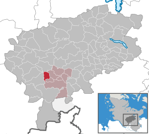
| Location of the municipality of Oersdorf in the Segeberg district | ||
  |
||

Oersdorf is a municipality in the Segeberg district in Schleswig-Holstein .
Geography and traffic
Oersdorf is located about 20 km north of Norderstedt in a rural area. To the west run the former federal highway 433 from Norderstedt to Kaltenkirchen and the federal highway 7 from Hamburg to Schleswig . The railway Hamburg-Altona-Kaltenkirchen-Neumünster the AKN passes through the neighboring city cold churches.
history
Archaeological finds prove a settlement in the Bronze Age .
The place was first mentioned in 1496 as Oygeestorpp.
politics
Community representation
Of the eleven seats in the municipal council, the Oersdorf voter community has had 6 seats since the 2018 local elections, the Oersdorfer voter association 3 seats and the FDP two seats.
coat of arms
Blazon : "In silver, a broad blue oblique left-hand bar, accompanied above by a rooted green deciduous tree, below by a six-spoke red wagon wheel."
Web links
Individual evidence
- ↑ North Statistics Office - Population of the municipalities in Schleswig-Holstein 4th quarter 2019 (XLSX file) (update based on the 2011 census) ( help on this ).
- ↑ Politics. Retrieved March 29, 2020 .
- ↑ Schleswig-Holstein's municipal coat of arms
Alveslohe | Armstedt | Bad Bramstedt | Bad Segeberg | Bahrenhof | Bark | Bebensee | Bimöhlen | Blunk | Boostedt | Bornhöved | Borstel | Bühnsdorf | Daldorf | Damsdorf | Dreggers | Ellerau | Fahrenkrug | Föhrden-Barl | Fredesdorf | Fuhlendorf | Geschendorf | Glasau | Gönnebek | Groß Kummerfeld | Gross Niendorf | Groß Rönnau | Great Aspen | Hagen | Hardebek | Hartenholm | Hasenkrug | Rabbit Moor | Heidmoor | Heidmühlen | Henstedt-Ulzburg | Hitzhusen | Högersdorf | Hüttblek | Itzstedt | Kaltenkirchen | Kattendorf | Kayhude | Kisdorf | Klein Gladebrugge | Klein Rönnau | Krems II | Kükels | Latendorf | Leezen | Lentföhrden | Mönkloh | Mözen | Near | Negro Bay | Take | Neuengörs | Neversdorf | Norderstedt | Use | Oering | Oersdorf | Pronstorf | Rickling | Rohlstorf | Schackendorf | Sheer | Schmalensee | Narrow field | Schwissel | Seedorf | Seth | Sievershütten | Stipsdorf | Stocksee | Strukdorf | Struvenhütten | Stuvenborn | Sülfeld | Tarbek | Tensfeld | Fields of death | Trappenkamp | Travenhorst | Traventhal | Wahlstedt | Wakendorf I | Wakendorf II | Weddelbrook | Weede | Wensin | Westerrade | Wiemersdorf | Winsen | Wittenborn
Non-parish area in the Segeberg
forest district of Buchholz