
Tensfeld
| coat of arms | Germany map | |
|---|---|---|

|
Coordinates: 54 ° 3 ′ N , 10 ° 19 ′ E |
|
| Basic data | ||
| State : | Schleswig-Holstein | |
| Circle : | Segeberg | |
| Office : | Bornhöved | |
| Height : | 40 m above sea level NHN | |
| Area : | 7.65 km 2 | |
| Residents: | 669 (Dec. 31, 2019) | |
| Population density : | 87 inhabitants per km 2 | |
| Postal code : | 23824 | |
| Area code : | 04557 | |
| License plate : | SE | |
| Community key : | 01 0 60 087 | |
| LOCODE : | DE 58Z | |
| Office administration address: | Am Markt 3 24610 Trappenkamp |
|
| Website : | ||
| Mayoress : | Beatrix Klüver (WGT) | |
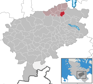
| Location of the municipality of Tensfeld in the Segeberg district | ||
  |
||

Tensfeld is a municipality in the Segeberg district in Schleswig-Holstein . Tensfelder Moor and Burade are in the municipality.
Geography and traffic
Tensfeld is located about 21 km east of Neumünster in a rural area with many lakes. The federal highway 21 runs to the west from Bad Segeberg to Kiel , to the north the federal highway 430 runs from Neumünster to Plön . To the south of the village is the Muggesfelder See . The Tensfelder Au flows through the municipality.
From 1911 to 1961 Tensfeld was the station of the Kleinbahn Kiel – Segeberg .
politics
Community representation
The voter community WGT has had all nine seats in the municipal council since the 2008 local elections.
coat of arms
Blazon : “Divided diagonally left by silver and green in a wavy cut. The moor plant sundew in mixed up colors above, an ammonite below. "
economy
The gravel quarrying is an important source of income for the place, there are several gravel works. There are also some retail and commercial operations in Tensfeld.
literature
- Heinrich Pöhls: Between Grimmelsberg, Stocksee and Tensfelder Au , a local lore d. Villages Stocksee, Damsdorf, Tensfeld, Tarbek, ed. of the four municipalities, Neumünster Evert, 1979
Web links
Individual evidence
- ↑ North Statistics Office - Population of the municipalities in Schleswig-Holstein 4th quarter 2019 (XLSX file) (update based on the 2011 census) ( help on this ).
- ↑ Schleswig-Holstein topography. Vol. 9: Schönberg - Tielenhemme . 1st edition Flying-Kiwi-Verl. Junge, Flensburg 2007, ISBN 978-3-926055-91-0 , p. 363 ( dnb.de [accessed on August 6, 2020]).
- ↑ Schleswig-Holstein's municipal coat of arms
Alveslohe | Armstedt | Bad Bramstedt | Bad Segeberg | Bahrenhof | Bark | Bebensee | Bimöhlen | Blunk | Boostedt | Bornhöved | Borstel | Bühnsdorf | Daldorf | Damsdorf | Dreggers | Ellerau | Fahrenkrug | Föhrden-Barl | Fredesdorf | Fuhlendorf | Geschendorf | Glasau | Gönnebek | Groß Kummerfeld | Gross Niendorf | Groß Rönnau | Great Aspen | Hagen | Hardebek | Hartenholm | Hasenkrug | Rabbit Moor | Heidmoor | Heidmühlen | Henstedt-Ulzburg | Hitzhusen | Högersdorf | Hüttblek | Itzstedt | Kaltenkirchen | Kattendorf | Kayhude | Kisdorf | Klein Gladebrugge | Klein Rönnau | Krems II | Kükels | Latendorf | Leezen | Lentföhrden | Mönkloh | Mözen | Near | Negro Bay | Take | Neuengörs | Neversdorf | Norderstedt | Use | Oering | Oersdorf | Pronstorf | Rickling | Rohlstorf | Schackendorf | Sheer | Schmalensee | Narrow field | Schwissel | Seedorf | Seth | Sievershütten | Stipsdorf | Stocksee | Strukdorf | Struvenhütten | Stuvenborn | Sülfeld | Tarbek | Tensfeld | Fields of death | Trappenkamp | Travenhorst | Traventhal | Wahlstedt | Wakendorf I | Wakendorf II | Weddelbrook | Weede | Wensin | Westerrade | Wiemersdorf | Winsen | Wittenborn
Non-parish area in the Segeberg
forest district of Buchholz