
Trappenkamp
| coat of arms | Germany map | |
|---|---|---|

|
Coordinates: 54 ° 2 ′ N , 10 ° 13 ′ E |
|
| Basic data | ||
| State : | Schleswig-Holstein | |
| Circle : | Segeberg | |
| Office : | Bornhöved | |
| Height : | 45 m above sea level NHN | |
| Area : | 3.45 km 2 | |
| Residents: | 5187 (Dec. 31, 2019) | |
| Population density : | 1503 inhabitants per km 2 | |
| Postal code : | 24610 | |
| Area code : | 04323 | |
| License plate : | SE | |
| Community key : | 01 0 60 089 | |
| LOCODE : | DE ZAQ | |
| Office administration address: | Am Markt 3 24610 Trappenkamp |
|
| Website : | ||
| Mayor : | Harald Krille ( SPD ) | |
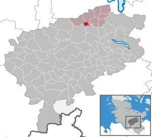
| Location of the municipality of Trappenkamp in the Segeberg district | ||
  |
||

Trappenkamp is a municipality on the northern edge of the Segeberg district in Schleswig-Holstein .
Geography and traffic
Trappenkamp is located in the Segeberg district, around 15 kilometers north of the district town of Bad Segeberg and east of the independent city of Neumünster . The community has a junction on Autobahn 21 . There are regional bus connections to Bad Segeberg and Kiel . The nearest train station is in the neighboring village of Rickling, about five kilometers away, on the Neumünster – Bad Oldesloe railway line . Shuttle buses also run there. Until December 31, 1961, Trappenkamp had its own train station, which was the end of an approximately three-kilometer branch line that branched off from the Kiel – Segeberg small railway in Bornhöved . It was primarily used for freight traffic, but individual passenger trains also ran until March 8, 1952.
Origin of name
The place name Trappenkamp comes from an old field name, which is composed of the two words " Trappen " (ground birds that live in grass steppes and in the fields) and " Kamp " (enclosed field). When the site of the naval arsenal was renamed Trappenkamp in 1936, the name of a parcel belonging to the municipality of Tarbek was used .
history
The territorial origins of today's municipality of Trappenkamp go back to a former Prussian parade ground for cavalry and infantry , the "Gönnebeker Heide". From 1901 one began with the cultivation and afforestation of the "Gönnebeker Heide". This measure lasted until the 1920s.
In July 1934, the naval command in Berlin ordered the construction of a new mine store near Kiel . This mine storage facility was supposed to relieve the blocked depot in Kiel-Dietrichsdorf. The former state forest of Neumünster was chosen as the location of the new arsenal. The Halloh forest south of Boostedt was not chosen because the terrain that was available at the time was not suitable: The trees in this area were too cleared, the ground too uneven, and it was a popular destination for the people of Neumünster . In 1940, however, the Luftmunitionsanstalt 6 / XI Boostedt was set up at another location in the Halloh Forest .
On May 18, 1945, English troops occupied the Trappenkamp naval locking arms arsenal. After this was cleared, displaced persons and refugees from the Sudetenland and the formerly German eastern regions moved into the former Wehrmacht buildings, which were largely simple buildings for the processing and storage of explosives. Some of these bunkers are still used today as garages or have been converted into houses by the residents, which are often no longer used for military purposes. The right-angled route layout from the time before 1945 is largely reflected in the street structure in the old district. The original simple alphabetical division was also retained in the north-south direction with the first letters of the street names in the first development areas. B. Fasanenweg - Falkenweg - Farnstieg - Friedlandstraße.
On April 1, 1956, the “Trappenkamp settlement”, which at that time had almost 900 inhabitants and until then belonged to the Bornhöved community, was declared an independent community at the behest of the Schleswig-Holstein state government. This makes Trappenkamp one of the youngest communities in Schleswig-Holstein.
Trappenkamp joined the Bornhöved office on January 1, 2008 and has been the seat of the office ever since.
politics
Community representation
Of the 19 seats in the municipal council, the SPD has had all 19 seats since the 2018 local elections.
coat of arms
The coat of arms was approved on February 17, 1972.
Blazon : "A golden tip in green."
The coat of arms is impressively designed in the style of a medieval herald image and reflects the settlement area carved into the forest in a wedge shape. In the protection of the large forest area on the Gönnebeker Heide, which belongs to the municipality of Rickling, a naval anti-missile arsenal was created from 1936. When it was also renamed “Trappenkamp” in 1936, the name of a neighboring parcel belonging to the municipality of Tarbek was used. After the end of the war, Trappenkamp developed into a provisional settlement for expellees. Gablonz glassblowers from the Sudetenland have settled here since 1946 , but the difficult post-war conditions made it difficult to establish a glass and jewelry industry in the north. The glassworks settlement was incorporated into Bornhöved as a district in 1949 . In 1956 Trappenkamp was given the status of an independent municipality.
The coat of arms was designed by the Brunsbüttel heraldist Willy "Horsa" Lippert .
flag
The flag was approved on April 25, 1983.
On the top and bottom of the yellow flag, bordered by a wide green stripe, the municipal coat of arms, shifted a little from the center towards the pole.
Culture and sights
The Trappenkamp Museum Bunker is a local history museum that has existed since 1996 and is located in a former ammunition warehouse. The Evangelical Lutheran Church of Peace is a modern church building with a 29 meter high bell tower.
From 2003 to 2010, the so-called “Street Move” took place every year. It was organized by the JUT ( Young Entrepreneur Trappenkamp ), a sub-organization of the ARGE ( Working Group on Economically Interested Circles eV ). It was a move with DJs playing techno music on converted trucks . Among other things, the DJ Pulsedriver, who lives in Trappenkamp, played here . This move traditionally started on the market square and ended in a paddock on Industriestrasse. The Schleswig-Holstein State Forests operate the Trappenkamp adventure forest .
Economy and Infrastructure
The local economic life is characterized by businesses from trade and commerce as well as industrial companies in the fields of electronics, mechanical engineering , precision mechanics, the beverage, construction and paper industries.
education
There is a primary and a community school in the village . The Dr. Gerlich School , founded in 1968 , named after Gerhard Gerlich , is a primary school with a support center. Gerhard Gerlich was himself a displaced person from the Sudetenland and, as a member of the state parliament, campaigned for the Trappenkamp school location. The Richard Hallmann School was founded in 1989 as an integrated comprehensive school and is now a community school with an upper level. It is named after a former mayor .
Personalities
Associated with Trappenkamp
- Rudolf Ducke (1918–2012) was a German entrepreneur who established himself as a beverage wholesaler in Schleswig-Holstein after the Second World War. In 1959 his company and later his family moved to Trappenkamp, where he lived until his death.
- Josef Holey (1899–1986) was a German expert for glass production and an entrepreneur in the Gablonz glass and jewelry industry . Josef Holey lived in Trappenkamp from 1946 until his death.
- Walter Zelinski (1948–2019) was a German teacher, radio host and Low German author. From 1976 until his retirement in 2012 he worked as a teacher in Trappenkamp, from 1989 as headmaster of the Integrated Comprehensive School, today Richard Hallmann School. Walter Zelinski lived in Trappenkamp until his death.
literature
- Claus Dietrich Bechert: Chronicle of the community of Trappenkamp , 1977
- Stefan Wendt: Trappenkamp - History of a Young Community , 1992
- Klaus Deneke: Materials on the person of Dr. Gerhard Gerlich , on the Dr. Gerlich School Trappenkamp and on the history of the communities of Trappenkamp and Bornhöved , Trappenkamp: Sudetendeutsches Kulturwerk Schleswig-Holstein, 2007
Web links
Individual evidence
- ↑ North Statistics Office - Population of the municipalities in Schleswig-Holstein 4th quarter 2019 (XLSX file) (update based on the 2011 census) ( help on this ).
- ↑ a b Schleswig-Holstein's municipal coat of arms
- ^ Trappenkamp: Exhibition about the bunker
- ↑ Metal specialists. Organizer website, accessed April 24, 2014.
- ↑ All school qualifications on site!
Alveslohe | Armstedt | Bad Bramstedt | Bad Segeberg | Bahrenhof | Bark | Bebensee | Bimöhlen | Blunk | Boostedt | Bornhöved | Borstel | Bühnsdorf | Daldorf | Damsdorf | Dreggers | Ellerau | Fahrenkrug | Föhrden-Barl | Fredesdorf | Fuhlendorf | Geschendorf | Glasau | Gönnebek | Groß Kummerfeld | Gross Niendorf | Groß Rönnau | Great Aspen | Hagen | Hardebek | Hartenholm | Hasenkrug | Rabbit Moor | Heidmoor | Heidmühlen | Henstedt-Ulzburg | Hitzhusen | Högersdorf | Hüttblek | Itzstedt | Kaltenkirchen | Kattendorf | Kayhude | Kisdorf | Klein Gladebrugge | Klein Rönnau | Krems II | Kükels | Latendorf | Leezen | Lentföhrden | Mönkloh | Mözen | Near | Negro Bay | Take | Neuengörs | Neversdorf | Norderstedt | Use | Oering | Oersdorf | Pronstorf | Rickling | Rohlstorf | Schackendorf | Sheer | Schmalensee | Narrow field | Schwissel | Seedorf | Seth | Sievershütten | Stipsdorf | Stocksee | Strukdorf | Struvenhütten | Stuvenborn | Sülfeld | Tarbek | Tensfeld | Fields of death | Trappenkamp | Travenhorst | Traventhal | Wahlstedt | Wakendorf I | Wakendorf II | Weddelbrook | Weede | Wensin | Westerrade | Wiemersdorf | Winsen | Wittenborn
Non-parish area in the Segeberg
forest district of Buchholz