Strukdorf
| coat of arms | Germany map | |
|---|---|---|

|
Coordinates: 53 ° 55 ' N , 10 ° 29' E |
|
| Basic data | ||
| State : | Schleswig-Holstein | |
| Circle : | Segeberg | |
| Office : | Trave land | |
| Height : | 47 m above sea level NHN | |
| Area : | 7.3 km 2 | |
| Residents: | 261 (Dec. 31, 2019) | |
| Population density : | 36 inhabitants per km 2 | |
| Postal code : | 23815 | |
| Area code : | 04553 | |
| License plate : | SE | |
| Community key : | 01 0 60 081 | |
| LOCODE : | DE 62T | |
| Office administration address: | Waldemar-von-Mohl-Strasse 10 23795 Bad Segeberg |
|
| Website : | ||
| Mayor : | Götz Leonhardt | |
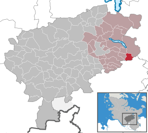
| Location of the community of Strukdorf in the Segeberg district | ||
Strukdorf is a municipality in the east of the Segeberg district in Schleswig-Holstein .
Geography and traffic
Strukdorf is about 14 km east of Bad Segeberg on the federal highway 206 . From 1916 to 1967 Strukdorf was a station on the Lübeck-Segeberger Railway .
history
Archaeological finds prove an early historical settlement of the municipal area, probably of Wendish origin.
Attractions
The list of cultural monuments in Strukdorf includes the cultural monuments entered in the list of monuments of Schleswig-Holstein.
Web links
Commons : Strukdorf - collection of images, videos and audio files
Individual evidence
- ↑ North Statistics Office - Population of the municipalities in Schleswig-Holstein 4th quarter 2019 (XLSX file) (update based on the 2011 census) ( help on this ).


