
Pronstorf
| coat of arms | Germany map | |
|---|---|---|

|
Coordinates: 53 ° 58 ' N , 10 ° 28' E |
|
| Basic data | ||
| State : | Schleswig-Holstein | |
| Circle : | Segeberg | |
| Office : | Trave land | |
| Height : | 37 m above sea level NHN | |
| Area : | 36.31 km 2 | |
| Residents: | 1625 (Dec. 31, 2019) | |
| Population density : | 45 inhabitants per km 2 | |
| Postcodes : | 23820, 23619 | |
| Primaries : | 04553, 04556, 04506 | |
| License plate : | SE | |
| Community key : | 01 0 60 067 | |
| LOCODE : | DE 62N | |
| Office administration address: | Waldemar-von-Mohl-Strasse 10 23795 Bad Segeberg |
|
| Website : | ||
| Mayoress : | Bettina Albert ( CDU ) | |
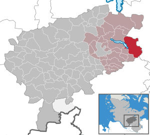
| Location of the community Pronstorf in the Segeberg district | ||
  |
||


Pronstorf is a municipality in the Segeberg district in Schleswig-Holstein . Eilsdorf, Goldenbek, Reinsbek, Strenglin, Wulfsfelde, Neukoppel, Butterstieg and Diekhof are located in the municipality that has existed in its current form since 1937.
Geography and traffic
Pronstorf is located about twelve kilometers east of Bad Segeberg in a rural area on state road 69 from Bornhöved to Goldenbek . The federal highway 20 runs south from Bad Segeberg to Lübeck , north the federal road 432 runs from Bad Segeberg to Scharbeutz . The Lübeck-Segeberger Railway used to run through the area.
Districts
The community of Pronstorf is made up of six individual places. The town of Pronstorf with around 100 inhabitants is characterized by the large aristocratic Pronstorf estate , to which most of the town's buildings belong. The place is right on the Wardersee . Goldenbek is located three kilometers south of Pronstorf on Landesstrasse 69. The village, which has around 140 inhabitants, has numerous community facilities, such as a kindergarten and the village community school.
The remaining places are smaller: Eilsdorf is about three kilometers east of it on county road 69, Reinsbek is about seven kilometers southeast of Pronstorf on state road 71. Strenglin is about three kilometers north of Pronstorf on state road 69. On the western edge of the The hamlet of Schlichtrott, characterized by four old thatched roofs, is located towards Warder See. And Wulfsfelde is about six kilometers east of Pronstorf on the national road 71.
The community of Pronstorf also includes the Butterstieg, Diekhof, Steinrade, Neukoppel, Rösing and Hartenkamp residential areas, which usually only consist of a few houses.
history
The name Pronstorf probably originated during the time of the Great Migration or a little later. This is suggested by the ending - peat , which means nothing more than village .
About 1600 m south-west of the Pronstorf district of Strenglin / Schlichtrott are the remains of a Slavic castle from the 9th century. Today it still has an oval diameter of 110 to 140 meters. This complex may have belonged to the tribe of the Wagrier , who in turn belonged to the Obodrites .
The Pronstorfer noble estate passed from Kaspar von Buchwaldt to his only daughter Adelheid Luise in 1875 , who was married to Count Otto zu Rantzau . Her descendants still manage the estate today.
The community Pronstorf was called Eilsdorf until July 16, 1929 .
The municipality has had a coat of arms since 2001 and a municipality flag since 2003.
politics
Community representation
Of the 13 seats in the municipal council, the CDU has had six seats since the 2013 local elections, the WG community of voters has five and the SPD two seats.
coat of arms
Blazon : "In blue a golden rape stalk with six flowers, a bud and a leaf, accompanied by a small silver church at the top left."
Historical reason: The coat of arms refers to the predominantly agricultural character of the place, which is represented by the golden rapeseed inflorescence. The six flowers stand for the six districts of the municipality. The Vicelin Church in Pronstorf is first mentioned in 1198. As a late Romanesque stone church, it has the typical characteristics of a Vicelin church. The round tower is from the first installation in the 12th century.
flag
On white flag cloth between two narrow blue stripes not far from the upper and lower edge of the cloth, the municipal coat of arms in tincture suitable for the flag.
Culture and sights
The list of cultural monuments in Pronstorf includes the cultural monuments entered in the list of monuments of Schleswig-Holstein.
Viewpoints
If you leave Pronstorf north in the direction of Hartenkamp, you will get a good view over the Wardersee on the left. If you leave Reinsbek in the direction of Wulfsfelde on the L 71, after about one kilometer, in good weather, you have a view of the silhouette of the “seven towers” of Lübeck, ten kilometers away.
Cultural monuments
There are numerous barrows in the area of the municipality . Including one in Strenglin.
Buildings


The Vicelinkirche in Pronstorf, a late Romanesque stone church, was first mentioned in 1198. The tower also dates from the 12th century. The grave of General Paul von Lettow-Vorbeck is in the church's cemetery .
The manor house on Gut Pronstorf, which dates from 1728, is one of the most beautiful baroque buildings in Schleswig-Holstein. The manor belongs to the family of the Counts of Rantzau .
Movie and TV
The community was the backdrop for the television film Landluft , which was first broadcast by ZDF on September 22, 1981 and was based on the novel Das Dorf by Hans Peter Renfranz and directed by Claus Peter Witt .
economy
The municipal area is predominantly agricultural, mainly grain , rapeseed and sugar beet are grown . Christmas trees and fir greens are also produced. Some farmers are engaged in livestock farming. However, there are also some hotels and restaurants as well as craftsmen and small businesses. Many residents of the community are commuters and have their jobs in and around Lübeck and Bad Segeberg.
Personalities
- Friedrich Peter Valentiner (* 1817 in Pronstorf; † 1894 in Preetz), Evangelical Lutheran clergyman, first pastor of the German Evangelical community in Jerusalem, 1866–1869 pastor in Pronstorf
- Leopold Iwan Cirsovius (* 1815 in Mettenhof; † 1895 in Lübeck), organist and teacher in Pronstorf from 1841 to 1887
literature
- Martin Botsch: Pronstorf and the rest of the world , antique & art, Pronstorf 2011, o.ISBN
Web links
Individual evidence
- ↑ North Statistics Office - Population of the municipalities in Schleswig-Holstein 4th quarter 2019 (XLSX file) (update based on the 2011 census) ( help on this ).
- ↑ Schleswig-Holstein topography. Vol. 8: Pölitz - Schönbek . 1st edition Flying-Kiwi-Verl. Junge, Flensburg 2007, ISBN 978-3-926055-89-7 , pp. 37 ( dnb.de [accessed on July 22, 2020]).
- ↑ State Statistical Office Schleswig-Holstein (Ed.): The population of the communities in Schleswig-Holstein . Historical municipality directory: Notes on the municipality of Pronstorf (footnote). Kiel 1972 ( digitized from genealogy.net [accessed on April 21, 2015]).
- ↑ a b c Schleswig-Holstein's municipal coat of arms
Alveslohe | Armstedt | Bad Bramstedt | Bad Segeberg | Bahrenhof | Bark | Bebensee | Bimöhlen | Blunk | Boostedt | Bornhöved | Borstel | Bühnsdorf | Daldorf | Damsdorf | Dreggers | Ellerau | Fahrenkrug | Föhrden-Barl | Fredesdorf | Fuhlendorf | Geschendorf | Glasau | Gönnebek | Groß Kummerfeld | Gross Niendorf | Groß Rönnau | Great Aspen | Hagen | Hardebek | Hartenholm | Hasenkrug | Rabbit Moor | Heidmoor | Heidmühlen | Henstedt-Ulzburg | Hitzhusen | Högersdorf | Hüttblek | Itzstedt | Kaltenkirchen | Kattendorf | Kayhude | Kisdorf | Klein Gladebrugge | Klein Rönnau | Krems II | Kükels | Latendorf | Leezen | Lentföhrden | Mönkloh | Mözen | Near | Negro Bay | Take | Neuengörs | Neversdorf | Norderstedt | Use | Oering | Oersdorf | Pronstorf | Rickling | Rohlstorf | Schackendorf | Sheer | Schmalensee | Narrow field | Schwissel | Seedorf | Seth | Sievershütten | Stipsdorf | Stocksee | Strukdorf | Struvenhütten | Stuvenborn | Sülfeld | Tarbek | Tensfeld | Fields of death | Trappenkamp | Travenhorst | Traventhal | Wahlstedt | Wakendorf I | Wakendorf II | Weddelbrook | Weede | Wensin | Westerrade | Wiemersdorf | Winsen | Wittenborn
Non-parish area in the Segeberg
forest district of Buchholz