Wardersee
| Wardersee | ||
|---|---|---|

|
||
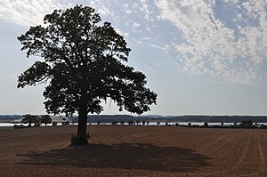
| View of the Wardersee from near Pronstorf | ||
| Geographical location | Segeberg district , Schleswig-Holstein | |
| Tributaries | Trave , Bißnitz | |
| Drain | Trave | |
| Location close to the shore | Bad Segeberg | |
| Data | ||
| Coordinates | 53 ° 58 '32 " N , 10 ° 25' 10" E | |
|
|
||
| surface | 3.6 km² | |
| Maximum depth | 10.8 m | |
| Middle deep | 3.7 m | |
The elongated and very narrow Wardersee lies east of Bad Segeberg in the area of the municipalities of Krems II , Pronstorf , Rohlstorf and Wensin (all in the Trave-Land district ).
description
The Wardersee, together with the Kembser See , the Seedorfer See and the Seekamper See, is the remainder of an ice reservoir formed between terminal moraines in the west and the ice rim in the east at the end of the Vistula glacial .
The privately owned Wardersee is traversed by the Trave , which is its largest tributary. Another tributary is the Bißnitz . Wardersee, one of the 15 largest lakes in Schleswig-Holstein, is around 45 hectares smaller today than when it was surveyed in 1875. This is due to the expansion of the Trave at the beginning of the 20th century, which caused the lake's water level to drop by one meter . This is also the reason for the considerable expansion of the reed zone in some bank areas. The peninsula, located near the village of Warder, about 80 m long and 55 m wide, was an island until the Traveaus expansion (around 1910). In the middle of the 19th century, settlement remains were discovered on this site, which are dated to the period from 800 to 1150 AD. Among them are the remains of the episcopal manor Nezenna.
The federal highway 432 crosses the lake in a west-east direction near the village of Warder .
The Wardersee is known for its extraordinary abundance of fish. One of the sea eagles native to Schleswig-Holstein breeds on its bank . The fishing rights are leased to a fisherman.
Around the Wardersee there are three former noble estates : Gut Wensin , Gut Rohlstorf and Gut Pronstorf .
Chemical condition
AMPA
Aminomethylphosphonic acid (AMPA) is the main breakdown product of glyphosate in the soil zone. AMPA has traction properties similar to glyphosate , but is considerably more stable. AMPA is broken down into carbon dioxide in soil and water. The half-life DT 50 for soils is 44 to 215 days, for water it is 14 days.
The AMPA content was examined in 33 lakes in Schleswig-Holstein in 2008 and 2012 and was found in 59% of the samples. The highest concentration occurred in Wardersee with 0.29 μg / l (11/2012), this exceeds the assumed drinking water reserve value of 0.1 μg / L several times.
See also
literature
- Uwe Muuß, Marcus Petersen, Dietrich König: The inland waters of Schleswig-Holstein. 162 p., Numerous Fig., Wachholtz-Verlag Neumünster, 1973. ISBN 3529053023
Web links
Individual evidence
- ^ A b Maren Jarosch: Report on the chemical situation of rivers and lakes in Schleswig-Holstein . Ed .: State Office for Agriculture, Environment and Rural Areas of the State of Schleswig-Holstein, Waters Department. 1st edition. Flintbek November 2018 ( schleswig-holstein.de [PDF]).
