
Klein Gladebrugge
| coat of arms | Germany map | |
|---|---|---|

|
Coordinates: 53 ° 55 ' N , 10 ° 19' E |
|
| Basic data | ||
| State : | Schleswig-Holstein | |
| Circle : | Segeberg | |
| Office : | Trave land | |
| Height : | 39 m above sea level NHN | |
| Area : | 4.67 km 2 | |
| Residents: | 577 (Dec. 31, 2019) | |
| Population density : | 124 inhabitants per km 2 | |
| Postal code : | 23795 | |
| Area code : | 04551 | |
| License plate : | SE | |
| Community key : | 01 0 60 048 | |
| LOCODE : | DE 62I | |
| Office administration address: | Waldemar-von-Mohl-Strasse 10 23795 Bad Segeberg |
|
| Website : | ||
| Mayor : | Arne Hansen (AWG) | |
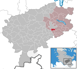
| Location of the municipality of Klein Gladebrügge in the Segeberg district | ||
  |
||

Klein Gladebrugge is a municipality in the Segeberg district in Schleswig-Holstein .
Geography and traffic
Klein Gladebrugge is located directly south of Bad Segeberg in a rural area on the Trave . To the west, the federal highway 21 runs from Bad Segeberg to Bad Oldesloe , to the north the federal highway 20 runs from Bad Segeberg ( Weede ) to Lübeck.
history
Excavations of Stone Age graves and a Slavic ring wall show that the area around Klein Gladebrugge was settled long before it was first mentioned in a document.
The place was first mentioned in a document in 1177, although the area was described as a forest area with a pond only forty years earlier in the deed of foundation of the castle, monastery and church in Bad Segeberg.
From January 1, 1974 to December 31, 1997, Klein Gladebrügge and Traventhal formed the municipality of Groß Gladebrügge .
The Ohlenborg
The Ohlenborg , a Slavic ring wall, was located on the left high bank of the Trave, where the river between the towns of Högersdorf and Klein Gladebrügge changes its flow direction almost at right angles to SSW and forms a distinctive impact slope . Immediately north of the castle site runs the Höftgraben, which joins the Trave-Kink from the east. The topography here offers ideal conditions for the construction of a castle: elevated location with a wide view of the Trave valley and approach protection by water.
Archaeological investigations were carried out between 1982 and 1985, which allowed detailed insights into the structure of the complex. A semicircular castle, which was protected by box palisades and a moat, was excavated. The trench was about 8 m wide and about 5 to 6 m deep. The box construction was made of split oak planks and allowed dendrochronological dating to the years 894 to 897. Based on ceramic and iron finds, it is assumed that settlement lasted about 50 years. With a walled area of approx. 1000 m 2 , Ohlenborg is considered to be the smallest Slavic castle in Schleswig-Holstein.
politics
Community representation
Of the nine seats in the municipal council, the AKW voter group has had four seats since the 2008 local elections, the AWG voter group three and the SPD two.
coat of arms
Blazon : "In silver, a sloping blue wavy bar that widens towards the bottom and is covered by a red brick bridge, at the top left an asymmetrical green oak with two red acorns."
economy
The municipality is predominantly agricultural, but there are also businesses and some riding stables in the municipality.
Personalities
The philosopher Reinhard Brandt was born in Klein Gladebrügge in 1937.
literature
- Arthur Dähn, Susan Möller Wiering: Ring walls and tower mounds: Medieval castles in Schleswig-Holstein . Husum Druck- und Verlagsgesellschaft, Husum 2001, ISBN 3-88042-850-6 , Slawischer Ringwall, Kl. Gladebrügge , p. 380.
- Barbara Goltz: The Slavic castle of Klein Gladebrügge, Segeberg district . In: Offa , 46 : 159-222 (1989).
- Anne Klammt: The Slavs in Schleswig-Holstein from an archaeological point of view , lecture 2013, Klein Gladebrügge - the small solution , slides 45, 46. [1]
- Albert Lüthje: Klein Gladebrügge and its past. A look back over 700 years (1177–1857) . Published by the Segeberg Land Office, Bad Segeberg 1987.
Web links
Individual evidence
- ↑ North Statistics Office - Population of the municipalities in Schleswig-Holstein 4th quarter 2019 (XLSX file) (update based on the 2011 census) ( help on this ).
- ^ Federal Statistical Office (ed.): Historical municipality directory for the Federal Republic of Germany. Name, border and key number changes in municipalities, counties and administrative districts from May 27, 1970 to December 31, 1982 . W. Kohlhammer GmbH, Stuttgart / Mainz 1983, ISBN 3-17-003263-1 , p. 186 .
- ↑ Schleswig-Holstein's municipal coat of arms
Alveslohe | Armstedt | Bad Bramstedt | Bad Segeberg | Bahrenhof | Bark | Bebensee | Bimöhlen | Blunk | Boostedt | Bornhöved | Borstel | Bühnsdorf | Daldorf | Damsdorf | Dreggers | Ellerau | Fahrenkrug | Föhrden-Barl | Fredesdorf | Fuhlendorf | Geschendorf | Glasau | Gönnebek | Groß Kummerfeld | Gross Niendorf | Groß Rönnau | Great Aspen | Hagen | Hardebek | Hartenholm | Hasenkrug | Rabbit Moor | Heidmoor | Heidmühlen | Henstedt-Ulzburg | Hitzhusen | Högersdorf | Hüttblek | Itzstedt | Kaltenkirchen | Kattendorf | Kayhude | Kisdorf | Klein Gladebrugge | Klein Rönnau | Krems II | Kükels | Latendorf | Leezen | Lentföhrden | Mönkloh | Mözen | Near | Negro Bay | Take | Neuengörs | Neversdorf | Norderstedt | Use | Oering | Oersdorf | Pronstorf | Rickling | Rohlstorf | Schackendorf | Sheer | Schmalensee | Narrow field | Schwissel | Seedorf | Seth | Sievershütten | Stipsdorf | Stocksee | Strukdorf | Struvenhütten | Stuvenborn | Sülfeld | Tarbek | Tensfeld | Fields of death | Trappenkamp | Travenhorst | Traventhal | Wahlstedt | Wakendorf I | Wakendorf II | Weddelbrook | Weede | Wensin | Westerrade | Wiemersdorf | Winsen | Wittenborn
Non-parish area in the Segeberg
forest district of Buchholz