
Take it
| coat of arms | Germany map | |
|---|---|---|

|
Coordinates: 54 ° 1 ′ N , 10 ° 21 ′ E |
|
| Basic data | ||
| State : | Schleswig-Holstein | |
| Circle : | Segeberg | |
| Office : | Trave land | |
| Height : | 44 m above sea level NHN | |
| Area : | 15.31 km 2 | |
| Residents: | 558 (Dec. 31, 2019) | |
| Population density : | 36 inhabitants per km 2 | |
| Postal code : | 23813 | |
| Primaries : | 04557, 04555 | |
| License plate : | SE | |
| Community key : | 01 0 60 060 | |
| LOCODE : | DE 62L | |
| Office administration address: | Waldemar-von-Mohl-Strasse 10 23795 Bad Segeberg |
|
| Website : | ||
| Mayor : | Ernst August Lawerentz (KWV) | |
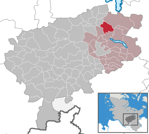
| Location of the municipality of Nehms in the Segeberg district | ||
  |
||

Nehms is a municipality in the Segeberg district in Schleswig-Holstein . Freudenberg, Gröhnwohld, Ihlkamp and Muggesfelderheide are in the municipality.
history
In 1928 the former estate districts Muggesfelde and Grönwohld were incorporated. The municipality has had a coat of arms since 1992.
Geography and traffic
Nehms is located about 13 km northeast of Bad Segeberg in Holstein Switzerland . To the south, the federal highway 432 runs from Bad Segeberg to Scharbeutz , to the west, the federal highway 404 / federal highway 21 from Kiel to Bad Oldesloe .
The Muggesfelder See , Nehmser See and Blunker See are in the municipality.
politics
Community representation
Since the local elections in 2008, the KWV has had all nine seats in the municipal council.
coat of arms
Blazon : "In gold over three blue wavy bars a green beech with roots."
The green beech stands for the extensive beech forests in the vicinity of Nehms. The three wave bars point to the Nehmser See, the Muggesfelder See and the Blunker See.
Attractions
The list of cultural monuments in Nehms includes the cultural monuments entered in the list of monuments of Schleswig-Holstein.
Web links
Individual evidence
- ↑ North Statistics Office - Population of the municipalities in Schleswig-Holstein 4th quarter 2019 (XLSX file) (update based on the 2011 census) ( help on this ).
- ↑ Schleswig-Holstein's municipal coat of arms
Alveslohe | Armstedt | Bad Bramstedt | Bad Segeberg | Bahrenhof | Bark | Bebensee | Bimöhlen | Blunk | Boostedt | Bornhöved | Borstel | Bühnsdorf | Daldorf | Damsdorf | Dreggers | Ellerau | Fahrenkrug | Föhrden-Barl | Fredesdorf | Fuhlendorf | Geschendorf | Glasau | Gönnebek | Groß Kummerfeld | Gross Niendorf | Groß Rönnau | Great Aspen | Hagen | Hardebek | Hartenholm | Hasenkrug | Rabbit Moor | Heidmoor | Heidmühlen | Henstedt-Ulzburg | Hitzhusen | Högersdorf | Hüttblek | Itzstedt | Kaltenkirchen | Kattendorf | Kayhude | Kisdorf | Klein Gladebrugge | Klein Rönnau | Krems II | Kükels | Latendorf | Leezen | Lentföhrden | Mönkloh | Mözen | Near | Negro Bay | Take | Neuengörs | Neversdorf | Norderstedt | Use | Oering | Oersdorf | Pronstorf | Rickling | Rohlstorf | Schackendorf | Sheer | Schmalensee | Narrow field | Schwissel | Seedorf | Seth | Sievershütten | Stipsdorf | Stocksee | Strukdorf | Struvenhütten | Stuvenborn | Sülfeld | Tarbek | Tensfeld | Fields of death | Trappenkamp | Travenhorst | Traventhal | Wahlstedt | Wakendorf I | Wakendorf II | Weddelbrook | Weede | Wensin | Westerrade | Wiemersdorf | Winsen | Wittenborn
Non-parish area in the Segeberg
forest district of Buchholz