
Pinnau
| Pinnau | ||
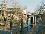
 The straightened Pinnau above Pinneberg |
||
| Data | ||
| Water code | DE : 5974 | |
| location | Germany, southwest of Schleswig-Holstein | |
| River system | Elbe | |
| Drain over | Elbe → North Sea | |
| River basin district | Elbe | |
| source | In Henstedt-Ulzburg 53 ° 47 '4 " N , 9 ° 58' 55" E |
|
| muzzle | In Haselau in the Page Sander addition same coordinates: 53 ° 40 '39 " N , 9 ° 32' 26" O 53 ° 40 '39 " N , 9 ° 32' 26" O
|
|
| length | 41 km | |
| Catchment area | 367 km² | |
| Discharge at the Renzel A Eo gauge : 71.3 km². Location: 29.4 km above the mouth |
NNQ (July 23, 1989) MNQ 1984–2014 MQ 1984–2014 Mq 1984–2014 MHQ 1984–2014 HHQ (November 15, 1977) |
117 l / s 209 l / s 811 l / s 11.4 l / (s km²) 6.49 m³ / s 12.6 m³ / s |
| Drain |
MQ |
3.46 m³ / s |
| Left tributaries | Ebach , Gronau , Mühlenau , Appener Au (Beek) | |
| Right tributaries | Krambek , Bilsener Bek , Bilsbek , Ohrtbrookgraben , Heidgraben , Klosterdeichwetter | |
| Medium-sized cities | Quickborn , Pinneberg | |
| Small towns | Uetersen | |
| Communities | Henstedt-Ulzburg , Alveslohe , Bilsen , Ellerau , Tangstedt , Borstel-Hohenraden , Rellingen , Appen , Prisdorf , Moorrege , Neuendeich , Seestermühe , Haselau | |
| Ports | Port of the Pinnau Sailing Association, Tiedehafen Neuendeich, Moorrege-Klevendeich harbor, Klosterdeich yacht harbor, Uetersen pier, Feldmuehle jetty | |
| Navigable | Federal waterway from Pinneberg to the mouth (18.81 km) - depending on the tide | |


The Pinnau is a 41 km long right-hand or eastern tributary of the Elbe in the southern part of Schleswig-Holstein (Germany). In terms of the type of flowing water , it is marshland (type 22).
course
The Pinnau rises in Henstedt-Ulzburg , initially flows to the south and from Pinneberg to the west and flows in the municipality of Haselau from the east into the Elbe flowing from the southeast .
In its lower reaches, the Pinnau forms the border between the Haseldorfer Marsch in the south and the Seestermüher Marsch in the north.
Hydrology
The water level of the Pinnau depends on the tide up to Pinneberg, as the stretch of the Elbe estuary, which is influenced by the tidal range , presses the water into the estuaries. A barrage at the estuary has been protecting the hinterland from storm surges since 1969 .
Tributaries
Tributaries of the Pinnau include:
- Krambek , the first tributary of the Pinnau
- Bilsener Bek , second and right tributary of the Pinnau
- Ebach , flows into Ellerau on the left
- Gronau , flows left between Ellerau and Quickborn
- Riedbach , flows right into Pinneberg
- Mühlenau , flows left in Pinneberg
- Appener Au (Beek), flows into Appen on the left
- Bilsbek , flows right between Prisdorf and Tornesch
- Ohrtbrookgraben , flows right between Tornesch and Uetersen .
history
The Pinnau was formerly called Ütristina and later Aue to Ueterst . During the Allerkind flood on December 28, 1248, it changed its course to the current Pinnau bed.
About the Pinnau also the second oldest functioning leads Swing Bridge Germany, the swing bridge Klevendeich , 1887 in Moor Reger Klevendeich was built in the district and as a cultural monument under monument stands.
Until the beginning of 1960 the river was one of the most polluted rivers in Germany, but the water quality has improved significantly in the meantime.
After storm-like rainfall in the low pressure areas “Freia I to IV” in December 2014, Pinnau, together with the Krückau and the Stör, reached the highest level values ever measured there (2.30 meters above mean water ). These had brought Schleswig-Holstein significantly more rain in the days up to Christmas Eve than the monthly mean in December.
Federal waterway
The Pinnau (Pi) is a federal waterway in the area of responsibility of the Hamburg Waterways and Shipping Office from the southwest edge of the railway bridge in Pinneberg to the confluence with the Pagensander Nebenelbe with km 18.81, at the Elbe km 658.99. It is one of the inland waterways on which the shipping routes regulations apply.
From 1886 to the turn of the century, the Pinnau was expanded from the mouth to Pinneberg and straightened a lot. After 1930 there were further expansion measures below Uetersen. In 1957–1962 the winding estuary was straightened and a 1 km long dam was built.
The storm surge barrier, built in 1969, has a 20 m wide shipping opening with mortise gates , the two side openings, each 8 m wide, have helicopters as locking devices.
It is currently being discussed whether, after the construction of the so-called western bypass of Pinneberg, the Pinnau should lose the status of a federal waterway on the section between Pinneberg and Uetersen , since since about 1930 only the approx. 8 km below Uetersen are important for commercial shipping.
Due to silt deposits, the Pinnau has not been used by commercial ships since Easter 2017, which previously supplied the field mill with paper raw materials.
gallery

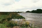
Pinnau lowlands near Pinneberg
Pinnauhafen of the Storawerke in Uetersen

The bascule bridge over the Pinnau in Uetersen
Pinnau below Uetersen

The pinnacle arch at Neuendeich

Klevendeich swing bridge over the Pinnau

The old pin arm at the pin lock

Pin lock from 1969


Individual evidence
- ↑ a b The Elbe and its catchment area. (PDF; 166 MB) A geographic, hydrological and water management overview. International Commission for the Protection of the Elbe, September 27, 2006, p. 196 , accessed on March 21, 2017 .
- ^ German Hydrological Yearbook Elbe Region, Part III 2014. (PDF) ISSN 0949-3654. Free and Hanseatic City of Hamburg, Hamburg Port Authority, p. 158 , accessed on October 4, 2017 (German, at: dgj.de).
- ^ HHQ from: Deutsches Gewässerkundliches Jahrbuch Elbe region, Part III 2012. (PDF) ISSN 0949-3654. Free and Hanseatic City of Hamburg, Hamburg Port Authority, p. 159 , accessed on October 4, 2017 (German, at: dgj.de).
- ↑ a b Lengths (in km) of the main shipping lanes (main routes and certain secondary routes) of the federal inland waterways ( Memento of the original from January 21, 2016 in the Internet Archive ) Info: The archive link was automatically inserted and not yet checked. Please check the original and archive link according to the instructions and then remove this notice. , Federal Waterways and Shipping Administration
- ↑ Directory E, serial no. 43 der Chronik ( Memento of the original from July 22, 2016 in the Internet Archive ) Info: The archive link was inserted automatically and has not yet been checked. Please check the original and archive link according to the instructions and then remove this notice. , Federal Waterways and Shipping Administration
literature
- M. Eckoldt (ed.): Rivers and canals. The history of the German waterways. DSV-Verlag 1998.
- Wilhelm Ehlers: History and folklore of the Pinneberg district. 1922.
- Muus / Petersen / König: The inland waters of Schleswig-Holstein. 1973.
- Rainer Naudiet: Stör lock, crutch lock, pin lock. Hansen & Hansen, Münsterdorf 1975, ISBN 3-87980-503-2 .
- Pinnau . In: Schleswig-Holstein Lexicon . 2nd ext. Edition Wachholtz Verlag, Neumünster 2006 ISBN 3-529-02441-4 , p. 470
- Paul L. Langer: Pinnau . In: The Uetersen Lexicon . Schmidt & Klaunig, Kiel 2012 ISBN 978-388312-421-6 , pp. 109–110
- Lars Bostelmann-Arp: Oswald-Dittrich Bridge . In: The Uetersen Lexicon . Schmidt & Klaunig, Kiel 2012 ISBN 978-388312-421-6 , pp. 102-104