
Fleestedt
|
Fleestedt
municipality Seevetal
|
|
|---|---|
 |
|
| Height : | 3–70 m |
| Residents : | 4750 (Dec. 31, 2013) |
| Incorporation : | July 1, 1972 |
| Postcodes : | 21217, 21218 |
| Area code : | 04105 |
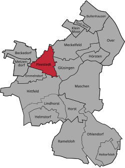  Location of Fleestedt in Seevetal
|
|
Fleestedt ( Fleest in Low German ) is a dependent part of the municipality of Seevetal , a municipality in the Harburg district in Lower Saxony , south of Hamburg . The place has 4750 inhabitants (148 of them with secondary residence), has a primary school, a small sports hall, a two-field hall, three sports fields, a tennis facility and a small shopping center as well as a supermarket, which was completed at the end of 2011.
Until July 1, 1972 Fleestedt was an independent municipality, then carried out the merger with 18 other municipalities unified community Seevetal.
The place is directly on the A 7 and is therefore easy to reach by car. The most important bus route is the Metrobus line 14 to Hamburg-Harburg. There are also bus connections to Maschen and via Hittfeld to Jesteburg. The northern part of Hittfeld station is to the west of Fleestedt, but the station building itself and the areas adjoining it to the south are already in the neighboring district of Emmelndorf .
The coat of arms shows the Fleestedter mill, which was destroyed towards the end of the Second World War so that it could not serve as a point of reference for the approaching English troops. The location of the mill was an elevation near the Mühlenweg on the western outskirts of Fleestedt.

Personalities
- Volker Dittrich (* 1951 in Fleestedt), publisher, journalist and author
- Claudia Preuß-Boehart (* 1951 in Fleestedt), politician (SPD)
Individual evidence
- ↑ Inhabitants of the Seevetal community (December 31, 2013)
- ^ Federal Statistical Office (ed.): Historical municipality directory for the Federal Republic of Germany. Name, border and key number changes in municipalities, counties and administrative districts from May 27, 1970 to December 31, 1982 . W. Kohlhammer GmbH, Stuttgart / Mainz 1983, ISBN 3-17-003263-1 , p. 228 and 229 .
Beckedorf | Bullenhausen | Emmelndorf | Fleestedt | Glüsingen | Great Moor | Helmstorf | Hittfeld with Karoxbostel | Holtorfsloh | Horst | Hearst | Klein-Moor | Lindhorst | Meshes | Meckelfeld | Metzendorf | Ohlendorf | Over | Ramelsloh