
Garlstorf
| coat of arms | Germany map | |
|---|---|---|

|
Coordinates: 53 ° 14 ' N , 10 ° 6' E |
|
| Basic data | ||
| State : | Lower Saxony | |
| County : | Harburg | |
| Joint municipality : | Salzhausen | |
| Height : | 53 m above sea level NHN | |
| Area : | 16.85 km 2 | |
| Residents: | 1124 (Dec. 31, 2019) | |
| Population density : | 67 inhabitants per km 2 | |
| Postal code : | 21376 | |
| Area code : | 04172 | |
| License plate : | WL | |
| Community key : | 03 3 53 011 | |
| LOCODE : | DE HVO | |
| Address of the municipal administration: |
Am Brink 2 21376 Garlstorf |
|
| Website : | ||
| Mayor : | Horst-Günter Jagau (GFG) | |
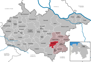
| Location of the municipality of Garlstorf in the Harburg district | ||
  |
||

Garlstorf is a municipality in the Harburg district in Lower Saxony .
geography
Geographical location
Garlstorf is located about 5 km east of the nature reserve Lueneburg Heath between the valleys of Luhe and the floodplain in the adjacent conservation area Garlstorfer Forest and further afield . The community belongs to the joint municipality of Salzhausen , which has its administrative seat in the municipality of Salzhausen .
history
The place was first mentioned in 1192.
politics
Municipal council
The council of the municipality of Garlstorf is composed of 11 councilors.
| GFG | total | |
| 2011 | 11 | 11 seats |
Status: Local election on September 11, 2011
mayor
The honorary mayor Horst-Günter Jagau was elected on September 9, 2001.
Economy and Infrastructure
traffic
It is approx. 1 km to the A 7 in the west of the municipality. Garlstorf is also on the Winsen – Hützel railway line , which is mainly used for freight traffic.
Individual evidence
- ↑ State Office for Statistics Lower Saxony, LSN-Online regional database, Table 12411: Update of the population, as of December 31, 2019 ( help ).
- ↑ Protected areas in Germany. Retrieved December 4, 2015 .
Web links
Appel | Asendorf | Bendestorf | Brackel | Buchholz in the north heath | Dohren | Drage | Drestedt | Egestorf | Eyendorf | Garlstorf | Garstedt | Gödenstorf | Halvesbostel | Handeloh | Hanstedt | Harmstorf | Heidenau | Hollenstedt | Jesteburg | Kakenstorf | Koenigsmoor | March shaft | Marxen | Moisburg | New Wulmstorf | Otter | Regesbostel | Rose garden | Salzhausen | Seevetal | Place | Tespe | Toppenstedt | Tostedt | Undeloh | Vierhöfen | Wave | Wenzendorf | Winsen (Luhe) | Wistedt | Wulfsen