
Drestedt
| coat of arms | Germany map | |
|---|---|---|

|
Coordinates: 53 ° 20 ' N , 9 ° 46' E |
|
| Basic data | ||
| State : | Lower Saxony | |
| County : | Harburg | |
| Joint municipality : | Hollenstedt | |
| Height : | 54 m above sea level NHN | |
| Area : | 5.71 km 2 | |
| Residents: | 786 (Dec. 31, 2019) | |
| Population density : | 138 inhabitants per km 2 | |
| Postcodes : | 21279, 21255 | |
| Area code : | 04186 | |
| License plate : | WL | |
| Community key : | 03 3 53 008 | |
| LOCODE : | DE DR7 | |
| Address of the municipal administration: |
Bahnhofstrasse 22 21279 Drestedt |
|
| Mayor : | Bernd Apel (WGD) | |
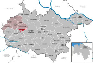
| Location of the municipality of Drestedt in the Harburg district | ||
  |
||

Drestedt is a municipality in the Harburg district in Lower Saxony .
geography
location
Drestedt is located north of the Lüneburg Heath Nature Park on the Este . The municipality belongs to the joint municipality of Hollenstedt , which has its administrative seat in the municipality of Hollenstedt .
Community structure
Only the place Drestedt belongs to the municipality of Drestedt.
history
Up to 1900 the communities Drestedt, Kakenstorf , Trelde and Sprötze formed the community Die Vierdörfer . Drestedt is now an independent municipality belonging to the joint municipality of Hollenstedt , Kakenstorf belongs to the joint municipality of Tostedt , and Trelde and Sprötze were incorporated into Buchholz in the Nordheide in 1972 .
politics
Municipal council
The council of the municipality consists of 9 members.
| CDU | FLD | WGD | total | |
| 2011 | 2 | - | 7th | 9 seats |
| 2016 | - | 3 | 6th | 9 seats |
Status: Local elections on September 11, 2016
mayor
The honorary mayor Thorsten Raid was first elected in September 2011.
coat of arms
Blazon : split shield. Divided three times on the right by red and silver. On the left in silver three red houses with black roofs. The three buildings symbolize the houses of the farmers who were instrumental in founding the village.
Economy and Infrastructure
traffic
- The federal highways 75 and 3 border the municipality to the south and east.
- Until 1968, trains on the disused Buchholz – Harsefeld railway stopped at Drestedt station. From 1935 to 1945 the route to the Wenzendorf military airfield and 1945–1948 / 49 the route to the former naval torpedo storage facility at Todtglüsingen branched off here .
Individual evidence
- ↑ State Office for Statistics Lower Saxony, LSN-Online regional database, Table 12411: Update of the population, as of December 31, 2019 ( help ).
- ↑ Drestedt station. In: spurkranz.de. Retrieved October 22, 2016 .
Web links
Appel | Asendorf | Bendestorf | Brackel | Buchholz in the north heath | Dohren | Drage | Drestedt | Egestorf | Eyendorf | Garlstorf | Garstedt | Gödenstorf | Halvesbostel | Handeloh | Hanstedt | Harmstorf | Heidenau | Hollenstedt | Jesteburg | Kakenstorf | Koenigsmoor | March shaft | Marxen | Moisburg | New Wulmstorf | Otter | Regesbostel | Rose garden | Salzhausen | Seevetal | Place | Tespe | Toppenstedt | Tostedt | Undeloh | Vierhöfen | Wave | Wenzendorf | Winsen (Luhe) | Wistedt | Wulfsen

Appel (with Eversen, Eversen-Heide, Grauen and Oldendorf) | Drestedt | Halvesbostel (with Holvede) | Hollenstedt (with Emmen, Ochtmannsbruch, Ochtmannsbruch-Siedlung, Staersbeck and Wohlesbostel) | Moisburg (with Appelbeck and Podendorf) | Regesbostel (with Holtorfsbostel, Holtorfer Heide and Rahmstorf) | Wenzendorf (with Dierstorf, Dierstorf-Heide, Klauenburg and Wennerstorf)