List of architectural monuments in Garlstorf
In the list of architectural monuments in Garlstorf , all listed buildings of the Lower Saxony municipality of Garlstorf ( Harburg district ) are listed. The list was as of 2014.
Garlstorf
The columns contain the following information:
- Location: the address of the monument and the geographical coordinates . Map view to set coordinates . In the map view, monuments without coordinates are shown with a red marker and can be set on the map. Architectural monuments without a picture are marked with a blue marker, architectural monuments with a picture with a green marker.
- Official name: Name of the monument
- Description: the description of the monument. Under § 3 (2) NDSchG individual monuments and under § 3 (3) NDSchG groups of structures and their components are shown.
- ID: the number of the monument
- Image: a picture of the monument
| location | designation | description |
ID |
image |
|---|---|---|---|---|
| Hanstedter Landstrasse 1 53 ° 14 ′ 12 ″ N, 10 ° 6 ′ 9 ″ E |
Farmhouse |

|
||
| Lüneburger Landstrasse 53 ° 14 ′ 13 ″ N, 10 ° 6 ′ 9 ″ E |
War memorial 1914/18 |

|
||
| Lüneburger Landstrasse 1 / An de Häg 2 53 ° 14 ′ 15 ″ N, 10 ° 6 ′ 12 ″ E |
barn |

|
||
| Lüneburger Landstrasse 10 53 ° 14 ′ 8 ″ N, 10 ° 6 ′ 15 ″ E |
Farmhouse |

|
||
| Meierhof 26 |
Farmhouse | |||
| Mühlenweg 10 53 ° 14 ′ 2 ″ N, 10 ° 6 ′ 14 ″ E |
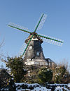
Windmill |

|
||
| Zur Osterheide 3 53 ° 14 ′ 15 ″ N, 10 ° 6 ′ 15 ″ E |
Courtyard | |||
| Fastweg in the Garlstorfer Wald 53 ° 13 ′ 15 ″ N, 10 ° 3 ′ 27 ″ E |
Historic landmark from the 18th century | A so-called Georg Rex stone ; Front with the monogram of George III. (1760 to 1801 King of Great Britain and Ireland, then until his death in 1820 King of the United Kingdom of Great Britain and Ireland) in his capacity as Elector of the Electorate of Braunschweig-Lüneburg , the number "1" and the year "1774" (probably the Year of stone setting) to mark the boundary between manorial forest and farm forest according to the recess from 1754; Back: Wolfsangel as a symbol of power in a forestry context. The stone was moved to its current location on Fastweg at the turn of the 19th century. Originally, the stone was set in Garlstorfer Ohe , a wooded area northwest of Garlstorf, which fell to Garlstorf after the general division in 1848 and later turned into arable land was converted so that the Georg-Rex-Stein on Fastweg is the only preserved historical boundary stone from Garlstorfer Ohe today. Historic Landmarks are as cultural monuments ( small monuments ) under monument protection . |

|
source
- List of architectural monuments of the Harburg district (as of September 4, 2014)
Web links
Commons : Architectural monuments in Garlstorf - Collection of images, videos and audio files
Individual evidence
- ↑ Carsten Päper: Landmarks - cultural monuments of the Harburg district. In: Stone Cross Research. No. 12, 1986, p. 36.
- ^ Richard Backhaus: The Garlstorfer Forest. In: Harburg district calendar. A yearbook for the year 1962. Volume 16, 1962, p. 26.
- ↑ Cf. Carsten Päper: Landmarks - cultural monuments of the Harburg district. In: Stone Cross Research. No. 12, 1986, p. 38.
- ↑ Compare for example: Lower Saxony State Office for Monument Preservation: Monument protection and monument preservation in Lower Saxony. (PDF; 3.1 MB) Lower Saxony State Office for Monument Preservation, 2015, p. 21 , accessed on March 25, 2017 .

