Sandberg (Gersfeld)
|
Sandberg
City of Gersfeld (Rhön)
Coordinates: 50 ° 27 ′ 28 ″ N , 9 ° 56 ′ 35 ″ E
|
|
|---|---|
| Height : | 581 m |
| Area : | 6.6 km² |
| Residents : | 122 (Sep 30, 2019) |
| Population density : | 18 inhabitants / km² |
| Incorporation : | December 31, 1970 |
| Postal code : | 36129 |
| Area code : | 06654 |
|
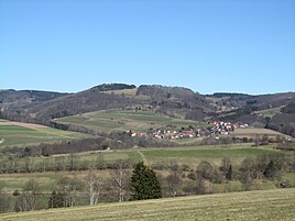
Location Sandberg south of the Feldberg from the southwest
|
|
Sandberg is a district of the city of Gersfeld (Rhön) in the eastern Hessian district of Fulda .
The village is located northeast of Gersfeld in the Rhön Biosphere Reserve on a southern branch of the Feldberg . The Fulda cycle path to the Wasserkuppe runs east of the village.
history
Sandberg was first mentioned in a document in 1544, when it was settled by six settlers.
Territorial reform
On December 31, 1970, the previously independent municipality Sandberg was in the course of administrative reform in Hesse on a voluntary basis in the city Gersfeld incorporated . For the district of Sandberg, as for the other incorporated, formerly independent municipalities, a local district with a local advisory board and local chief was set up in accordance with the Hessian municipal code.
Population development
- 1544: 6 settlers (foundation)
| Sandberg: Population from 1834 to 2018 | ||||
|---|---|---|---|---|
| year | Residents | |||
| 1834 | 203 | |||
| 1840 | 212 | |||
| 1846 | 208 | |||
| 1852 | 204 | |||
| 1858 | 194 | |||
| 1864 | 173 | |||
| 1871 | 186 | |||
| 1875 | 177 | |||
| 1885 | 159 | |||
| 1895 | 166 | |||
| 1905 | 174 | |||
| 1910 | 173 | |||
| 1925 | 163 | |||
| 1939 | 154 | |||
| 1946 | 198 | |||
| 1950 | 176 | |||
| 1956 | 162 | |||
| 1961 | 143 | |||
| 1967 | 132 | |||
| 1970 | 133 | |||
| 1980 | ? | |||
| 1990 | ? | |||
| 2000 | 164 | |||
| 2005 | 174 | |||
| 2010 | 156 | |||
| 2011 | 147 | |||
| 2015 | 125 | |||
| 2018 | 124 | |||
| Data source: Historical municipality register for Hesse: The population of the municipalities from 1834 to 1967. Wiesbaden: Hessisches Statistisches Landesamt, 1968. Further sources: up to 1970 :; After 1970 City of Gersfeld :; 2011 census | ||||
Web links
- Website of the city of Gersfeld
- Sandberg (Gersfeld), Fulda district. Historical local dictionary for Hessen. In: Landesgeschichtliches Informationssystem Hessen (LAGIS).
- Literature on Sandberg in the Hessian Bibliography
Individual evidence
- ↑ a b c d Sandberg (Gersfeld), district of Fulda. Historical local dictionary for Hessen. (As of October 16, 2018). In: Landesgeschichtliches Informationssystem Hessen (LAGIS).
- ↑ Population of the city of Gersfeld (Rhön). (PDF; 76 kB) Retrieved August 2020 .
- ↑ Incorporation of communities into the city of Gersfeld, district of Fulda from January 7, 1971 . In: The Hessian Minister of the Interior (ed.): State Gazette for the State of Hesse. 1971 No. 4 , p. 141 , point 172 ( online at the information system of the Hessian state parliament [PDF; 6.3 MB ]).
- ^ Federal Statistical Office (ed.): Historical municipality directory for the Federal Republic of Germany. Name, border and key number changes in municipalities, counties and administrative districts from May 27, 1970 to December 31, 1982 . W. Kohlhammer, Stuttgart / Mainz 1983, ISBN 3-17-003263-1 , p. 393 .
- ↑ main statute. (PDF; 791 kB) § 6. In: Website. City of Gersfeld, accessed August 2020 .
- ↑ Population figures from 2000 to 2018. City of Gersfeld, accessed in August 2020 .
- ↑ Selected data on population and households on May 9, 2011 in the Hessian municipalities and parts of the municipality. (PDF; 1.2 MB) In: 2011 Census . Hessian State Statistical Office
