Rodholz
|
Rodholz
Municipality Poppenhausen (Wasserkuppe)
Coordinates: 50 ° 29 ′ 18 ″ N , 9 ° 53 ′ 38 ″ E
|
|
|---|---|
| Height : | 551 (510-875) m above sea level NHN |
| Area : | 5.75 km² [LAGIS] |
| Residents : | 192 (December 31, 2013) |
| Population density : | 33 inhabitants / km² |
| Incorporation : | August 1, 1972 |
| Postal code : | 36163 |
| Area code : | 06658 |
|
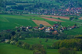
Rodholz seen from the horse's head, in the background Poppenhausen
|
|
Rodholz is the smallest part of the municipality of Poppenhausen (Wasserkuppe) in the eastern Hessian district of Fulda .
Rodholz is located in the Rhön Biosphere Reserve east of Poppenhausen at the foot of the Wasserkuppe . In the east of the village on the edge of the forest is the Guckaisee . The place was first mentioned in a document as "Rotholfs" in 1467. The district includes scattered settlements, hamlets and individual farms Farnlieden, Heckenhöfchen, Kohlstock, Guckai, Schwarzerden, Güntersberg, Lahmenhof and Oberaltenweiher. Rodholz Poppenhausen is ecclesiastically assigned.
In 1927 the gymnastics school Schwarzerden was founded in the district of the same name. On August 1, 1972, Rodholz was incorporated into the newly formed Poppenhausen community in the course of the regional reform in Hesse by virtue of state law .
literature
- Michael Mott : Hutebuche in Poppenhäuser "Berger-Viertel" Guckai (Rodholz), in: "Buchenblätter" Fuldaer Zeitung, 60th year, No. 30, Nov. 27, 1987, p. 118.
- Michael Mott: Old boundary stone (road component) on the Landwehr (near Güntersberg) / Reichsarbeitsdienst built “Höhenweg”, in: “Buchenblätter” Fuldaer Zeitung, 69th year, No. 18, July 26, 1996, pp. 71, 72.
- Petra Sauer, Markus Müller, Wolfgang Weiser, Michael Mott, u. a .: Life at the foot of the Wasserkuppe and Eube - home register of the Rhön community Rodholz: community Poppenhausen (Wasserkuppe) , Rindt Druck Fulda, July 2008.
- Literature about Rodholz in the Hessian Bibliography
Web links
- Internet presence of the Poppenhausen community
- Rodholz, Fulda district. Historical local dictionary for Hessen. (As of September 7, 2015). In: Landesgeschichtliches Informationssystem Hessen (LAGIS).
Individual evidence
- ↑ Population statistics of the Fulda district , accessed in September 2015.
- ↑ Law on the reorganization of the districts of Fulda and Hünfeld and the city of Fulda (GVBl. II 330-14) of July 11, 1972 . In: The Hessian Minister of the Interior (ed.): Law and Ordinance Gazette for the State of Hesse . 1972 No. 17 , p. 220 , § 9 ( online at the information system of the Hessian state parliament [PDF; 1,2 MB ]).
- ^ Federal Statistical Office (ed.): Historical municipality directory for the Federal Republic of Germany. Name, border and key number changes in municipalities, counties and administrative districts from May 27, 1970 to December 31, 1982 . W. Kohlhammer GmbH, Stuttgart and Mainz 1983, ISBN 3-17-003263-1 , p. 395 .
