
Odenwaldkreis
| coat of arms | Germany map |
|---|---|

|

Coordinates: 49 ° 40 ' N , 9 ° 0' E |
| Basic data | |
| State : | Hesse |
| Administrative region : | Darmstadt |
| Administrative headquarters : | Erbach |
| Area : | 623.98 km 2 |
| Residents: | 96,703 (Dec. 31, 2019) |
| Population density : | 155 inhabitants per km 2 |
| License plate : | ERB |
| Circle key : | 06 4 37 |
| NUTS : | DE71B |
| Circle structure: | 12 municipalities |
| Address of the district administration: |
Michelstädter Strasse 12 64711 Erbach |
| Website : | |
| District Administrator : | Frank Matiaske ( SPD ) |
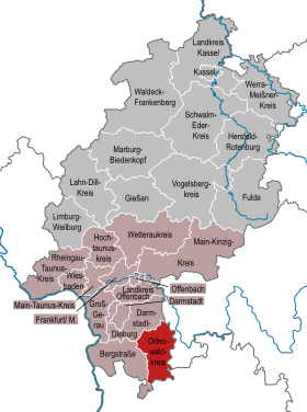
| Location of the Odenwaldkreis in Hesse | |
  |
|
The Odenwaldkreis is a district in the administrative district of Darmstadt in Hesse . With a little less than 100,000 inhabitants, it is the poorest district in Hesse.
geography
location
The Odenwaldkreis is the only district that lies with the entire district area in the Odenwald , thus including its core area. The central part of the landscape of the Odenwaldkreis is the Mümlingtal , which runs in a south-north direction, and the mountain ranges accompanying it to the east and west. The largest cities in the district are lined up along the Mümling: Beerfelden, Erbach, Michelstadt, Bad König and Höchst. In the north-west the district extends into part of the Gersprenz lowland and in the south there are some valleys beyond the main watershed of the Main and Neckar , which strive towards the Neckar to the south: the Finkenbach , the Gammelsbach , the Sensbach and the Itter .
The highest elevations in the Odenwald district are the Kohlwald ( 560.4 m above sea level ) northwest of Bullau , the Sensbacher Höhe ( 558 m above sea level ) and the Krähberg ( 555 m above sea level ), both in the Ober-Sensbach area . At 515 meters, Würzberg and Bullau are the two highest villages in the district. The lowest is Hainstadt an der Mümling just before the Bavarian border with 143 m .
Neighboring areas
The Odenwaldkreis borders clockwise in the north, starting with the districts of Darmstadt-Dieburg (in Hesse), Miltenberg (in Bavaria ), Neckar-Odenwald-Kreis and Rhein-Neckar-Kreis (both in Baden-Württemberg ) and Bergstrasse (again in Hesse) .
history
Until the mediatization in 1806, the area of the Odenwaldkreis, within limits similar to those since the district reform , was a direct imperial territory of the Counts of Erbach , belonged as an exclave to the Franconian Empire and then became part of the Grand Duchy of Hesse . After the constitution of the Grand Duchy was promulgated on December 17, 1820, a comprehensive administrative reform followed on July 14, 1821. Instead of the offices, districts were now set up. These were the forerunners of the circles. In Erbach, the district and judicial district of Erbach was founded in 1822 for the Graeflich Erbachischen and Erbach-Fürstenauischen offices . Also in 1822 a district and judicial district Breuberg was established with its seat in Neustadt (from 1847) or Höchst in the Odenwald. With the law of July 31, 1848, the administrative units were enlarged one more time. The districts and administrative districts were replaced by administrative districts , with the previous administrative districts of Breuberg and Erbach being combined to form the administrative district of Erbach . In addition, there was the Wimpfen district , an exclave in Baden. Four years later, however, they returned to the division into districts, which resulted in the establishment of the district of Erbach , the district of Neustadt and the district of Wimpfen . On July 1, 1874, the Neustadt district was dissolved again and most of the communities were integrated into the Erbach district. The district of Lindenfels was also dissolved and gave 16 communities to the district of Erbach.
In the course of the reform of the district constitution in the Grand Duchy of Hesse based on the Prussian model in 1874, there was also a new district division. The division of the Grand Duchy into seven districts that formed the Starkenburg Province (Bensheim, Darmstadt, Dieburg, Erbach, Groß-Gerau, Heppenheim, Offenbach) lasted for more than six decades.
After the dissolution of the provincial and district assemblies in what is now the People's State of Hesse (from 1918) and the dissolution of the three provinces of Starkenburg, Upper Hesse and Rheinhessen in 1937, the year 1938 brought a review of the district boundaries. On November 1, 1938, a decisive regional reform was carried out in Hesse. One district was dissolved in each of the three Hessian provinces of Starkenburg, Rheinhessen and Upper Hesse. In Starkenburg, the Bensheim district was affected. This was largely added to the Heppenheim district, which also became the legal successor to the Bensheim district. The new administrative unit was renamed the Bergstrasse district. At the same time, the cities of Darmstadt, Gießen, Mainz, Offenbach and Worms became independent as urban districts. This regional division of the people's state initially lasted until the end of the war in 1945.
As part of the regional reform in Hesse , the municipality of Laudenau from the Bergstrasse district came to the district of Erbach on July 1, 1971 after a citizen survey, when it joined the municipality of Reichelsheim (Odenwald) . When the law on the reorganization of the district of Erbach came into force , the district area expanded on August 1, 1972 to include the communities of Fränkisch-Crumbach and Brensbach (with Wersau ) from the district of Dieburg . At the same time, the district was named Odenwaldkreis .
On January 1st, 2018, the communities of Beerfelden , Hesseneck , Rothenberg and Sensbachtal merged to form the new town of Oberzent .
Population development
| date | Residents | source |
|---|---|---|
| 1972 | 81,800 | |
| 1975 | 82,300 | |
| 1980 | 84,200 | |
| 1985 | 85,900 | |
| 1990 | 91,300 | |
| 1995 | 98,305 | |
| 2000 | 99,667 | |
| 2005 | 100.174 | |
| 2010 | 97.198 | |
| 2015 | 96,047 |
politics
District council
The local elections on March 6, 2016 produced the following results, compared to previous local elections:
| Diagram showing the election results and the distribution of seats | |
|---|---|
| Nominations | % 2016 |
Seats 2016 |
% 2011 |
Seats 2011 |
% 2006 |
Seats 2006 |
% 2001 |
Seats 2001 |
|
|---|---|---|---|---|---|---|---|---|---|
| SPD | Social Democratic Party of Germany | 35.1 | 18th | 34.1 | 17th | 43.6 | 22nd | 45.8 | 23 |
| CDU | Christian Democratic Union of Germany | 21.3 | 11 | 25.4 | 13 | 29.3 | 15th | 28.7 | 15th |
| ÜWG | Non-partisan voter community for the Odenwaldkreis | 13.7 | 7th | 17.5 | 9 | 10.6 | 5 | 12.0 | 6th |
| AfD | Alternative for Germany | 12.6 | 6th | - | - | - | - | - | - |
| GREEN | Alliance 90 / The Greens | 7.6 | 4th | 14.6 | 7th | 6.3 | 3 | 7.0 | 4th |
| FDP | Free Democratic Party | 6.0 | 3 | 3.1 | 2 | 3.8 | 2 | 2.9 | 1 |
| THE LEFT. | THE LEFT. | 3.7 | 2 | 2.9 | 2 | 3.1 | 2 | - | - |
| REP | The Republicans | - | - | 2.4 | 1 | 3.3 | 2 | 3.5 | 2 |
| total | 100.0 | 51 | 100.0 | 51 | 100.0 | 51 | 100.0 | 51 | |
| Voter turnout in% | 52.0 | 51.3 | 52.6 | 59.8 | |||||
District Administrator
- June 21, 1865 - June 20, 1877: District Councilor Wilhelm Christoph Adolf Schenck zu Schweinsberg
- June 20, 1877 - August 7, 1886: District Councilor Johann Karl Jost
- August 7, 1886 - September 20, 1888: District Councilor Hermann von Bechtold
- October 10, 1888 - July 16, 1894: District Councilor Andreas Breidert
- July 16, 1894 - August 19, 1897: District Councilor Gustav Weiprecht von Gemmingen
- September 6, 1897 - September 30, 1901: District Councilor Friedrich Wilhelm Fey
- October 1, 1901 - February 28, 1910: District Councilor Karl Schliephake
- 1910–1913: District Councilor Adalbert Rinck von Starck
- October 1, 1913 - April 30, 1920: District Councilor Eugen Kranzbühler
- As a representative of the district council called up for military service:
- District Director Wilhelm Anton Diehl
- Senior Government Councilor Hermann Stammler
- October 1, 1920 - June 15, 1923: District Director Ernst Merck
- June 16, 1923 - April 30, 1932: District Director Leopold von Werner
- May 16, 1932 - September 30, 1937: District Director Hermann Braun
- October 1, 1937–1938: Provisional District Director Hellmuth Scheer
- June 1, 1938 - March 31, 1945 District Director, from 1939 District Administrator Dieter Stammler
- (1942–1945): Provisional District Director Hans Bornscheuer
- 1945–1951: Karl Neff , SPD
- 1951–1963: Georg Ackermann , SPD
- 1963–1979: Gustav Hoffmann , SPD
- 1979–1991: Baldur Nothhardt , SPD
- 1991–2009: Horst Schnur , SPD
- 2009–2015: Dietrich Kübler , ÜWG
- Since September 1, 2015: Frank Matiaske , SPD
Coat of arms, flag and banner

Hoist flag

Banner flag

The Odenwaldkreis has a coat of arms as well as a hoist and banner flag .
|
|
Blazon : "A black, rooted oak on a golden background, accompanied by three six-pointed red stars" |
|
Foundation of the coat of arms: The oak stands for the forests of the region, which also gave the district its name. The three stars were taken from the coat of arms of the Counts of Erbach, who ruled this region until 1806. The coat of arms was awarded on November 20, 1956.
Flag description: “The flag is divided black and yellow; on the leech an equilateral red triangle covered with the coat of arms. The banner is split in black and yellow; in the head of the banner an equilateral red triangle covered with the coat of arms. " |
court House

The district office building was designed in the Renaissance style from 1902–1904 by the Worms city architect and later professor at the Technical University of Darmstadt, Karl Christian Hofmann (1856–1933) , and built by the building contractor and stonemason Adam Hild from Hetzbach. Extension buildings were necessary in 1960 and 1989.
At this point there was formerly the court of the Erbacher Zent and then a brickworks.
Partnerships
The Odenwaldkreis has a partnership with the Falkirk region , which is located in the center of Scotland between Edinburgh and Glasgow .
Culture
- The German Ivory Museum Erbach presents the public at this important European location for ivory carving with a uniquely extensive collection of more than 2000 exhibits of various origins and dates of creation.
- Breuberger sculptors, the Kunstverein Breuberg and the community foundation have invited sculptors to a meeting every year since 2002 to create works of art for the sculpture field on the Breuberger Aue. In 2010 there were 18 sculptures on the field.
Nature and protected areas
12 nature reserves have been designated in the Odenwald district . In addition, there are several Natura 2000 areas (FFH areas and EU bird protection areas), some of which span districts. 69 natural monuments protect striking individual trees or groups of trees, rock formations and small areas.
- see also: List of nature reserves in the Odenwaldkreis
- see also: List of natural monuments in the Odenwaldkreis
- See also: List of FFH areas in Hessen
- See also: List of EU bird protection areas in Hessen
Communities


(Residents on December 31, 2019)
|
|
License Plate
On July 1, 1956, the predecessor of the Odenwaldkreis, the district of Erbach, was assigned the distinguishing mark ERB . This was still used after the name was changed to Odenwaldkreis on August 1, 1972, and is still issued today.
literature
- Eva Haberkorn: District of Erbach 1821–1945 (= repertories of the Hessian State Archives Darmstadt), Dept. G 15 (PDF; 89 kB). In: Archive Information System Hessen (Arcinsys Hessen).
- The inscriptions of the Odenwald district. Volume 63 of the series " The German Inscriptions ". Collected and edited by Sebastian Scholz. Wiesbaden 2005. (Offers a scientific edition of the medieval and early modern inscriptions from 1119 to 1650; can be viewed online )
- Literature from and about the Odenwaldkreis in the catalog of the German National Library
Web links
- Website of the Odenwaldkreis
- Odenwaldkreis. Historical local dictionary. In: Landesgeschichtliches Informationssystem Hessen (LAGIS).
- Pictures from the Odenwaldkreis. (No longer available online.) In: galerie.odenwaldkreis.de. District Office of the Odenwaldkreis, archived from the original on March 7, 2013 .
- Odenwald Regional Society. In: www.oreg.de. Odenwald-Regional-Gesellschaft mbH
- Tourism in the region. In: www.odenwald.de. Odenwald Tourismus GmbH
- Link catalog on the topic of the Odenwaldkreis at curlie.org (formerly DMOZ )
Individual evidence
- ↑ Hessian State Statistical Office: Population status on December 31, 2019 (districts and urban districts as well as municipalities, population figures based on the 2011 census) ( help ).
- ↑ Headlines from Bensheim on the 175th anniversary of the "Bergsträßer Anzeiger". (PDF; 9.0 MB) The creation of the Bergstrasse district. 2007, p. 109 , archived from the original on October 5, 2016 ; Retrieved February 9, 2015 .
- ↑ Law on the reorganization of the district of Erbach (GVBl. II 330–16) of July 11, 1972 . In: The Hessian Minister of the Interior (ed.): Law and Ordinance Gazette for the State of Hesse . 1972 No. 17 , p. 224 , § 9 ( online at the information system of the Hessian state parliament [PDF; 1,2 MB ]).
- ↑ The border change agreement has been concluded. Communication dated May 3, 2017
- ↑ Statistical Yearbook for the Federal Republic of Germany 1974
- ↑ Statistical Yearbook for the Federal Republic of Germany 1976
- ↑ Statistical Yearbook for the Federal Republic of Germany 1981
- ↑ Statistical Yearbook for the Federal Republic of Germany 1986
- ^ Michael Rademacher: German administrative history from the unification of the empire in 1871 to the reunification in 1990. Odenwaldkreis. (Online material for the dissertation, Osnabrück 2006).
- ↑ a b c GenWiki: Odenwaldkreis
- ↑ Population in the administrative districts on September 30, 2010 and population processes in the 3rd quarter of 2010. Hessian State Statistical Office, archived from the original on May 10, 2011 ; accessed on May 31, 2019 .
- ↑ Population in the administrative districts on June 30, 2015 and change in population in the 2nd quarter of 2015. Hessian State Statistical Office, archived from the original on March 24, 2016 ; accessed on May 31, 2019 .
- ^ Hessian State Statistical Office: Results of the district elections of 2016 and 2011
- ^ Hessian State Statistical Office: Results of the district elections of 2011 and 2006
- ^ Hessian State Statistical Office: Results of the district elections of 2006 and 2001
- ^ Hessian State Statistical Office: Results of the district elections of 2001 and 1997
- ↑ Results of the district election 2015
- ^ Breuberg-Neustadt sculpture park on the floodplain
- ↑ Map of the protected areas in the Odenwaldkreis. natureg.hessen.de, accessed on July 9, 2020 .
- ↑ Hessian State Statistical Office: Population status on December 31, 2019 (districts and urban districts as well as municipalities, population figures based on the 2011 census) ( help ).
Counties: Bergstrasse | Darmstadt-Dieburg | Fulda | Casting | Gross-Gerau | Hersfeld-Rotenburg | Hochtaunuskreis | Kassel (Country) | Lahn-Dill-Kreis | Limburg-Weilburg | Main-Kinzig-Kreis | Main-Taunus-Kreis | Marburg-Biedenkopf | Odenwaldkreis | Offenbach (State) | Rheingau-Taunus-Kreis | Schwalm-Eder district | Vogelsbergkreis | Waldeck-Frankenberg | Werra-Meißner district | Wetteraukreis
Independent cities: Darmstadt | Frankfurt am Main | Kassel | Offenbach am Main | Wiesbaden