
Falkirk (Council Area)
| Falkirk to Eaglais Bhreac |
|
|---|---|
  |
|
| Administrative headquarters | Falkirk |
| surface | 297 km² (22.) |
| Residents | 156,800 (2012) (11.) |
| ISO 3166-2 | GB-FAL |
| ONS code | 00QQ |
| Website | www.falkirk.gov.uk |

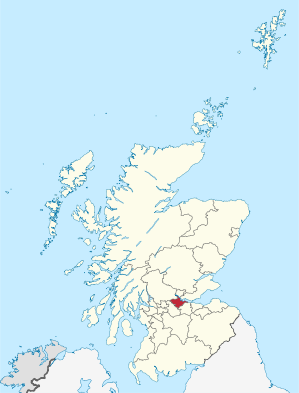
Falkirk ( Gaelic to Eaglais Bhreac ) is one of 32 Council Areas in Scotland . It borders North Lanarkshire , Stirling and West Lothian . The county comprises parts of the traditional counties of Stirlingshire and West Lothian.
Area forums
The area of the Council Area is divided into six Area Forums , which in turn include the following communities:
Bo'ness Area Forum
Braes Area Forum
- Avonbridge
- Brightons
- California
- Laurieston
- Limerigg
- Maddiston
- Polmont
- Redding
- Reddingmuirhead
- Rumford
- Shieldhill
- Slamannan
- Standburn
- Wallacestone
- West Quarter
- Whitecross
Denny, Bonnybridge & Banknock Area Forum
Falkirk Area Forum
Grangemouth Area Forum
Larbert & Stenhousemuir Area Forum
Council
The Falkirk Council has 30 seats, which are distributed among the parties as follows:
| Political party | Seats |
|---|---|
| Scottish National Party | 12 |
| Scottish Labor | 9 |
| Scottish Conservatives | 7th |
| Independently | 2 |
Partnerships

The Falkirk Council has had a friendly partnership with the Odenwaldkreis since 1969 .
See also
Individual evidence
- ↑ Mid-2012 Population ( Memento from November 29, 2014 in the Internet Archive ) (PDF; 1.2 MB)
- ↑ Results of the regional elections 2017
Web links
Aberdeen | Aberdeenshire | Angus | Argyll and Bute | Clackmannanshire | Dumfries and Galloway | Dundee | East Ayrshire | East Dunbartonshire | East Lothian | East Renfrewshire | Edinburgh | Falkirk | Fife | Glasgow | Highland | Inverclyde | Midlothian | Moray | Outer Hebrides | North Ayrshire | North Lanarkshire | Orkney | Perth and Kinross | Renfrewshire | Scottish Borders | Shetland | South Ayrshire | South Lanarkshire | Stirling | West Dunbartonshire | West Lothian