
West Dunbartonshire
| West Dunbartonshire Siorrachd Dhùn Bhreatainn on Iar |
|
|---|---|
  |
|
| Administrative headquarters | Dumbarton |
| surface | 159 km² (31.) |
| Residents | 90.340 (2012) (25.) |
| ISO 3166-2 | GB-WDU |
| ONS code | 00QG |
| Website | www.west-dunbarton.gov.uk |
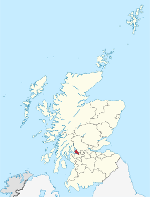
West Dunbartonshire ( Gaelic Siorrachd Dhùn Bhreatainn an Iar ) is one of 32 Council Areas in Scotland . It borders Argyll and Bute , Stirling , East Dunbartonshire , Glasgow and Renfrewshire .
The largest place is Clydebank , but the administrative center is Dumbarton . Note that the city is spelled with an 'm' but the district and traditional county are spelled with an 'n'. These variations are due to the translation from Gaelic into English (Dùn Breatainn became Dumbarton, Siorrachd Dhùn Bhreatainn became Dunbartonshire ).
places
- Alexandria
- Balloch
- Bonhill
- bowling
- Clydebank
- Dumbarton
- Duntocher
- Hardgate
- Jamestown
- Old Kilpatrick
- Renton
- Townend
Attractions
- Cochno stone
- Dumbarton Castle
- Erskine Bridge
- Inchmurrin
- Loch Lomond
- see also List of Category A structures in West Dunbartonshire
politics
West Dunbartonshire Council has 22 seats, divided among the parties as follows:
| Political party | Seats |
|---|---|
| Scottish National Party | 10 |
| Labor | 8th |
| Conservative | 2 |
| West Dunbartonshire Community Party |
1 |
| Independently | 1 |
Individual evidence
- ↑ Mid-2012 Population ( Memento from November 29, 2014 in the Internet Archive ) (PDF; 1.2 MB)
- ↑ Results of the regional elections 2017
Web links
Aberdeen | Aberdeenshire | Angus | Argyll and Bute | Clackmannanshire | Dumfries and Galloway | Dundee | East Ayrshire | East Dunbartonshire | East Lothian | East Renfrewshire | Edinburgh | Falkirk | Fife | Glasgow | Highland | Inverclyde | Midlothian | Moray | Outer Hebrides | North Ayrshire | North Lanarkshire | Orkney | Perth and Kinross | Renfrewshire | Scottish Borders | Shetland | South Ayrshire | South Lanarkshire | Stirling | West Dunbartonshire | West Lothian