
Bowling (Scotland)
| bowling | |||
|---|---|---|---|
 |
|||
| Coordinates | 55 ° 56 ′ N , 4 ° 29 ′ W | ||
|
|||
| administration | |||
| Post town | GLASGOW | ||
| ZIP code section | G60 | ||
| prefix | 01389 | ||
| Part of the country | Scotland | ||
| Council area | West Dunbartonshire | ||
| British Parliament | West Dunbartonshire | ||
| Scottish Parliament | Dumbarton | ||

Bowling is a village in the Scottish council area of West Dunbartonshire . It is located about five kilometers east-southeast of Dumbarton and 16 km northwest of central Glasgow on the north bank of the Firth of Clyde and at the foot of the Kilpatrick Hills .
Bowling had mills and a brewery in the 18th century . In 1790, the opening of the Forth and Clyde Canal , whose end point is bowling, had a positive effect on the development of the village. At the beginning of the 19th century port facilities were set up and a steamboat connection to Lochgilphead was established. Bowling was also the location of the major whiskey distillery Littlemill . It was founded in 1772 and closed in 1992.

Bowling station

Firth and Clyde Canal at bowling
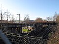
Crossing railroads in bowling


