
Birstein
| coat of arms | Germany map | |
|---|---|---|

|
Coordinates: 50 ° 21 ' N , 9 ° 19' E |
|
| Basic data | ||
| State : | Hesse | |
| Administrative region : | Darmstadt | |
| County : | Main-Kinzig district | |
| Height : | 286 m above sea level NHN | |
| Area : | 86.63 km 2 | |
| Residents: | 6198 (Dec. 31, 2019) | |
| Population density : | 72 inhabitants per km 2 | |
| Postcodes : | 63633, 63699 | |
| Primaries : | 06054, 06668 | |
| License plate : | MKK, GN, HU , SLÜ | |
| Community key : | 06 4 35 004 | |
| Community structure: | 16 districts | |
| Address of the municipal administration: |
Carl-Lomb-Str. 1 63633 Birstein |
|
| Website : | ||
| Mayor : | Fabian Fehl ( SPD ) | |
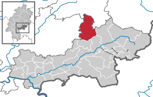
| Location of the municipality of Birstein in the Main-Kinzig district | ||
  |
||

Birstein is a municipality on the northeastern edge of the Main-Kinzig district in southeastern Hesse .

geography
The community is located at the southern foot of the Vogelsberg .
Neighboring communities
Birstein borders in the north on the municipality Grebenhain ( Vogelsbergkreis ), in the east on the municipality Freiensteinau (Vogelsbergkreis) and the town Steinau an der Straße , in the south on the town Bad Soden-Salmünster and the municipality Brachttal and in the west on the municipality Kefenrod and the city of Gedern (both Wetteraukreis ).
Community structure
The community consists of the 16 districts Birstein, Bösgesäß , Böß-Gesäß , Fischborn , Hettersroth , Illnhausen , Kirchbracht , Lichenroth , Mauswinkel , Oberreichenbach , Obersotzbach , Unterreichenbach , Untersotzbach , Völzberg , Wettges and Wüstwillenroth .
The separation of Bösgesäß (Bösgesäß I, colloquially “Prussian Bösgesäß”) and Bösgesäß (Bösgesäß II, colloquially “Hessian Bösgesäß”) has already been proven for the end of the Middle Ages. At that time, the Bracht flowing through the village was defined as the border between the Isenburg courts of Reichenbach and Wolferborn . The two districts are about 100 meters apart.
The small residential areas Höfen, Birkenstocks and Loosemühle still belong to the district of Hettersroth. Due to their small size, these are usually not officially mentioned explicitly.
The unofficial districts of Unterberg and Oberberg also belong to the core community of Birstein.
history

The " castrum birsenstein" (birsen = birches, to hunt with sniffer dogs ) was first mentioned in 1279. The rule was Birstein fuldischer possession, emerged from the fuldischen centering Reichenbach, and initially to the Lords of Lords of Büdingen as a fief gone. It was inherited from these by the Lords of Trimberg , and in 1279, Prince Abbot Bertho IV. Enfeoffed Heinrich von Weilnau and his wife Lukardis von Trimberg together with this inheritance from their family, the "castrum birsenstein et Advochatiam in Richenbach".
Count Heinrich II. Von Weilnau moved his seat to Birstein in 1326.
The Weilnau rule in Birstein did not last long. Already in 1332 Heinrich II. Von Ysenburg acquired half of the castle and lordship of Birstein through marriage, and in 1438 the entire remainder went to Diether I von Ysenburg, unless it had already been pledged or pledged to the Lords of Stockheim or those of Reifenberg , again as a fuldisches fief.
Territorial reform
On February 1, 1971, the previously independent municipalities Birstein, Bößgesäß, Fischborn and church Bracht included as part of the Hesse regional reorganization the new municipality Birstein together . On March 1, 1971, Hettersroth and Oberreichenbach were added. Böß-Gesäß and Illnhausen followed on December 31, 1971. Obersotzbach, Unterreichenbach and Untersotzbach were added on April 1, 1972. The series of incorporations was completed with the incorporation of the then municipality of Oberland by virtue of state law on July 1, 1974. The formerly independent communities of Oberland, Lichenroth , Mauswinkel , Völzberg , Wettges and Wüstwillenroth became districts of Birstein. For the area of each of the 16 formerly independent municipalities that have merged in the municipality of Birstein, a local district with a local advisory board and a local head was formed according to the Hessian municipal code.
religion
The population of the community Birstein is to a quite high percentage of Protestant denomination. In addition to the five Protestant churches in the municipality, there is a Catholic church and other religious communities .
A Jewish community existed in Birstein since the 17th century . In 1925 Jews made up 10.4% of the population. In the first years of National Socialism , a large number of Birstein Jews were forced to emigrate; the Jewish community was dissolved in 1937. At least 26 of the Jews born or resident in Birstein were murdered during the Nazi era.
politics
Community representation
The local elections on March 6, 2016 produced the following results, compared to previous local elections:
| Parties and constituencies |
% 2016 |
Seats 2016 |
% 2011 |
Seats 2011 |
% 2006 |
Seats 2006 |
% 2001 |
Seats 2001 |
||
|---|---|---|---|---|---|---|---|---|---|---|
| SPD | Social Democratic Party of Germany | 27.3 | 7th | 33.5 | 9 | 36.9 | 9 | 34.7 | 11 | |
| CDU | Christian Democratic Union of Germany | 23.9 | 6th | 28.7 | 7th | 34.3 | 9 | 33.6 | 10 | |
| FBG | Free community of citizens | 38.4 | 9 | 27.5 | 7th | 28.8 | 7th | 25.3 | 8th | |
| FIG | Active citizens for Birstein | - | - | 5.5 | 1 | - | - | - | - | |
| FDP | Free Democratic Party | 6.4 | 2 | 4.8 | 1 | - | - | - | - | |
| GREEN | Alliance 90 / The Greens | 4.1 | 1 | - | - | - | - | 6.5 | 2 | |
| total | 100.0 | 25th | 100.0 | 25th | 100.0 | 25th | 100.0 | 31 | ||
| Voter turnout in% | 55.5 | 55.5 | 49.6 | 59.4 | ||||||
mayor

Fabian Fehl , ( SPD ) (born June 25, 1991 ) was elected Mayor of the Birstein community on November 3, 2019 with 52.77% of the vote . He initially prevailed against the candidates Danica Radtke ( CDU ) and Jürgen Spielmann ( FDP ), but was defeated in the first ballot by the first alderman Christian Götz (FBG). In the runoff election on November 3, 2019, he was able to unite the required absolute majority of the votes. Fabian Fehl is the first mayor of the Birstein community appointed by the SPD since the regional reform in Hesse in 1971 . He was appointed and sworn in as mayor on March 19, 2020 in a community council meeting . He took over the official business of the mayor on April 1, 2020. When he took office, Fabian Fehl replaced his predecessor Wolfgang Gottlieb.
Wolfgang Gottlieb (independent) was elected in 1995 and re-elected in 2001, 2007 and 2013. His term of office ended on April 1, 2020 after he did not run for mayor's office again.
Attractions

- Birstein Castle , since 1517 the seat of the Isenburg Princely House , one of the oldest noble families in Europe.
- old town center of Birstein (Kirchgasse, Schlossstraße, Schulweg, Lauterbacher Straße), u. a. with the former Latin school (built in 1692), the former district court (built in 1903) and the former town hall
- Protestant rectory (built 1556)
- Birstein Evangelical Church (built in 1914) and burial place of the Isenburg Princely House
- Evangelical church Birstein-Unterreichenbach (built 1748), also called "Vogelsberg Cathedral"
- Catholic Church Mariae Visitation Birstein (built 1914)
- Sotzbacher fire brigade barn, the only fire brigade museum of its kind in the Main-Kinzig district.
- Nature trail 'Graf-Dietrich-Weiher' in Birstein-Fischborn, which brings visitors closer to the flora and fauna of the nature reserve founded in 1980 around the Graf-Dietrich-Weiher
- Educational trail 'The Path of Water' in Birstein-Fischborn, which reconstructs the path of drinking water from the Vogelsberg to Frankfurt am Main
- The BahnRadweg Hessen runs through the city . It leads about 250 km through the Vogelsberg and on former railway lines
- Locomotive monument of the last remaining VL13 diesel locomotive, which ran on the Vogelsberg Südbahn between Wächtersbach, Birstein and Hartmannshain until 1967

traffic
Birstein is connected to the motorway network via the federal road 276 , which leads to the Bad Orb / Wächtersbach junction of the A 66 . The bus lines MKK-71 and MKK-72 of Kreiswerke Main-Kinzig GmbH provide an hourly connection via the places Wächtersbach-Schlierbach-Neuenschmidten-Birstein. In Wächtersbach there is a connection to the Frankfurt-Fulda railway line .
There is also a connection to the Hessen cycle path network via the Vogelsberger Südbahn cycle path , which runs through Birstein. The now disused Vogelsberger Südbahn operated on this until 1967 . A number of rest areas with information boards have been set up along the cycle path. Pedelecs can be recharged at several free charging stations. A few of the charging stations are published on the Main-Kinzig District Works website . Many other charging stations can be found on the maps on the GoingElectric.de website.
Personalities
- Anton Praetorius (1560–1613), reformed theologian, worked as court preacher in Birstein from 1596–1598.
- Friedrich Karl von Buri (1702–1767), lawyer and diplomat, court, government and consistorial councilor in Birstein
- Carl Philipp Kopp (1728–1777), lawyer, Hessian Privy Council and Higher Appeal Court director.
- Carl Friedrich Ludwig Moritz von Isenburg-Birstein (1766–1820), Prince of Isenburg and Büdingen, sovereign prince of the Rheinbund state, Principality of Isenburg from 1806–1815.
- Prince Karl II. Zu Isenburg-Birstein (1838–1899), head of the noble house of Isenburg-Birstein , nobleman and member of the Prussian manor house and the First Chamber of Parliament of the estates of the Grand Duchy of Hesse
- Antonia Pilars de Pilar , née Freiin von Oer-Egelborg (1872–1946), lady-in-waiting to Duchess Marie Antoinette of Mecklenburg-Schwerin (1884–1944), married to the writer Ladislaus Pilars de Pilar .
- Friedrich von Oer (1842–1896), Chief Chamberlain of Prince Ysenburg .
- Fritz Maubach (* 1912 in Birstein, † 1963 in Eichenzell), son of the former royal pharmacist Andreas Maubach. Writer, wrote the book “Die Zwingburg” in 1947, in which he described his childhood years in Birstein. He also published travel law under the pseudonym Caspar (for example Rhön from all sides and home of the light muse). Like his father, he was a pharmacist, later worked as an editor and as such was also a reporter at the Nuremberg trials.
literature
- Literature on Birstein in the Hessian Bibliography
- Literature by and about Birstein in the catalog of the German National Library
Web links
- Internet presence of the community of Birstein
- Birstein, Main-Kinzig district. Historical local dictionary for Hessen. In: Landesgeschichtliches Informationssystem Hessen (LAGIS).
- Link catalog on Birstein at curlie.org (formerly DMOZ )
Individual evidence
- ↑ Hessian State Statistical Office: Population status on December 31, 2019 (districts and urban districts as well as municipalities, population figures based on the 2011 census) ( help ).
- ^ Municipal reform: mergers and integration of municipalities from January 20, 1971 . In: The Hessian Minister of the Interior (ed.): State Gazette for the State of Hesse. 1971 No. 6 , p. 248 , point 328, paragraph 48 ( online at the information system of the Hessian state parliament [PDF; 6.2 MB ]).
- ↑ Law on the reorganization of the districts of Gelnhausen, Hanau and Schlüchtern and the city of Hanau as well as the recirculation of the cities of Fulda, Hanau and Marburg (Lahn) concerning questions (GVBl. 330-26) of March 12, 1974 . In: The Hessian Minister of the Interior (ed.): Law and Ordinance Gazette for the State of Hesse . 1974 No. 9 , p. 149 , § 7 ( online at the information system of the Hessian state parliament [PDF; 3.0 MB ]).
- ^ Federal Statistical Office (ed.): Historical municipality directory for the Federal Republic of Germany. Name, border and key number changes in municipalities, counties and administrative districts from May 27, 1970 to December 31, 1982 . W. Kohlhammer, Stuttgart / Mainz 1983, ISBN 3-17-003263-1 , p. 362-363 .
- ↑ Local advisory board according to the main statute of the Birstein community , page 2 of the PDF file 0.048 MB
- ^ Alemannia Judaica
- ^ Result of the municipal election on March 6, 2016. Hessian State Statistical Office, accessed in April 2016 .
- ^ Hessian State Statistical Office: Result of the municipal elections on March 27, 2011
- ^ Hessian State Statistical Office: Result of the municipal elections on March 26, 2006
- ↑ Birstein Elected: Gottlieb, Wolfgang. Hessian Statistical Office (HSL), September 22, 2013, accessed on August 22, 2018 .

Bad Orb | Bad Soden-Salmünster | Biebergemünd | Birstein | Brachttal | Bruchköbel | Erlensee | Flörsbachtal | Free court | Gelnhausen | Großkrotzenburg | Gründau | Hammersbach | Hanau | Hasselroth | Jossgrund | Langenselbold | Lentil dish | Maintal | Neuberg | Nidderau | Niederdorfelden | Rodenbach | Ronneburg | Schluechtern | Schöneck | Sinntal | Steinau an der Straße | Waechtersbach
Unregulated area in the Main-Kinzig
district of the Spessart estate
Birstein | Buttocks | Boss buttocks | Fischborn | Hettersroth | Illnhausen | Kirchbracht | Lichen red | Mouse angle | Oberreichenbach | Obersotzbach | Unterreichenbach | Untersotzbach | Völzberg | Wettges | Wüstwillenroth