
Hammersbach
| coat of arms | Germany map | |
|---|---|---|
.svg)
|
Coordinates: 50 ° 14 ' N , 8 ° 59' E |
|
| Basic data | ||
| State : | Hesse | |
| Administrative region : | Darmstadt | |
| County : | Main-Kinzig district | |
| Height : | 134 m above sea level NHN | |
| Area : | 20.14 km 2 | |
| Residents: | 4824 (Dec. 31, 2019) | |
| Population density : | 240 inhabitants per km 2 | |
| Postal code : | 63546 | |
| Area code : | 06185 | |
| License plate : | MKK, GN, HU , SLÜ | |
| Community key : | 06 4 35 013 | |
| LOCODE : | DE HMY | |
| Community structure: | 2 districts | |
| Address of the municipal administration: |
Köbler Weg 44 63546 Hammersbach |
|
| Website : | ||
| Mayor : | Michael Göllner ( SPD ) | |
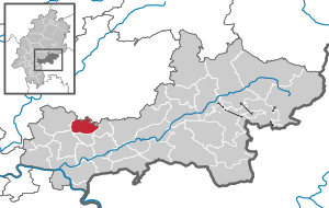
| Location of the municipality of Hammersbach in the Main-Kinzig district | ||
  |
||

Hammersbach is a municipality in the Main-Kinzig district in East Hesse on the northeastern edge of the Frankfurt Rhine-Main conurbation . It is located in the southern Wetterau about 15 km northeast of Hanau . The Upper Germanic-Raetian Limes ran through what is now the municipality .
geography
Neighboring communities
Hammersbach borders in the north on the municipality of Limeshain and the city of Büdingen (both Wetteraukreis ), in the east on the municipality Ronneburg , in the south on the municipality Neuberg , in the southwest on the city of Bruchköbel and in the west on the city of Nidderau .
Community structure
Hammersbach consists of the districts Marköbel and Langen-Bergheim , as well as the hamlet Hirzbacherhöfe and the domain Baiersröderhof .
history


History of the districts
Archaeological finds in the municipality from the Neolithic to the Hallstatt period to the Celtic Latène period (around 5000 to 50 years before Christ) indicate prehistoric settlement.
The Romans built the Marköbel fort on the area of Marköbel on a rectangular floor plan the size of the Saalburg , through which the Krebsbach crossing through the Limes was monitored. This also controlled trade along the Hohen Strasse - an old trade route that connected the Rhine Main region with eastern Germania. It is also interesting in this regard that precisely at this point the Limes has a slight bend in the otherwise straight course. The Romans therefore consciously included the already existing trading center in their empire.
The fort was the garrison site of a no longer comprehensible cohort. The excavation work of the Limes fort discovered in 1884 and the localization of the camp village and the remains of a thermal bath dragged on until 1994.
The emergence of the places that are summarized in today's Hammersbach municipality shows no continuity with this ancient prehistory. The Marköbel district was mentioned in a document as "cavilla" in 839. Langen-Bergheim (only called "Bergheim" until 1820) was first mentioned as "bercheim" in 1057. The oldest written mention of Hirzbach as "hirzbach" comes from the year 1128. Baiersröderhof was mentioned in 1139 as "allodium rode".
Territorial are all places except the Baiersröderhof, which belonged to the Ilbenstadt monastery until 1803 and became a Prussian (1945 Hessian) state domain after the secularization , in the Middle Ages until 1255 the lords of Munzenberg, but after their extinction they experienced a different story. Marköbel and Hirzbach fell to the County of Hanau ; In 1368 Marköbel received town charter and was fortified by Ulrich IV with a curtain wall and two town gates. It had already been a market town known supraregionally under the name of Koebeler Mess under the Munzenburgers ; The market retained this name when it was moved to his residence in Gelnhausen in 1220 by Emperor Friedrich II . Bergheim, on the other hand, fell to Büdingen and from then on shared the history of this house until it was incorporated into the Grand Duchy of Hesse in 1815.
During the Thirty Years' War , all parts of today's community suffered considerable destruction; Marköbel was completely burned down in 1635 by the Protestant troops retreating westward from Nördlingen . The Hanau- Munzenberg region fell to Hesse-Kassel when the Hanau population died out in 1736, and to Prussia in 1866 . In 1905 the city wall in Marköbel was torn down.
Marköbel and Langen-Bergheim only have a common national history since 1919 ( Weimar Republic ). They have been part of the State of Hesse since 1945.
In the mid-1980s, extensive restoration work took place on the historic building fabric of the community.
Church building
The namesake of today's municipality of Hammersbach, which was established in the course of the regional reform in Hesse on December 31, 1970 through the voluntary amalgamation of the municipalities of Langen-Bergheim (until 1820 Bergheim) from the district of Büdingen and Marköbel with Hirzbach and the state domain Baiersröderhof from the district of Hanau to the community "Hammersbach" in the district of Hanau, is the stream of the same name, which rises in the district of Langen-Bergheim and flows into the Krebsbach in the district of Marköbel.
politics
Community representation
The local elections on March 6, 2016 produced the following results, compared to previous local elections:
| Parties and constituencies |
% 2016 |
Seats 2016 |
% 2011 |
Seats 2011 |
% 2006 |
Seats 2006 |
% 2001 |
Seats 2001 |
||
|---|---|---|---|---|---|---|---|---|---|---|
| SPD | Social Democratic Party of Germany | 61.1 | 14th | 65.1 | 15th | 56.5 | 13 | 54.4 | 13 | |
| CDU | Christian Democratic Union of Germany | 38.9 | 9 | 34.9 | 8th | 36.6 | 8th | 31.2 | 7th | |
| FDP | Free Democratic Party | - | - | - | - | 6.9 | 2 | 6.2 | 1 | |
| BBH | Hammersbach civic block | - | - | - | - | - | - | 8.3 | 2 | |
| total | 100.0 | 23 | 100.0 | 23 | 100.0 | 23 | 100.0 | 23 | ||
| Voter turnout in% | 56.9 | 50.4 | 54.3 | 61.8 | ||||||

mayor
After the Hessian municipal constitution is Mayor Chairman of the Municipal Board , the volunteer next to the mayor four in the municipality Hammersbach Associate members. Michael Göllner (SPD) has been mayor since November 1, 2004. His directly elected predecessor was
- 1984 to 2004 Helga Meininger (SPD)
badges and flags
.svg)
coat of arms
Blazon : Three red rafters in gold with a black sword placed above them at an angle to the left.
The coat of arms of the municipality of Hammersbach in what was then the district of Hanau was approved by the Hessian Ministry of the Interior on May 11, 1973 . It was designed by the Bad Nauheim heraldist Heinz Ritt .
It was taken over directly from the former municipality of Marköbel.
flag
On December 8, 1978, the municipality's interior ministry approved a flag described as follows:
"Between narrow green side stripes and two broad golden stripes a wide green central strip, in the upper third covered with the municipal coat of arms."
Culture and sights
Buildings

- At the Marköbel cemetery in 1994, a 4.7 m long remains of the wall of the Roman Limes fort was prepared and made accessible. Incidentally, nothing can be seen of the Roman camp village, which was completely built over by today's market furniture, except for the route of the main road and north road, which exactly reflect the layout of the fort.
- In the 1990s, the plan of the Roman fort bath was made visible in the churchyard of the Marköbel church.
- From the largely demolished Marköbeler city wall, the foreign m in the Middle Ages by a 14 wide and 3 m deep trench with Gebück -Hecke was surrounded, nor the Untertor (are Gelnhäuser gate ), which served upstairs as a prison since 1989, a copy of the coat of arms of the Marköbel court with a sword (taken over into the Hammersbach municipal coat of arms ) , as well as a defense tower at the former Obertor ( Rödertor ).

- The half-timbered Marköbel town hall building from 1686 (restored in 1987/88), which was used as a local authority until 1986, replaces an older Spilhaus (forerunner of today's town hall) from the time before the Thirty Years War (first mentioned in 1391). This served as a wine cellar in the basement, as a market hall on the open ground floor and as a court, archive and administrative headquarters on the upper floor. A market fountain ( Spillesborn ) is no longer available. Incidentally, there are other half-timbered houses from the same period on the main street in the center of Marköbel.
- The current state domain of Baiersröder Hof was first mentioned in 1139. Today there is an annual exhibition of historical agricultural machines from the regional area.
- The Antoniterkapelle in the district of Hirzbach dates back to 1254 and a donation from Reinhard I to the order . The renovated chapel can be visited ( see main article: Hirzbach Chapel ).
Sports
With KSV Langen-Bergheim and SG Marköbel , both districts have their own football club . With the Chung Gun Hammersbach eV , Hammersbach also has a Taekwondo club .
Economy and Infrastructure
Agriculture was the main source of income until the middle of the 20th century. Viticulture, which the Romans had introduced, was given up in the middle of the 19th century because of phylloxera infestation in favor of fruit growing.
Today the community belongs to the catchment area of the Rhine-Main metropolitan region .
traffic
In 2007, the new Hammersbach junction was inaugurated on the A 45 near Langen-Bergheim.
education
There are two kindergartens and the Astrid-Lindgren-Schule (elementary school) in the municipality.
Commercial areas
On the northeastern edge of the district of Langen-Bergheim, the already existing industrial area "Am Schulzehnten" has been supplemented by a new industrial and residential area "Am Lachbach" since 2004. The entire new building area covers 13 hectares, of which 6 hectares are commercial and 3 hectares are residential. The remaining areas are traffic, parking and green areas. The areas of the industrial park are mainly used by retail businesses.
An intermunicipal industrial park east of the A 45 together with the municipalities of Büdingen , Limeshain and Altenstadt has been in preparation for several years .
literature
- Parish council (ed.); 1150 years of Marköbel - 850 years of Baiersröderhof (1989), p. 525
- Peter Jüngling, "This chapel is still standing today ..." - Contributions to the history of the Marienkapelle in Hirzbach, Hammersbach community, Main-Kinzig district. Hanauer Schr. On archeology and history 2, 2004, p. 218
- Literature by and about Hammersbach in the catalog of the German National Library
Web links
- Internet presence of the municipality of Hammersbach
- Internet presence of the association for culture and local history
- Link catalog on Hammersbach at curlie.org (formerly DMOZ )
Individual evidence
- ↑ Hessian State Statistical Office: Population status on December 31, 2019 (districts and urban districts as well as municipalities, population figures based on the 2011 census) ( help ).
- ↑ Amalgamation of the communities of Langen-Bergheim in the district of Büdingen and Markgöbel in the district of Hanau to form the new community "Hammersbach" in the district of Hanau on August 5, 1971 . In: The Hessian Minister of the Interior (ed.): State Gazette for the State of Hesse. 1971 No. 3 , p. 110 , point 112 ( online at the information system of the Hessian state parliament [PDF; 5.5 MB ]).
- ^ Result of the municipal election on March 6, 2016. Hessian State Statistical Office, accessed in April 2016 .
- ^ Hessian State Statistical Office: Result of the municipal elections on March 27, 2011
- ^ Hessian State Statistical Office: Result of the municipal elections on March 26, 2006
- ^ Hessian State Statistical Office: direct elections in Hammersbach
- ^ SPD Hammersbach: Reception "Ten Years of Mayor Michael Göllner", accessed on July 28, 2016
- ^ SPD Hammersbach: The mayor. Helga Meininger - a stroke of luck for the community , accessed on July 28, 2016
- ^ Approval of a coat of arms of the Hammersbach community, Hanau district dated May 11, 1973 . In: The Hessian Minister of the Interior (ed.): State Gazette for the State of Hesse. 1973 No. 23 , p. 1007 , point 709 ( online at the information system of the Hessian state parliament [PDF; 6.2 MB ]).
- ^ Approval of a flag of the Hammersbach community, Main-Kinzig-Kreis dated December 8, 1978 . In: The Hessian Minister of the Interior (ed.): State Gazette for the State of Hesse. 1978 No. 52 , p. 2582 , point 1548 ( online at the information system of the Hessian state parliament [PDF; 9.4 MB ]).

Bad Orb | Bad Soden-Salmünster | Biebergemünd | Birstein | Brachttal | Bruchköbel | Erlensee | Flörsbachtal | Free court | Gelnhausen | Großkrotzenburg | Gründau | Hammersbach | Hanau | Hasselroth | Jossgrund | Langenselbold | Lentil dish | Maintal | Neuberg | Nidderau | Niederdorfelden | Rodenbach | Ronneburg | Schluechtern | Schöneck | Sinntal | Steinau an der Straße | Waechtersbach
Unregulated area in the Main-Kinzig
district of the Spessart estate